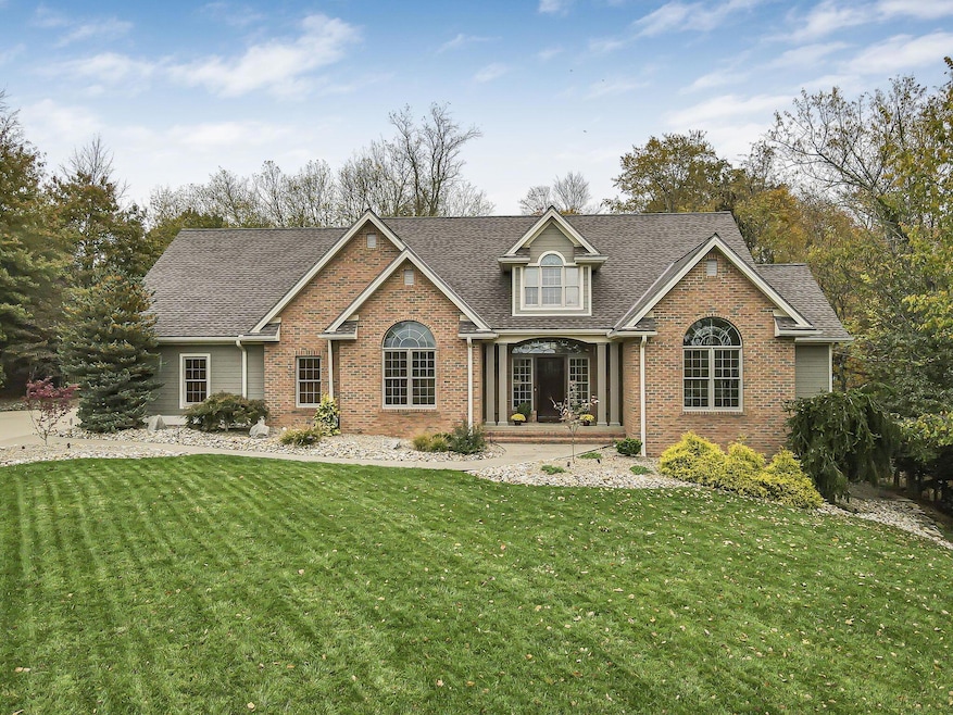
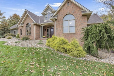
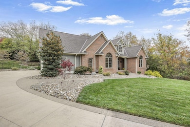
485 Ash Cir New Concord, OH 43762
Estimated payment $4,141/month
Highlights
- 0.87 Acre Lot
- Wooded Lot
- Traditional Architecture
- Deck
- Vaulted Ceiling
- Wood Flooring
About This Home
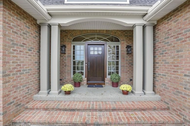
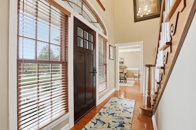
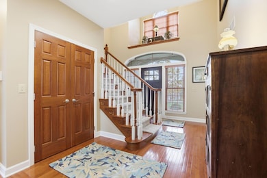
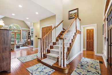
Welcome home to this exquisite custom-built Mennonite home nestled on a serene .87-acre cul-de-sac lot surrounded by mature trees and stunning seasonal views. From the moment you step through the front door, you'll feel a sense of warmth and timeless craftsmanship throughout. The main floor features a welcoming foyer leading to a spacious great room with vaulted ceilings, large arched windows, and a cozy fireplace framed by custom cherry cabinetry. The open-concept kitchen offers handcrafted Mennonite cherry cabinets, solid-surface countertops, stainless steel appliances, and a convenient breakfast bar. A formal dining room sits just off the entryway, perfect for entertaining. The main-level owner's suite includes a luxurious full bath, while an additional bedroom and full bath provide versatility for guests or an office. A half bath and laundry room are conveniently located near the garage entry. Upstairs, you'll find three spacious bedrooms and two full baths, all beautifully finished. The fully finished lower level—with over $125,000 in updates—features a second kitchen, family room, office/gym, full bedroom, and full bath. French doors open to a private patio overlooking a wooded ravine, creating a peaceful retreat.
With 5 bedrooms, 5.5 baths, and two office spaces (both with closets), this home can easily accommodate a large family or multi-generational living—potentially up to seven bedrooms total. Every detail was handcrafted by Mennonite artisans, from the solid cherry cabinetry and trim to the gleaming hardwood floors. Outside, the professionally landscaped yard offers a magical outdoor living experience, complete with a custom Quality-built shed for storage. Enjoy quiet luxury and natural beauty—truly a home where craftsmanship and comfort meet.
Home Details
Home Type
- Single Family
Est. Annual Taxes
- $7,872
Year Built
- Built in 2004
Lot Details
- 0.87 Acre Lot
- Cul-De-Sac
- Fenced Yard
- Wooded Lot
Parking
- 2 Car Attached Garage
- Garage Door Opener
Home Design
- Traditional Architecture
- Brick Exterior Construction
- Block Foundation
- Poured Concrete
Interior Spaces
- 4,616 Sq Ft Home
- 2-Story Property
- Vaulted Ceiling
- 2 Fireplaces
- Gas Log Fireplace
- Insulated Windows
- Great Room
Kitchen
- Electric Range
- Microwave
- Dishwasher
Flooring
- Wood
- Carpet
Bedrooms and Bathrooms
- 5 Bedrooms | 1 Primary Bedroom on Main
- Whirlpool Bathtub
Laundry
- Laundry Room
- Laundry on main level
- Electric Dryer Hookup
Basement
- Walk-Out Basement
- Basement Fills Entire Space Under The House
- Recreation or Family Area in Basement
Outdoor Features
- Deck
Utilities
- Humidifier
- Forced Air Heating and Cooling System
- Heating System Uses Gas
- Heat Pump System
Community Details
- No Home Owners Association
- Property is near a ravine
Listing and Financial Details
- Assessor Parcel Number 66-26-01-91-000
Map
Home Values in the Area
Average Home Value in this Area
Tax History
| Year | Tax Paid | Tax Assessment Tax Assessment Total Assessment is a certain percentage of the fair market value that is determined by local assessors to be the total taxable value of land and additions on the property. | Land | Improvement |
|---|---|---|---|---|
| 2024 | $7,872 | $225,120 | $16,905 | $208,215 |
| 2023 | $5,739 | $151,760 | $16,170 | $135,590 |
| 2022 | $5,621 | $151,760 | $16,170 | $135,590 |
| 2021 | $5,700 | $151,760 | $16,170 | $135,590 |
| 2020 | $5,851 | $151,760 | $16,170 | $135,590 |
| 2019 | $5,736 | $151,760 | $16,170 | $135,590 |
| 2018 | $5,559 | $151,760 | $16,170 | $135,590 |
| 2017 | $5,174 | $128,870 | $16,170 | $112,700 |
| 2016 | $5,181 | $128,870 | $16,170 | $112,700 |
| 2015 | $5,262 | $128,870 | $16,170 | $112,700 |
| 2013 | $5,605 | $128,870 | $16,170 | $112,700 |
Property History
| Date | Event | Price | List to Sale | Price per Sq Ft |
|---|---|---|---|---|
| 11/17/2025 11/17/25 | Pending | -- | -- | -- |
| 11/07/2025 11/07/25 | For Sale | $659,900 | -- | $143 / Sq Ft |
Purchase History
| Date | Type | Sale Price | Title Company |
|---|---|---|---|
| Limited Warranty Deed | $50,500 | -- |
Source: Columbus and Central Ohio Regional MLS
MLS Number: 225041202
APN: 66-26-01-91-000
Disclaimer: Certain information contained herein is derived from information provided by parties other than Homes.com. All information provided is deemed reliable, but is not guaranteed to be accurate and should be independently verified.
![]() IDX information is provided exclusively for personal, non-commercial use, and may not be used for any purpose other than to identify prospective properties consumers may be interested in purchasing.
IDX information is provided exclusively for personal, non-commercial use, and may not be used for any purpose other than to identify prospective properties consumers may be interested in purchasing.
Information is deemed reliable but not guaranteed.
- 67 E Main St
- 8 E Main St
- 154 Montgomery Blvd
- 112 Thompson Ave
- 760 Friendship Dr
- 930 Friendship Dr
- 1420 Glenn Hwy
- 60936 Patch Rd
- 0 Maple Ln
- 12985 John Glenn School Rd
- Lot 18 & 19 Greenbriar Dr
- 61220 Kadon Dr
- 60040 Bliss Rd
- 3029 Best Rd
- 3859 Mayfair Ln
- 0 Norfield Unit 5124761
- 10545 Main St
- 3278 Rough & Ready Rd
- 100 Linvale Dr
- 62063 Savage Rd
