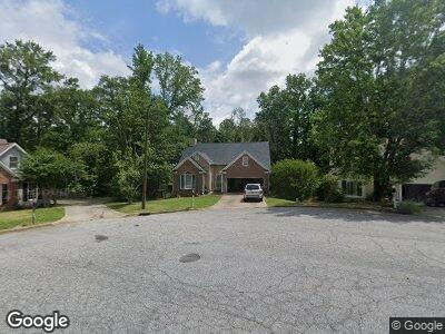
485 Ashville Dr Macon, GA 31210
Estimated Value: $234,000 - $271,109
3
Beds
2
Baths
2,071
Sq Ft
$125/Sq Ft
Est. Value
About This Home
This home is located at 485 Ashville Dr, Macon, GA 31210 and is currently estimated at $259,527, approximately $125 per square foot. 485 Ashville Dr is a home located in Bibb County with nearby schools including Springdale Elementary School, Howard Middle School, and Howard High School.
Ownership History
Date
Name
Owned For
Owner Type
Purchase Details
Closed on
Nov 16, 2021
Sold by
Bearchell Angela R and Bearchell David L
Bought by
Blades Brandon Reid and Blades Kayla
Current Estimated Value
Home Financials for this Owner
Home Financials are based on the most recent Mortgage that was taken out on this home.
Original Mortgage
$165,750
Outstanding Balance
$155,344
Interest Rate
2.99%
Mortgage Type
New Conventional
Purchase Details
Closed on
Jul 24, 2008
Sold by
Sedghi Reza
Bought by
Bearchell Angela R and Bearchell David L
Home Financials for this Owner
Home Financials are based on the most recent Mortgage that was taken out on this home.
Original Mortgage
$143,450
Interest Rate
6.27%
Mortgage Type
Unknown
Purchase Details
Closed on
Sep 30, 1999
Bought by
Sedghi Reza
Create a Home Valuation Report for This Property
The Home Valuation Report is an in-depth analysis detailing your home's value as well as a comparison with similar homes in the area
Home Values in the Area
Average Home Value in this Area
Purchase History
| Date | Buyer | Sale Price | Title Company |
|---|---|---|---|
| Blades Brandon Reid | $195,000 | None Available | |
| Bearchell Angela R | $151,000 | None Available | |
| Sedghi Reza | $137,000 | -- |
Source: Public Records
Mortgage History
| Date | Status | Borrower | Loan Amount |
|---|---|---|---|
| Open | Blades Brandon Reid | $22,000 | |
| Open | Blades Brandon Reid | $165,750 | |
| Previous Owner | Bearchell Angela R | $133,950 | |
| Previous Owner | Bearchell Angela R | $0 | |
| Previous Owner | Bearchell Angela R | $143,450 |
Source: Public Records
Tax History Compared to Growth
Tax History
| Year | Tax Paid | Tax Assessment Tax Assessment Total Assessment is a certain percentage of the fair market value that is determined by local assessors to be the total taxable value of land and additions on the property. | Land | Improvement |
|---|---|---|---|---|
| 2024 | $2,214 | $94,162 | $12,000 | $82,162 |
| 2023 | $2,151 | $84,693 | $10,000 | $74,693 |
| 2022 | $2,700 | $78,668 | $10,170 | $68,498 |
| 2021 | $2,470 | $71,992 | $9,450 | $62,542 |
| 2020 | $2,523 | $71,992 | $9,450 | $62,542 |
| 2019 | $2,229 | $63,944 | $8,550 | $55,394 |
| 2018 | $3,594 | $63,944 | $8,550 | $55,394 |
| 2017 | $1,921 | $58,279 | $7,650 | $50,629 |
| 2016 | $1,774 | $58,279 | $7,650 | $50,629 |
| 2015 | $2,512 | $58,279 | $7,650 | $50,629 |
| 2014 | $839 | $58,279 | $7,650 | $50,629 |
Source: Public Records
Map
Nearby Homes
- 480 Ashville Dr
- 305 Ashville Ct
- 109 Waterford Ct
- 132 N Springs Ct
- 172 Lake View Dr N
- 172 Lake View Dr N Unit North
- 102 Braxton Dr
- 1016 Brookford Rd
- 113 Lake Pointe Dr
- 200 N Wesleyan Cir
- 412 Old Mill Ct
- 5262 White House Plantation Rd
- 404 Old Mill Ct
- 113 Rivoli Oaks Cir
- 163 Carriage Way
- 135 Chadwick Dr
- 541 Edgefield Way
- 485 Ashville Dr
- 481 Ashville Dr
- 479 Ashville Dr
- 475 Ashville Dr
- 484 Ashville Dr
- 488 Ashville Dr
- 143 Hillbrooke Ct
- 478 Ashville Dr
- 471 Ashville Dr
- 140 Hillbrooke Ct
- 470 Ashville Dr
- 469 Ashville Dr
- 139 Hillbrooke Ct
- 109 Raliegh Dr
- 468 Ashville Dr
- 465 Ashville Dr
- 111 Raliegh Dr
- 136 Hillbrooke Ct
- 135 Hillbrooke Ct
- 105 Raliegh Dr