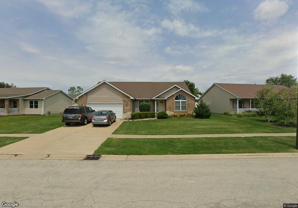
485 Highpoint Cir S Bourbonnais, IL 60914
Estimated Value: $349,718 - $385,000
4
Beds
2
Baths
2,200
Sq Ft
$166/Sq Ft
Est. Value
About This Home
This home is located at 485 Highpoint Cir S, Bourbonnais, IL 60914 and is currently estimated at $365,430, approximately $166 per square foot. 485 Highpoint Cir S is a home located in Kankakee County with nearby schools including Noel Levasseur Elementary School, Liberty Intermediate School, and Bourbonnais Upper Grade Center.
Ownership History
Date
Name
Owned For
Owner Type
Purchase Details
Closed on
Oct 7, 2021
Sold by
Fernando Eric P
Bought by
Eric P Fernando Trust
Current Estimated Value
Purchase Details
Closed on
Jun 24, 2006
Sold by
Twc Construction
Bought by
Eric Fernando P
Create a Home Valuation Report for This Property
The Home Valuation Report is an in-depth analysis detailing your home's value as well as a comparison with similar homes in the area
Home Values in the Area
Average Home Value in this Area
Purchase History
| Date | Buyer | Sale Price | Title Company |
|---|---|---|---|
| Eric P Fernando Trust | -- | Ann L Brezinski Law Office Llc | |
| Eric Fernando P | -- | Standard Title |
Source: Public Records
Mortgage History
| Date | Status | Borrower | Loan Amount |
|---|---|---|---|
| Closed | Eric Fernando P | $154,000 |
Source: Public Records
Tax History
| Year | Tax Paid | Tax Assessment Tax Assessment Total Assessment is a certain percentage of the fair market value that is determined by local assessors to be the total taxable value of land and additions on the property. | Land | Improvement |
|---|---|---|---|---|
| 2024 | $7,889 | $101,261 | $12,030 | $89,231 |
| 2023 | $7,022 | $91,354 | $11,139 | $80,215 |
| 2022 | $6,723 | $84,427 | $10,736 | $73,691 |
| 2021 | $6,482 | $81,156 | $10,500 | $70,656 |
| 2020 | $6,419 | $78,984 | $10,219 | $68,765 |
| 2019 | $6,283 | $76,683 | $9,921 | $66,762 |
| 2018 | $6,031 | $73,633 | $9,774 | $63,859 |
| 2017 | $5,903 | $71,766 | $9,536 | $62,230 |
| 2016 | $5,741 | $70,098 | $9,395 | $60,703 |
| 2015 | $5,691 | $68,732 | $9,302 | $59,430 |
| 2014 | $5,519 | $69,351 | $9,302 | $60,049 |
| 2013 | -- | $71,649 | $9,302 | $62,347 |
Source: Public Records
Map
Nearby Homes
- 366 Centerpoint Dr S
- 172 Anita Dr
- 1356 Eagle Bluff Dr
- 16 Kim Dr
- 22 Emery Dr
- 54 Bonds Dr
- 1947 Flagstone Ave
- 9 Hilltop Dr
- 471 Spring Park Loop
- 501 Spring Park Loop
- 859 Pheasant Run
- 5659 N 1000 West Rd
- 42 Hanson Dr
- 1565 Stefanie Ln
- 214 Greenbriar Ln
- 15 Hanson Dr
- 1 Saint Francis Dr
- 30 Saint Pauls Dr
- 206 Meadows Rd S
- 36 Saint Francis Dr
- 465 Highpoint Cir S
- 378 Centerpoint Dr S
- 445 Highpoint Cir S
- 570 Highpoint Cir N
- 372 Centerpoint Dr S
- 384 Centerpoint Dr S
- 465 Halfway Rd
- 425 Highpoint Cir S
- 470 Halfway Rd
- 556 Highpoint Cir N
- 390 Centerpoint Dr S
- 575 Highpoint Cir N
- 440 Highpoint Cir S
- 565 Highpoint Cir N
- 405 Highpoint Cir S
- 542 Highpoint Cir N
- 375 Centerpoint Dr S
- 430 Highpoint Cir S
- 396 Centerpoint Dr S
- 410 Highpoint Cir S
Your Personal Tour Guide
Ask me questions while you tour the home.