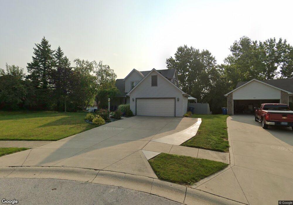
485 Lowry Way Roanoke, IN 46783
Estimated Value: $312,000 - $365,000
3
Beds
3
Baths
1,740
Sq Ft
$197/Sq Ft
Est. Value
About This Home
This home is located at 485 Lowry Way, Roanoke, IN 46783 and is currently estimated at $342,021, approximately $196 per square foot. 485 Lowry Way is a home located in Huntington County with nearby schools including Roanoke Elementary School, Crestview Middle School, and Huntington North High School.
Ownership History
Date
Name
Owned For
Owner Type
Purchase Details
Closed on
Mar 15, 2007
Sold by
Pickell Daniel F and Pickell Patricia G
Bought by
Milton Brian C and Milton Sarah L
Current Estimated Value
Home Financials for this Owner
Home Financials are based on the most recent Mortgage that was taken out on this home.
Original Mortgage
$43,250
Interest Rate
6.25%
Mortgage Type
Stand Alone Second
Create a Home Valuation Report for This Property
The Home Valuation Report is an in-depth analysis detailing your home's value as well as a comparison with similar homes in the area
Home Values in the Area
Average Home Value in this Area
Purchase History
| Date | Buyer | Sale Price | Title Company |
|---|---|---|---|
| Milton Brian C | -- | None Available |
Source: Public Records
Mortgage History
| Date | Status | Borrower | Loan Amount |
|---|---|---|---|
| Closed | Milton Brian C | $43,250 | |
| Open | Milton Brian C | $129,750 |
Source: Public Records
Tax History Compared to Growth
Tax History
| Year | Tax Paid | Tax Assessment Tax Assessment Total Assessment is a certain percentage of the fair market value that is determined by local assessors to be the total taxable value of land and additions on the property. | Land | Improvement |
|---|---|---|---|---|
| 2024 | $3,245 | $324,500 | $28,000 | $296,500 |
| 2023 | $3,159 | $297,100 | $28,000 | $269,100 |
| 2022 | $2,752 | $262,200 | $28,000 | $234,200 |
| 2021 | $2,596 | $245,900 | $27,000 | $218,900 |
| 2020 | $2,462 | $229,800 | $27,000 | $202,800 |
| 2019 | $2,337 | $216,500 | $27,000 | $189,500 |
| 2018 | $2,380 | $209,100 | $27,000 | $182,100 |
| 2017 | $2,356 | $212,300 | $27,000 | $185,300 |
| 2016 | $2,335 | $209,600 | $27,000 | $182,600 |
| 2014 | $2,174 | $192,600 | $27,000 | $165,600 |
| 2013 | $2,174 | $198,200 | $27,100 | $171,100 |
Source: Public Records
Map
Nearby Homes
- 602 Nancyk Crossing
- 548 Frederick Crossing
- 366 Hillside Ave
- 183 W Vine St
- 680 Helms Orange Dr
- 451 Rockwell Ave
- 738 Waxwing Ct Unit 29
- 599 N Seminary St
- 180 W 6th St
- 715 N Seminary St
- 775 N Seminary St
- 836 N Seminary St
- 4565 E Station Rd
- 1047 Stevens Ct
- TBD Feighner Rd
- tbd Kilsoquah
- 0 Ginger Rd
- * Ginger Rd
- 4543 E 1200 N
- 3069 E 1200 N
- 467 Lowry Way
- 497 Lowry Way
- 235 Hillside Ave
- 219 Hillside Ave
- 447 Lowry Way
- 505 Lowry Way
- 203 Hillside Ave
- 506 Lowry Way
- 454 Lowry Way
- 470 Lowry Way
- 524 S Main St
- 438 Lowry Way
- 498 Lowry Way
- 484 Lowry Way
- 189 Hillside Ave
- 536 S Main St
- 214 Hillside Ave
- 248 Hillside Ave
- 305 Hillside Ave
- 175 Hillside Ave