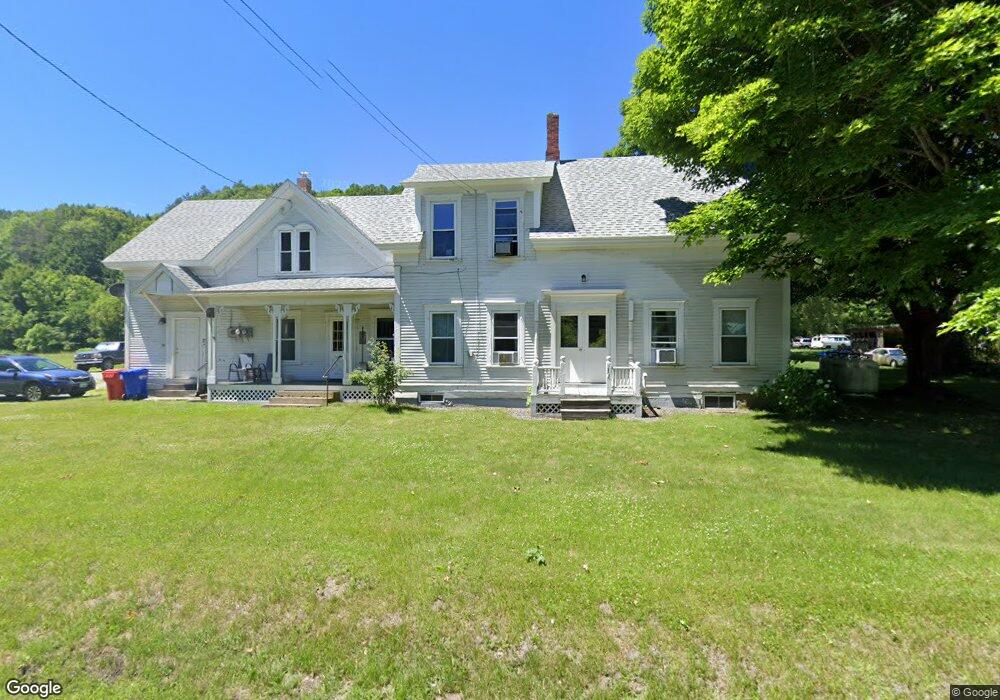
485 Us Route 5 N Unit 1 Barnet, VT 05821
Estimated Value: $275,000 - $336,000
1
Bed
1
Bath
2,864
Sq Ft
$103/Sq Ft
Est. Value
About This Home
This home is located at 485 Us Route 5 N Unit 1, Barnet, VT 05821 and is currently estimated at $295,957, approximately $103 per square foot. 485 Us Route 5 N Unit 1 is a home located in Caledonia County with nearby schools including Barnet Elementary School.
Ownership History
Date
Name
Owned For
Owner Type
Purchase Details
Closed on
Feb 7, 2025
Sold by
Sanborn Derek and Sanborn Carrie
Bought by
Elms Estate Revocable Trust Agreement
Current Estimated Value
Purchase Details
Closed on
Jun 18, 2024
Sold by
Bailey Danial and Bailey Jeffrey
Bought by
Sanborn Carrie and Sanborn Derek
Purchase Details
Closed on
Dec 13, 2017
Sold by
Bailey Marvin O and Bailey Virginia S
Bought by
Bailey Danial M and Bailey Jeffrey
Create a Home Valuation Report for This Property
The Home Valuation Report is an in-depth analysis detailing your home's value as well as a comparison with similar homes in the area
Home Values in the Area
Average Home Value in this Area
Purchase History
| Date | Buyer | Sale Price | Title Company |
|---|---|---|---|
| Elms Estate Revocable Trust Agreement | -- | -- | |
| Sanborn Carrie | $100,000 | -- | |
| Bailey Danial M | -- | -- | |
| Bailey Danial M | -- | -- |
Source: Public Records
Tax History Compared to Growth
Tax History
| Year | Tax Paid | Tax Assessment Tax Assessment Total Assessment is a certain percentage of the fair market value that is determined by local assessors to be the total taxable value of land and additions on the property. | Land | Improvement |
|---|---|---|---|---|
| 2024 | -- | $155,200 | $50,200 | $105,000 |
| 2023 | -- | $155,200 | $50,200 | $105,000 |
| 2022 | $3,241 | $156,500 | $50,200 | $106,300 |
| 2021 | $3,593 | $156,500 | $50,200 | $106,300 |
| 2020 | $3,583 | $156,500 | $50,200 | $106,300 |
| 2019 | $3,401 | $162,200 | $53,100 | $109,100 |
| 2018 | $3,248 | $162,200 | $53,100 | $109,100 |
| 2016 | $3,443 | $165,400 | $56,300 | $109,100 |
Source: Public Records
Map
Nearby Homes
- 0 Denio Rd Unit 5059200
- 0 Denio Rd Unit 5059211
- 0 Denio Rd Unit 5059215
- 0 Denio Rd Unit 24587948
- 0 Denio Rd
- 0 Denio Rd Unit 5059206
- 0 Denio Rd Unit 24587953
- - Denio Rd
- 1374 Old Silo Rd
- 1573 Us Route 5 S
- 88 Mill Hill
- 286 Carter St
- 391 Bimson Dr
- 441 Tower Rd
- 1291 Littleton Rd
- 342 Grange Hall Rd
- 433 Grange Hall Rd
- 162 Town Forest Rd
- 3945 Lower Waterford Rd Unit Lot C-9 & C-10
- 00 Coppermine Rd Unit 59