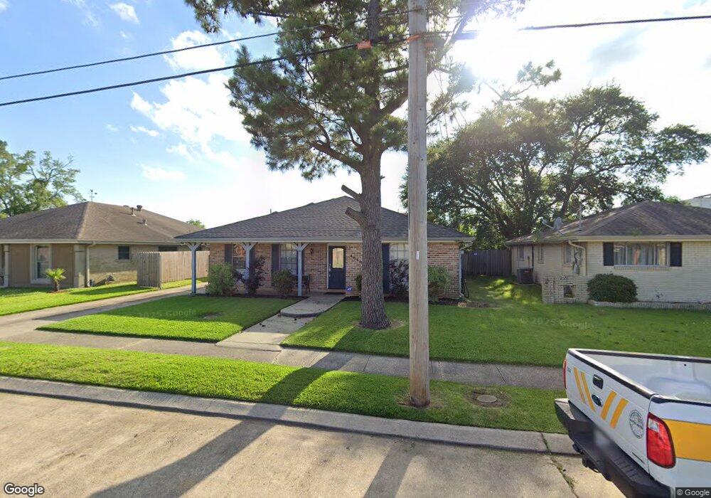
4850 Eunice Dr New Orleans, LA 70127
Read Boulevard West NeighborhoodEstimated Value: $171,140 - $202,000
3
Beds
2
Baths
1,845
Sq Ft
$101/Sq Ft
Est. Value
About This Home
This home is located at 4850 Eunice Dr, New Orleans, LA 70127 and is currently estimated at $186,285, approximately $100 per square foot. 4850 Eunice Dr is a home located in Orleans Parish with nearby schools including Einstein Charter at Sherwood Forest, Einstein Charter School - Village De L'est Elementary, and Lake Forest Elementary Charter School.
Ownership History
Date
Name
Owned For
Owner Type
Purchase Details
Closed on
Feb 10, 2021
Sold by
Gatlin Candice Brown and Gatlin James E
Bought by
Williams Aimee
Current Estimated Value
Home Financials for this Owner
Home Financials are based on the most recent Mortgage that was taken out on this home.
Original Mortgage
$176,641
Outstanding Balance
$157,849
Interest Rate
2.65%
Mortgage Type
FHA
Estimated Equity
$28,436
Create a Home Valuation Report for This Property
The Home Valuation Report is an in-depth analysis detailing your home's value as well as a comparison with similar homes in the area
Home Values in the Area
Average Home Value in this Area
Purchase History
| Date | Buyer | Sale Price | Title Company |
|---|---|---|---|
| Williams Aimee | $179,900 | Four Points Title Llc |
Source: Public Records
Mortgage History
| Date | Status | Borrower | Loan Amount |
|---|---|---|---|
| Open | Williams Aimee | $176,641 |
Source: Public Records
Tax History Compared to Growth
Tax History
| Year | Tax Paid | Tax Assessment Tax Assessment Total Assessment is a certain percentage of the fair market value that is determined by local assessors to be the total taxable value of land and additions on the property. | Land | Improvement |
|---|---|---|---|---|
| 2025 | $1,244 | $16,270 | $1,140 | $15,130 |
| 2024 | $2,180 | $16,270 | $1,140 | $15,130 |
| 2023 | $1,195 | $16,050 | $1,140 | $14,910 |
| 2022 | $1,195 | $15,300 | $1,140 | $14,160 |
| 2021 | $876 | $12,910 | $1,140 | $11,770 |
| 2020 | $884 | $12,910 | $1,140 | $11,770 |
| 2019 | $915 | $12,910 | $1,430 | $11,480 |
| 2018 | $931 | $12,910 | $1,430 | $11,480 |
| 2017 | $874 | $12,910 | $1,430 | $11,480 |
| 2016 | $900 | $12,910 | $1,430 | $11,480 |
| 2015 | $929 | $13,220 | $1,430 | $11,790 |
| 2014 | -- | $13,220 | $1,430 | $11,790 |
| 2013 | -- | $13,220 | $1,430 | $11,790 |
Source: Public Records
Map
Nearby Homes
- 4790 Eunice St
- 4811 Longfellow Dr
- 4838 Rosalia Dr
- 4934 Longfellow Dr
- 4859 Bundy Rd
- 4951 Marque Dr
- 4975 Marque Dr
- 4700 Longfellow Dr
- 4012 Evangeline Dr
- 4943 Evangeline Dr
- 4766 Evangeline Dr
- 4811 Perelli Dr
- 4682 Perrault Walk
- 4897 Cerise Ave
- 4658 Perelli Dr
- 4671 Perelli Dr
- 4922 Sandalwood St
- 4529 Citrus Dr
- 4958 Sandalwood St
- 4534 Hickerson Dr
- 4850 Eunice St
- 4858 Eunice St
- 4842 Eunice St
- 4842 Eunice Dr
- 4851 Hickerson St
- 4859 Hickerson St
- 4900 Eunice St
- 4843 Hickerson St
- 4834 Eunice St
- 4851 Eunice St
- 4901 Hickerson St
- 4843 Eunice St
- 4859 Eunice St
- 4835 Hickerson St
- 4910 Eunice St
- 4826 Eunice St
- 4901 Eunice Dr
- 4835 Eunice St
- 4835 Eunice Dr
- 4901 Eunice St