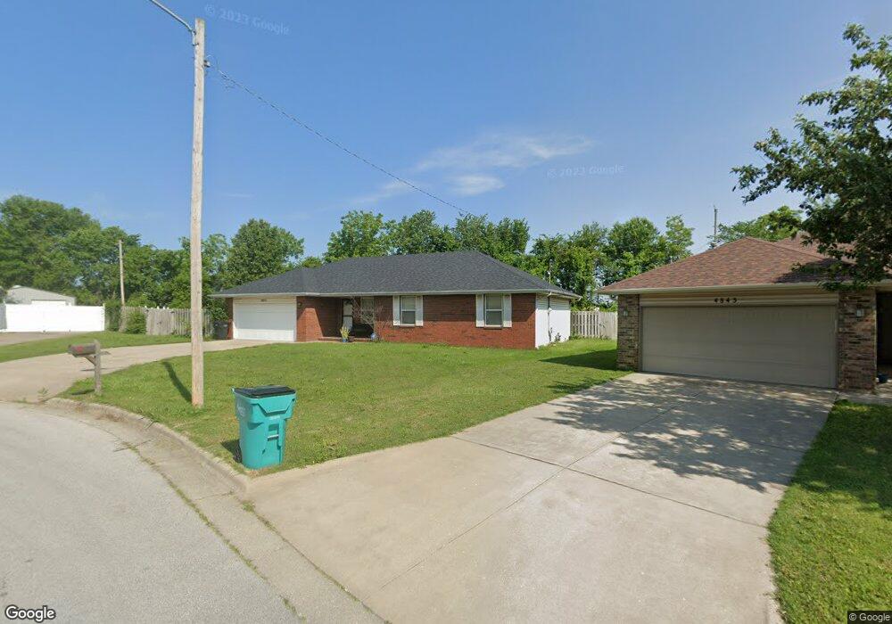
4851 W Burbank St Springfield, MO 65802
Young-Lilly NeighborhoodEstimated Value: $227,597 - $243,000
3
Beds
2
Baths
1,388
Sq Ft
$171/Sq Ft
Est. Value
About This Home
This home is located at 4851 W Burbank St, Springfield, MO 65802 and is currently estimated at $237,399, approximately $171 per square foot. 4851 W Burbank St is a home located in Greene County with nearby schools including Willard Intermediate-South and Willard High School.
Ownership History
Date
Name
Owned For
Owner Type
Purchase Details
Closed on
Mar 13, 2018
Sold by
Blalark Ronald
Bought by
Johnson Kimberly and Blalark Kimberly
Current Estimated Value
Purchase Details
Closed on
Oct 17, 2005
Sold by
Miller Mark D and Miller Max H
Bought by
Blalark Kim A and Blalark Ronald E
Home Financials for this Owner
Home Financials are based on the most recent Mortgage that was taken out on this home.
Original Mortgage
$21,680
Interest Rate
5.33%
Mortgage Type
Stand Alone Second
Create a Home Valuation Report for This Property
The Home Valuation Report is an in-depth analysis detailing your home's value as well as a comparison with similar homes in the area
Home Values in the Area
Average Home Value in this Area
Purchase History
| Date | Buyer | Sale Price | Title Company |
|---|---|---|---|
| Johnson Kimberly | -- | None Available | |
| Blalark Kim A | -- | None Available |
Source: Public Records
Mortgage History
| Date | Status | Borrower | Loan Amount |
|---|---|---|---|
| Closed | Blalark Kim A | $21,680 | |
| Open | Blalark Kim A | $86,720 |
Source: Public Records
Tax History Compared to Growth
Tax History
| Year | Tax Paid | Tax Assessment Tax Assessment Total Assessment is a certain percentage of the fair market value that is determined by local assessors to be the total taxable value of land and additions on the property. | Land | Improvement |
|---|---|---|---|---|
| 2025 | $1,520 | $31,370 | $5,700 | $25,670 |
| 2024 | $1,520 | $27,610 | $4,750 | $22,860 |
| 2023 | $1,514 | $27,610 | $4,750 | $22,860 |
| 2022 | $1,267 | $22,990 | $4,750 | $18,240 |
| 2021 | $1,268 | $22,990 | $4,750 | $18,240 |
| 2020 | $1,167 | $20,960 | $4,750 | $16,210 |
| 2019 | $1,162 | $20,960 | $4,750 | $16,210 |
| 2018 | $1,053 | $18,910 | $3,330 | $15,580 |
| 2017 | $1,044 | $18,190 | $3,330 | $14,860 |
| 2016 | $999 | $18,190 | $3,330 | $14,860 |
| 2015 | $992 | $18,190 | $3,330 | $14,860 |
| 2014 | $963 | $17,540 | $3,330 | $14,210 |
Source: Public Records
Map
Nearby Homes
- 209 N Miller Ave
- 452 S Dove Valley Ave
- 438 S Lulwood Ave
- 4553 W La Siesta St
- 4803 W Tilden Ct
- 516 S Bernier Ave
- 4800 W Mount Vernon St
- 4533 W Tarkio St
- 4426 W Billings St
- 602 S Casa Grande Ave
- 4360 W Mount Vernon St
- 4247 W La Siesta Place
- 709 S Mahn Ave
- 5182 W Sunstruck St
- 5175 W Sunstruck St
- 5163 W Sunstruck St
- 5131 W Sunstruck St
- 5145 W Sunstruck St
- 4211 W Tarkio St
- 5331 W Harrison St
- 4843 W Burbank St
- 4857 W Burbank St
- 4837 W Burbank St
- 4852 W Burbank St
- 4846 W Burbank St
- 4838 W Burbank St
- 229 N Foster Ave
- 235 N Foster Ave
- 4912 W State Highway 266
- 4830 W Burbank St
- 4875 W La Siesta St
- 241 N Foster Ave
- 4855 W La Siesta St
- 4824 W Burbank St
- 4845 W La Siesta St
- 4885 W La Siesta St
- 4835 W La Siesta St
- 4825 W La Siesta St
- 230 N Foster Ave
- 4814 W Burbank St