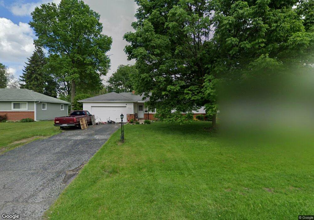
4854 Cedarhurst Rd Toledo, OH 43613
DeVeaux NeighborhoodEstimated Value: $188,000 - $200,000
3
Beds
2
Baths
1,362
Sq Ft
$143/Sq Ft
Est. Value
About This Home
This home is located at 4854 Cedarhurst Rd, Toledo, OH 43613 and is currently estimated at $194,542, approximately $142 per square foot. 4854 Cedarhurst Rd is a home located in Lucas County with nearby schools including Hiawatha Elementary School, Jefferson Junior High School, and Washington Junior High School.
Ownership History
Date
Name
Owned For
Owner Type
Purchase Details
Closed on
Aug 11, 2000
Sold by
Papen Karen C and Papen Karen C
Bought by
Kamer Christopher D and Lashley Melanie
Current Estimated Value
Home Financials for this Owner
Home Financials are based on the most recent Mortgage that was taken out on this home.
Original Mortgage
$104,850
Outstanding Balance
$37,856
Interest Rate
8.16%
Estimated Equity
$156,686
Purchase Details
Closed on
Jan 14, 1998
Sold by
Stoll Corinne M
Bought by
Papen Karen C
Create a Home Valuation Report for This Property
The Home Valuation Report is an in-depth analysis detailing your home's value as well as a comparison with similar homes in the area
Home Values in the Area
Average Home Value in this Area
Purchase History
| Date | Buyer | Sale Price | Title Company |
|---|---|---|---|
| Kamer Christopher D | -- | A.R.E.A. Title Agency Inc | |
| Papen Karen C | -- | -- |
Source: Public Records
Mortgage History
| Date | Status | Borrower | Loan Amount |
|---|---|---|---|
| Open | Kamer Christopher D | $104,850 |
Source: Public Records
Tax History Compared to Growth
Tax History
| Year | Tax Paid | Tax Assessment Tax Assessment Total Assessment is a certain percentage of the fair market value that is determined by local assessors to be the total taxable value of land and additions on the property. | Land | Improvement |
|---|---|---|---|---|
| 2024 | $1,464 | $46,270 | $10,290 | $35,980 |
| 2023 | $2,973 | $40,355 | $9,170 | $31,185 |
| 2022 | $2,945 | $40,355 | $9,170 | $31,185 |
| 2021 | $3,028 | $40,355 | $9,170 | $31,185 |
| 2020 | $2,952 | $33,600 | $7,630 | $25,970 |
| 2019 | $2,854 | $33,600 | $7,630 | $25,970 |
| 2018 | $2,602 | $33,600 | $7,630 | $25,970 |
| 2017 | $2,537 | $30,940 | $8,190 | $22,750 |
| 2016 | $2,551 | $88,400 | $23,400 | $65,000 |
| 2015 | $2,583 | $88,400 | $23,400 | $65,000 |
| 2014 | $2,108 | $30,940 | $8,190 | $22,750 |
| 2013 | $2,108 | $30,940 | $8,190 | $22,750 |
Source: Public Records
Map
Nearby Homes
- 4823 Cedarhurst Rd
- 4807 Brott Rd
- 2849 W Laskey Rd
- 3065 Reen Dr
- 5111 Elaine Dr
- 5117 Fern Dr
- 2820 Claredale Rd
- 5201 Elaine Dr
- 4812 Secor Rd
- 5044 Secor Rd
- 2842 Oak Grove Place
- 5238 Sheila Dr
- 2855 Castleton Ave
- 2623 W Laskey Rd
- 5213 Fairgreen Dr
- 2728 Castleton Ave
- 5264 Fairgreen Dr
- 2605 Wyndale Rd
- 2659 Oak Grove Place
- 5215 Secor Rd
- 4862 Cedarhurst Rd
- 4842 Cedarhurst Rd
- 4906 Cedarhurst Rd
- 4838 Cedarhurst Rd
- 4857 Bowser Dr
- 4851 Bowser Dr
- 4859 Bowser Dr
- 4849 Bowser Dr
- 4845 Bowser Dr
- 4905 Bowser Dr
- 4855 Cedarhurst Rd
- 4841 Bowser Dr
- 4847 Cedarhurst Rd
- 4861 Cedarhurst Rd
- 4914 Cedarhurst Rd
- 4830 Cedarhurst Rd
- 4835 Bowser Dr
- 4839 Cedarhurst Rd
- 4911 Bowser Dr
- 4907 Cedarhurst Rd