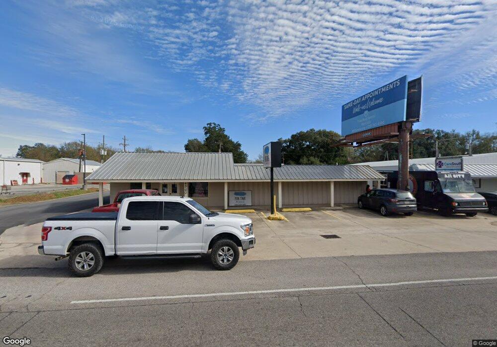
4860 Zachary Slaughter Hwy Zachary, LA 70791
Estimated Value: $261,000 - $281,000
--
Bed
--
Bath
2,331
Sq Ft
$115/Sq Ft
Est. Value
About This Home
This home is located at 4860 Zachary Slaughter Hwy, Zachary, LA 70791 and is currently estimated at $268,984, approximately $115 per square foot. 4860 Zachary Slaughter Hwy is a home located in East Baton Rouge Parish with nearby schools including Rollins Place Elementary School, Northwestern Elementary School, and Zachary Elementary School.
Ownership History
Date
Name
Owned For
Owner Type
Purchase Details
Closed on
Aug 24, 2012
Sold by
Gros Nellie A
Bought by
Gros Roy D
Current Estimated Value
Home Financials for this Owner
Home Financials are based on the most recent Mortgage that was taken out on this home.
Original Mortgage
$216,000
Outstanding Balance
$148,929
Interest Rate
3.57%
Mortgage Type
New Conventional
Estimated Equity
$120,055
Purchase Details
Closed on
Jun 12, 2001
Sold by
Gros Whitney Paul and Gros Brent Louis
Bought by
Gros Nellie Aucoin
Create a Home Valuation Report for This Property
The Home Valuation Report is an in-depth analysis detailing your home's value as well as a comparison with similar homes in the area
Home Values in the Area
Average Home Value in this Area
Purchase History
| Date | Buyer | Sale Price | Title Company |
|---|---|---|---|
| Gros Roy D | $175,000 | -- | |
| Gros Nellie Aucoin | -- | -- |
Source: Public Records
Mortgage History
| Date | Status | Borrower | Loan Amount |
|---|---|---|---|
| Open | Gros Roy D | $216,000 |
Source: Public Records
Tax History Compared to Growth
Tax History
| Year | Tax Paid | Tax Assessment Tax Assessment Total Assessment is a certain percentage of the fair market value that is determined by local assessors to be the total taxable value of land and additions on the property. | Land | Improvement |
|---|---|---|---|---|
| 2024 | $1,325 | $19,958 | $1,232 | $18,726 |
| 2023 | $1,325 | $17,820 | $1,100 | $16,720 |
| 2022 | $2,330 | $17,820 | $1,100 | $16,720 |
| 2021 | $2,330 | $17,820 | $1,100 | $16,720 |
| 2020 | $2,316 | $17,820 | $1,100 | $16,720 |
| 2019 | $2,306 | $16,200 | $1,000 | $15,200 |
| 2018 | $2,314 | $16,200 | $1,000 | $15,200 |
| 2017 | $2,314 | $16,200 | $1,000 | $15,200 |
| 2016 | $1,232 | $16,200 | $1,000 | $15,200 |
| 2015 | $1,168 | $15,750 | $1,000 | $14,750 |
| 2014 | $1,165 | $15,750 | $1,000 | $14,750 |
| 2013 | -- | $15,750 | $1,000 | $14,750 |
Source: Public Records
Map
Nearby Homes
- 5081 Kennedy Dr
- 5125 Harlem St
- 4904 Bob Odom Dr Unit B1
- 4906 Bob Odom Dr Unit C2
- 4908 Bob Odom Dr Unit B2
- 5633 Emmie Dr Unit C2
- 5635 Emmie Dr Unit B1
- 5629 Emmie Dr Unit A2
- 5631 Emmie Dr Unit B2
- 5708 Montegudo Blvd
- 5710 Montegudo Blvd
- 5704 Montegudo Blvd
- 5706 Montegudo Blvd
- 150 Prestwick Ct
- 5702 Blvd
- 4311 Locke St
- 4848 Lois Dr
- N-2-B Milldale Rd
- N-2-A Milldale Rd
- TBD Main St
- 4860 Louisiana 19
- 4852 Highway 19
- 4852 Louisiana 19
- 4852 Rankin St
- 4824 Louisiana 19
- 4848 Rankin St
- 4913 Highway 19
- 4913 Louisiana 19
- 4948 Rankin St
- 4814 Rankin St
- 4800 Louisiana 19
- 4800 -C La Hwy 19
- 4800 -B La Hwy 19
- 4941 Highway 19
- 4941 Louisiana 19
- 4800 Highway 19
- 4720 Louisiana 19
- 5044 Kennedy Dr
- 4754 Rankin St
- 5059 Kennedy Dr
