
Seller's Agent in 2025
Barry Taylor
Daignault Realty Inc
(321) 795-7074
13 in this area
79 Total Sales
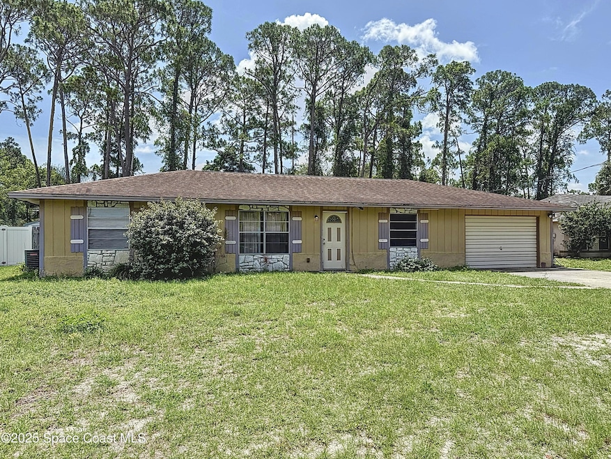
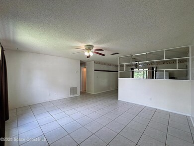
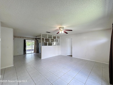
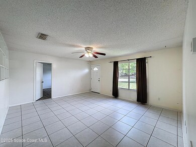
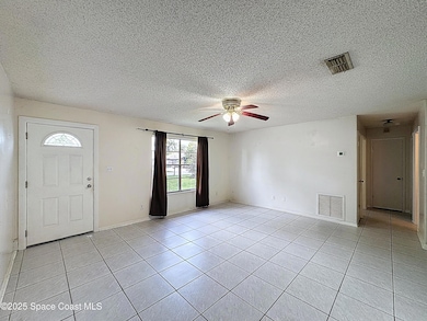
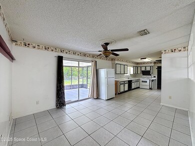
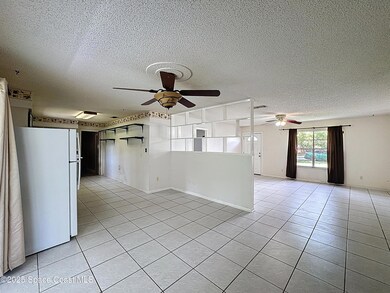
Nice house! Many great features: large tiled great room, large tiled dining area, large master with laminate wood flooring, nice size guest bedrooms and a large guest bathroom, a really large laundry room with additional storage or craft room... are you seeing a large theme here? And if that's not enough, there is a screened patio to enjoy the large fenced back yard. But wait, there's more! There is a storage shed in the back yard, however, it does need a lot of TLC! Come see this hidden gem and make it a beautiful home or a great addition to your investment portfolio!
Last Agent to Sell the Property
Daignault Realty Inc License #3247698 Listed on: 05/29/2025
| Date | Type | Sale Price | Title Company |
|---|---|---|---|
| Warranty Deed | $250,000 | Title Solutions | |
| Warranty Deed | $250,000 | Title Solutions | |
| Quit Claim Deed | $100 | -- | |
| Quit Claim Deed | $100 | None Listed On Document | |
| Warranty Deed | $59,000 | Sunbelt Title Agency | |
| Warranty Deed | -- | None Available |
| Date | Status | Loan Amount | Loan Type |
|---|---|---|---|
| Open | $250,000 | VA | |
| Closed | $250,000 | VA |
| Date | Event | Price | List to Sale | Price per Sq Ft |
|---|---|---|---|---|
| 06/27/2025 06/27/25 | Sold | $250,000 | 0.0% | $190 / Sq Ft |
| 05/29/2025 05/29/25 | For Sale | $250,000 | -- | $190 / Sq Ft |
| Year | Tax Paid | Tax Assessment Tax Assessment Total Assessment is a certain percentage of the fair market value that is determined by local assessors to be the total taxable value of land and additions on the property. | Land | Improvement |
|---|---|---|---|---|
| 2025 | $3,024 | $212,630 | -- | -- |
| 2024 | $2,947 | $216,660 | -- | -- |
| 2023 | $2,947 | $213,870 | $0 | $0 |
| 2022 | $2,664 | $203,840 | $0 | $0 |
| 2021 | $2,414 | $153,580 | $42,000 | $111,580 |
| 2020 | $2,225 | $137,920 | $40,000 | $97,920 |
| 2019 | $2,108 | $133,300 | $35,000 | $98,300 |
| 2018 | $2,001 | $121,750 | $27,000 | $94,750 |
| 2017 | $1,901 | $108,900 | $24,000 | $84,900 |
| 2016 | $1,783 | $93,370 | $18,000 | $75,370 |
| 2015 | $1,697 | $74,340 | $15,000 | $59,340 |
| 2014 | $1,554 | $67,590 | $11,000 | $56,590 |
Seller's Agent in 2025
Barry Taylor
Daignault Realty Inc
(321) 795-7074
13 in this area
79 Total Sales
C
Seller Co-Listing Agent in 2025
Christine Daignault-Taylor
Daignault Realty Inc
(321) 591-3228
11 in this area
75 Total Sales
Buyer's Agent in 2025
Brianna Lalumiere
EXP Realty, LLC
(727) 641-3957
6 in this area
144 Total Sales
Source: Space Coast MLS (Space Coast Association of REALTORS®)
MLS Number: 1047418
APN: 23-35-23-JM-00085.0-0009.00
Disclaimer: Certain information contained herein is derived from information provided by parties other than Homes.com. All information provided is deemed reliable, but is not guaranteed to be accurate and should be independently verified.
![]() IDX information is provided exclusively for personal, non-commercial use, and may not be used for any purpose other than to identify prospective properties consumers may be interested in purchasing.
IDX information is provided exclusively for personal, non-commercial use, and may not be used for any purpose other than to identify prospective properties consumers may be interested in purchasing.
Information is deemed reliable but not guaranteed.