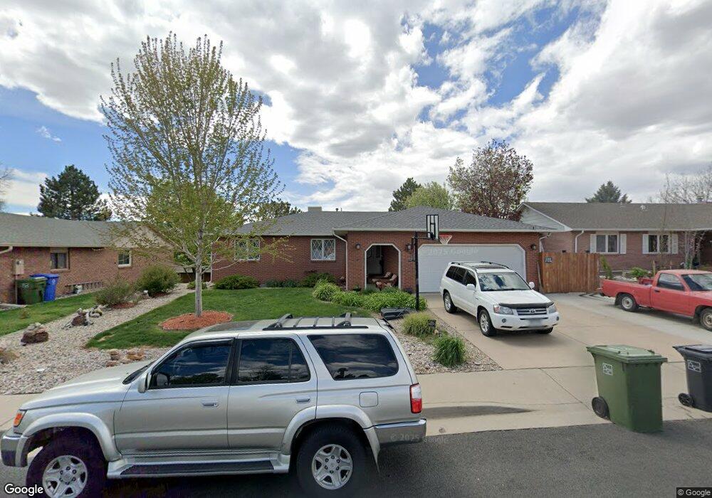
4867 N Franklin Ave Loveland, CO 80538
Estimated Value: $461,394 - $509,000
3
Beds
2
Baths
1,645
Sq Ft
$300/Sq Ft
Est. Value
About This Home
This home is located at 4867 N Franklin Ave, Loveland, CO 80538 and is currently estimated at $492,849, approximately $299 per square foot. 4867 N Franklin Ave is a home located in Larimer County with nearby schools including Laurene Edmondson Elementary School, Lucile Erwin Middle School, and Loveland High School.
Ownership History
Date
Name
Owned For
Owner Type
Purchase Details
Closed on
Jul 31, 2007
Sold by
Locicero Elizabeth J and Kuzmich Steven J
Bought by
Keen Michael Kent and Keen Robin Elaine
Current Estimated Value
Home Financials for this Owner
Home Financials are based on the most recent Mortgage that was taken out on this home.
Original Mortgage
$131,449
Outstanding Balance
$83,524
Interest Rate
6.73%
Mortgage Type
New Conventional
Estimated Equity
$409,325
Purchase Details
Closed on
Jun 1, 1985
Bought by
Kuzmich Steven F
Create a Home Valuation Report for This Property
The Home Valuation Report is an in-depth analysis detailing your home's value as well as a comparison with similar homes in the area
Home Values in the Area
Average Home Value in this Area
Purchase History
| Date | Buyer | Sale Price | Title Company |
|---|---|---|---|
| Keen Michael Kent | $213,500 | Chicago Title Co | |
| Kuzmich Steven F | $16,000 | -- |
Source: Public Records
Mortgage History
| Date | Status | Borrower | Loan Amount |
|---|---|---|---|
| Open | Keen Michael Kent | $131,449 |
Source: Public Records
Tax History Compared to Growth
Tax History
| Year | Tax Paid | Tax Assessment Tax Assessment Total Assessment is a certain percentage of the fair market value that is determined by local assessors to be the total taxable value of land and additions on the property. | Land | Improvement |
|---|---|---|---|---|
| 2025 | $2,444 | $34,304 | $2,948 | $31,356 |
| 2024 | $2,357 | $34,304 | $2,948 | $31,356 |
| 2022 | $2,139 | $26,883 | $3,058 | $23,825 |
| 2021 | $2,198 | $27,656 | $3,146 | $24,510 |
| 2020 | $2,048 | $25,754 | $3,146 | $22,608 |
| 2019 | $2,013 | $25,754 | $3,146 | $22,608 |
| 2018 | $1,791 | $21,766 | $3,168 | $18,598 |
| 2017 | $1,543 | $21,766 | $3,168 | $18,598 |
| 2016 | $1,464 | $19,963 | $3,502 | $16,461 |
| 2015 | $1,452 | $19,960 | $3,500 | $16,460 |
| 2014 | $1,326 | $17,640 | $3,500 | $14,140 |
Source: Public Records
Map
Nearby Homes
- 4869 Roosevelt Ave
- 307 Juniper Place
- 132 W 47th Place Unit 1
- 980 Norway Maple Dr
- 127 Juniper Place
- 138 Juniper Place
- 126 Juniper Place
- 5180 Brandywine Dr
- 5190 Brandywine Dr
- 309 Ranch Acres Dr
- 4019 Burr Oak Dr
- 1015 Coral Burst Dr
- 4403 Shubert Dr
- 1078 Coral Burst Dr
- 845 Cottonwood Dr
- 1266 W 45th St
- 4105 N Garfield Ave Unit 100
- 4105 N Garfield Ave Unit 61
- 119 E 42nd St Unit 3B
- 4150 Ebony Ct
- 4879 N Franklin Ave
- 4861 N Franklin Ave
- 4868 Filbert Dr
- 4862 Filbert Dr
- 4874 Filbert Dr
- 4891 N Franklin Ave
- 4855 N Franklin Ave
- 4868 N Franklin Ave
- 4862 N Franklin Ave
- 4856 Filbert Dr
- 4880 N Franklin Ave
- 4903 N Franklin Ave
- 4886 N Franklin Ave
- 4850 Filbert Dr
- 4886 Filbert Dr
- 4849 N Franklin Ave
- 4873 Ranch Acres Dr
- 4867 Filbert Dr
- 4867 Ranch Acres Dr
- 4952 N Franklin Ave