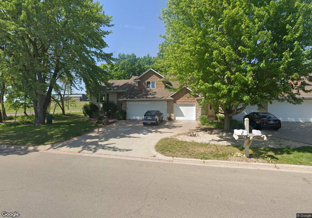
487 487 Mendota Rd W West St. Paul, MN 55118
Estimated Value: $549,000 - $596,000
4
Beds
4
Baths
1,944
Sq Ft
$291/Sq Ft
Est. Value
About This Home
This home is located at 487 487 Mendota Rd W, West St. Paul, MN 55118 and is currently estimated at $564,742, approximately $290 per square foot. 487 487 Mendota Rd W is a home located in Dakota County with nearby schools including Garlough Environmental Magnet, Friendly Hills Middle School, and Two Rivers High School.
Ownership History
Date
Name
Owned For
Owner Type
Purchase Details
Closed on
Apr 5, 2022
Sold by
Zavada John and Zavada Margaret
Bought by
Newman Leslie and Smith Aaron
Current Estimated Value
Home Financials for this Owner
Home Financials are based on the most recent Mortgage that was taken out on this home.
Original Mortgage
$550,000
Outstanding Balance
$514,796
Interest Rate
3.92%
Mortgage Type
New Conventional
Estimated Equity
$49,946
Purchase Details
Closed on
Mar 31, 2010
Sold by
Bremer Daryl D
Bought by
Zavada John C
Home Financials for this Owner
Home Financials are based on the most recent Mortgage that was taken out on this home.
Original Mortgage
$50,000
Interest Rate
4.96%
Mortgage Type
New Conventional
Purchase Details
Closed on
Mar 5, 2002
Sold by
Bjorklund David and Bjorklund Kathleen K
Bought by
Danzeisen Lorie E
Create a Home Valuation Report for This Property
The Home Valuation Report is an in-depth analysis detailing your home's value as well as a comparison with similar homes in the area
Home Values in the Area
Average Home Value in this Area
Purchase History
| Date | Buyer | Sale Price | Title Company |
|---|---|---|---|
| Newman Leslie | $550,000 | -- | |
| Zavada John C | $297,500 | -- | |
| Danzeisen Lorie E | $245,000 | -- |
Source: Public Records
Mortgage History
| Date | Status | Borrower | Loan Amount |
|---|---|---|---|
| Open | Newman Leslie | $550,000 | |
| Previous Owner | Zavada John C | $50,000 |
Source: Public Records
Tax History Compared to Growth
Tax History
| Year | Tax Paid | Tax Assessment Tax Assessment Total Assessment is a certain percentage of the fair market value that is determined by local assessors to be the total taxable value of land and additions on the property. | Land | Improvement |
|---|---|---|---|---|
| 2024 | $6,230 | $480,600 | $74,600 | $406,000 |
| 2023 | $6,230 | $502,200 | $79,100 | $423,100 |
| 2022 | $5,642 | $489,100 | $78,800 | $410,300 |
| 2021 | $5,860 | $427,400 | $68,500 | $358,900 |
| 2020 | $5,384 | $412,500 | $65,200 | $347,300 |
| 2019 | $4,815 | $367,900 | $62,100 | $305,800 |
| 2018 | $4,469 | $313,400 | $58,100 | $255,300 |
| 2017 | $4,123 | $301,100 | $55,300 | $245,800 |
| 2016 | $3,916 | $266,100 | $50,300 | $215,800 |
| 2015 | $3,878 | $237,222 | $46,446 | $190,776 |
| 2014 | -- | $225,995 | $42,860 | $183,135 |
| 2013 | -- | $209,536 | $39,057 | $170,479 |
Source: Public Records
Map
Nearby Homes
- 492 Deer Run Trail
- 485 Preserve Path
- 600 Sibley Ct
- 2122 Delaware Ave
- 1912 South Ln
- 2148 Delaware Ave
- 2194 Charlton Rd
- 614 Hidden Creek Trail
- 2012 Pine Ridge Dr
- 685 Hidden Creek Trail
- 1774 Dodd Rd
- 357 Salem Church Rd
- 1941 Dodd Rd
- 1620 Charlton St Unit 109
- 180 Wentworth Ave W Unit E
- 795 Creek Ave
- 170 Wentworth Ave W Unit F
- 2222 Apache St
- 688 Wentworth Ave W
- 1513 Smith Ave S
- 487 Mendota Rd W
- 485 Mendota Rd W
- 2040 Delaware Ave
- 477 Mendota Rd W
- 475 Mendota Rd W
- 475 475 Mendota Rd W
- 490 Darla Ct
- 467 Mendota Rd W
- 480 Darla Ct
- 472 Darla Ct
- 465 Mendota Rd W
- 2050 Delaware Ave
- 2050 Delaware Ave
- 459 Mendota Rd W
- 466 Darla Ct
- 457 Mendota Rd W
- 457 W Mendota Rd
- 472 472 Darla Ct
- 457 457 Mendota-Road-w
- 489 Darla Ct