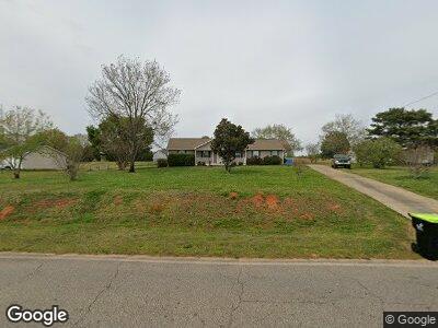
487 Laney Rd Locust Grove, GA 30248
Estimated Value: $251,000 - $279,000
3
Beds
2
Baths
1,387
Sq Ft
$191/Sq Ft
Est. Value
About This Home
This home is located at 487 Laney Rd, Locust Grove, GA 30248 and is currently estimated at $265,235, approximately $191 per square foot. 487 Laney Rd is a home located in Henry County with nearby schools including New Hope Elementary School, Locust Grove Middle School, and Locust Grove High School.
Ownership History
Date
Name
Owned For
Owner Type
Purchase Details
Closed on
Oct 22, 2019
Sold by
Poe Jeanette Jackson
Bought by
Sobadjian Christian
Current Estimated Value
Home Financials for this Owner
Home Financials are based on the most recent Mortgage that was taken out on this home.
Original Mortgage
$153,890
Outstanding Balance
$136,838
Interest Rate
3.6%
Mortgage Type
New Conventional
Estimated Equity
$128,397
Purchase Details
Closed on
Jul 1, 1993
Sold by
Gintole Jeffrey J and Gintole Melissa A
Bought by
Jackson Janette
Home Financials for this Owner
Home Financials are based on the most recent Mortgage that was taken out on this home.
Original Mortgage
$69,549
Interest Rate
7.52%
Create a Home Valuation Report for This Property
The Home Valuation Report is an in-depth analysis detailing your home's value as well as a comparison with similar homes in the area
Home Values in the Area
Average Home Value in this Area
Purchase History
| Date | Buyer | Sale Price | Title Company |
|---|---|---|---|
| Sobadjian Christian | $158,650 | -- | |
| Jackson Janette | $69,600 | -- |
Source: Public Records
Mortgage History
| Date | Status | Borrower | Loan Amount |
|---|---|---|---|
| Open | Sobadjian Christian | $153,890 | |
| Closed | Sobadjian Christian | $6,346 | |
| Previous Owner | Jackson Jeanette | $37,300 | |
| Previous Owner | Jackson Janette | $69,549 |
Source: Public Records
Tax History Compared to Growth
Tax History
| Year | Tax Paid | Tax Assessment Tax Assessment Total Assessment is a certain percentage of the fair market value that is determined by local assessors to be the total taxable value of land and additions on the property. | Land | Improvement |
|---|---|---|---|---|
| 2024 | $3,158 | $102,240 | $14,000 | $88,240 |
| 2023 | $2,673 | $102,600 | $13,480 | $89,120 |
| 2022 | $2,594 | $77,880 | $12,440 | $65,440 |
| 2021 | $2,604 | $66,840 | $10,680 | $56,160 |
| 2020 | $2,317 | $59,360 | $10,040 | $49,320 |
| 2019 | $449 | $50,080 | $9,520 | $40,560 |
| 2018 | $449 | $45,320 | $8,800 | $36,520 |
| 2016 | $372 | $37,520 | $6,560 | $30,960 |
| 2015 | $381 | $36,480 | $7,360 | $29,120 |
| 2014 | $271 | $29,200 | $7,360 | $21,840 |
Source: Public Records
Map
Nearby Homes
- 578 Laney Rd
- 45 Plantation Ln
- 935 S Laney Rd
- 376 Cattlemans Cir
- 125 Laney Ct
- 173 Michael Ln
- 175 Laney Ct Unit 1
- 153 Cedar Ridge Rd
- 328 Cattlemans Cir
- 235 Creekside Way Unit 3
- 1126 Old Jackson Rd
- 888 Laney Rd
- 116 Ducati Dr
- 195 Creekside Way
- 732 New Hope Rd
- 30 Apache Ct
- 281 New Hope Dr
- 281 Laney Dr
- 812 Graeme Dr
- 308 Tussahaw Trail
- 487 Laney Rd
- 505 Laney Rd Unit 805
- 505 Laney Rd
- 575 Plantation Rd
- 475 Laney Rd
- 555 Plantation Rd
- 525 Laney Rd
- 490 Laney Rd
- 480 Laney Rd
- 480 Laney Rd Unit 20
- 120 Michael Ln
- 570 Plantation Rd
- 520 Laney Rd
- 124 Michael Ln
- 560 Plantation Rd
- 455 Laney Rd
- 116 Michael Ln
- 545 Plantation Rd
- 535 Laney Rd
- 25 Plantation Ln