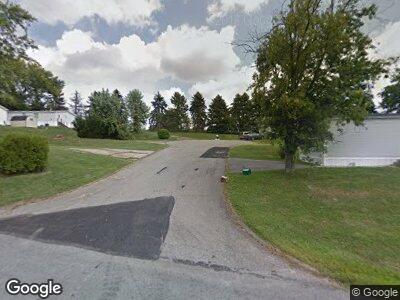
487 Prince Cir Belle Vernon, PA 15012
Rostaver Township NeighborhoodEstimated Value: $199,106 - $508,000
--
Bed
--
Bath
2,808
Sq Ft
$148/Sq Ft
Est. Value
About This Home
This home is located at 487 Prince Cir, Belle Vernon, PA 15012 and is currently estimated at $415,027, approximately $147 per square foot. 487 Prince Cir is a home located in Westmoreland County with nearby schools including Belle Vernon Area Middle School and Belle Vernon Area High School.
Ownership History
Date
Name
Owned For
Owner Type
Purchase Details
Closed on
Dec 22, 2006
Sold by
Maronda Homes Inc
Bought by
Altemara Cynthia
Current Estimated Value
Home Financials for this Owner
Home Financials are based on the most recent Mortgage that was taken out on this home.
Original Mortgage
$159,600
Interest Rate
11.99%
Mortgage Type
Purchase Money Mortgage
Create a Home Valuation Report for This Property
The Home Valuation Report is an in-depth analysis detailing your home's value as well as a comparison with similar homes in the area
Home Values in the Area
Average Home Value in this Area
Purchase History
| Date | Buyer | Sale Price | Title Company |
|---|---|---|---|
| Altemara Cynthia | $266,000 | None Available | |
| Altemara Cynthia | $266,000 | None Available |
Source: Public Records
Mortgage History
| Date | Status | Borrower | Loan Amount |
|---|---|---|---|
| Open | Neill Shawn P O | $212,500 | |
| Closed | Altemara Cynthia | $218,700 | |
| Closed | Altemara Cynthia | $199,500 | |
| Closed | Altemara Cynthia | $159,600 | |
| Previous Owner | Miller Susan | $50,000 |
Source: Public Records
Tax History Compared to Growth
Tax History
| Year | Tax Paid | Tax Assessment Tax Assessment Total Assessment is a certain percentage of the fair market value that is determined by local assessors to be the total taxable value of land and additions on the property. | Land | Improvement |
|---|---|---|---|---|
| 2025 | $6,211 | $44,120 | $5,510 | $38,610 |
| 2024 | $6,211 | $44,120 | $5,510 | $38,610 |
| 2023 | $5,687 | $44,120 | $5,510 | $38,610 |
| 2022 | $5,621 | $44,120 | $5,510 | $38,610 |
| 2021 | $5,576 | $44,120 | $5,510 | $38,610 |
| 2020 | $5,444 | $44,120 | $5,510 | $38,610 |
| 2019 | $5,305 | $43,870 | $5,260 | $38,610 |
| 2018 | $5,160 | $43,870 | $5,260 | $38,610 |
| 2017 | $5,055 | $43,870 | $5,260 | $38,610 |
| 2016 | $4,929 | $43,870 | $5,260 | $38,610 |
| 2015 | $4,929 | $43,870 | $5,260 | $38,610 |
| 2014 | $4,903 | $43,870 | $5,260 | $38,610 |
Source: Public Records
Map
Nearby Homes
- 502 W Spring Grove Blvd
- 2007 Lake View Dr
- 106 Birch Dr
- 1040 1/2 Sharon Dr
- 1100 Willowbrook Rd
- 209 Country Dr
- 1949 Rostraver Rd
- 404 Belrose Dr
- 1967 Rostraver Rd
- 602 Skyline Dr
- 411 Sunset Dr
- 204 Rolling Hill Farm Dr
- 180 Sweeney Circle Dr
- 254 Stump Dr
- 1574 Rostraver Rd
- 136 Azalea Cir
- 321 Crest Ave
- 530 Gardenia Dr
- 372 Vernon Dr
- 123 Fell Ave
- 487 Prince Cir
- 491 W Spring Grove Blvd
- 487 W Spring Grove Blvd
- 486 W Spring Grove Blvd
- 495 W Spring Grove Blvd
- 494 W Spring Grove Blvd
- 483 W Spring Grove Blvd
- 490 W Spring Grove Blvd
- 499 W Spring Grove Blvd
- 478 W Spring Grove Blvd
- 498 W Spring Grove Blvd
- 479 W Spring Grove Blvd
- 503 W Spring Grove Blvd
- 2048 Lake View Dr Unit 2048
- 2038 Lake View Dr
- 2046 Lake View Dr
- 2044 Lake View Dr
- 2042 Lake View Dr Unit 2042
- 2034 Lake View Dr
- 2032 Lake View Dr
