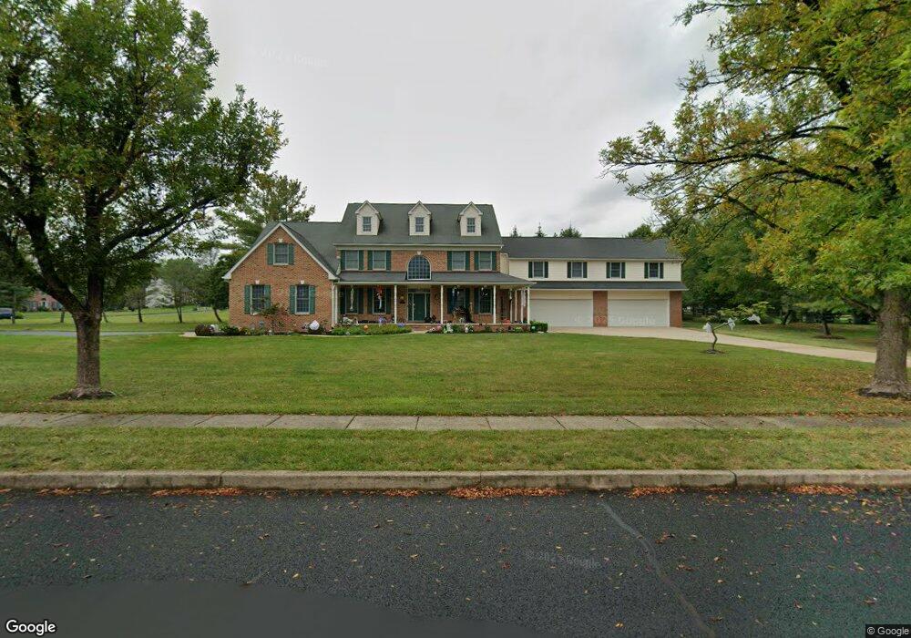
4871 Gloucester Dr Doylestown, PA 18902
Plumstead NeighborhoodEstimated Value: $1,042,000 - $1,452,000
5
Beds
4
Baths
5,370
Sq Ft
$238/Sq Ft
Est. Value
About This Home
This home is located at 4871 Gloucester Dr, Doylestown, PA 18902 and is currently estimated at $1,275,891, approximately $237 per square foot. 4871 Gloucester Dr is a home located in Bucks County with nearby schools including Gayman Elementary School, Tohickon Middle School, and Central Bucks High School - East.
Ownership History
Date
Name
Owned For
Owner Type
Purchase Details
Closed on
Dec 20, 1993
Sold by
Willow Grove Federal Savings
Bought by
Kelly Michael A and Kelly Eileen B
Current Estimated Value
Home Financials for this Owner
Home Financials are based on the most recent Mortgage that was taken out on this home.
Original Mortgage
$58,500
Interest Rate
7.08%
Mortgage Type
Seller Take Back
Create a Home Valuation Report for This Property
The Home Valuation Report is an in-depth analysis detailing your home's value as well as a comparison with similar homes in the area
Home Values in the Area
Average Home Value in this Area
Purchase History
| Date | Buyer | Sale Price | Title Company |
|---|---|---|---|
| Kelly Michael A | $78,000 | -- |
Source: Public Records
Mortgage History
| Date | Status | Borrower | Loan Amount |
|---|---|---|---|
| Previous Owner | Kelly Michael A | $58,500 |
Source: Public Records
Tax History
| Year | Tax Paid | Tax Assessment Tax Assessment Total Assessment is a certain percentage of the fair market value that is determined by local assessors to be the total taxable value of land and additions on the property. | Land | Improvement |
|---|---|---|---|---|
| 2025 | $12,684 | $73,000 | $10,310 | $62,690 |
| 2024 | $12,684 | $73,000 | $10,310 | $62,690 |
| 2023 | $12,281 | $73,000 | $10,310 | $62,690 |
| 2022 | $12,144 | $73,000 | $10,310 | $62,690 |
| 2021 | $12,008 | $73,000 | $10,310 | $62,690 |
| 2020 | $12,008 | $73,000 | $10,310 | $62,690 |
| 2019 | $11,935 | $73,000 | $10,310 | $62,690 |
| 2018 | $11,935 | $73,000 | $10,310 | $62,690 |
| 2017 | $11,771 | $73,000 | $10,310 | $62,690 |
| 2016 | $11,771 | $73,000 | $10,310 | $62,690 |
| 2015 | -- | $73,000 | $10,310 | $62,690 |
| 2014 | -- | $73,000 | $10,310 | $62,690 |
Source: Public Records
Map
Nearby Homes
- 4783 Landisville Rd
- 4745 Nottingham Way
- 4990 Point Pleasant Pike
- 4925 Redfield Rd
- 5182 Point Pleasant Pike
- 6680 Point Pleasant Pike
- 4525 Deep Glen Way
- 4533 Deep Creek Way
- 5380 Point Pleasant Pike
- 3960 S Mallard Ln
- 4215 Ferguson Dr
- 4306 Kleinot Dr
- 4298 Kleinot Dr
- 4246 Kleinot Dr
- 4330 Kleinot Dr
- 4464 Kleinot Dr
- 4317 Kleinot Dr
- 5087 Raintree Ct
- 3689 Hancock Ln
- 5491 Long Ln
- 4857 Gloucester Dr
- 4864 Gloucester Dr
- 4895 Gloucester Dr
- 4888 Gloucester Dr
- 4880 Gloucester Dr
- 4856 Gloucester Dr
- 4889 Gloucester Dr
- 4876 Gloucester Dr
- 4849 Gloucester Dr
- 4903 Gloucester Dr
- 4848 Gloucester Dr
- 4742 Essex Dr
- 4904 Gloucester Dr
- 4841 Gloucester Dr
- 4957 Gloucester Dr
- 4911 Gloucester Dr
- 4746 Essex Dr
- 4840 Gloucester Dr
- 4897 Landisville Rd
- 4754 Essex Dr
Your Personal Tour Guide
Ask me questions while you tour the home.