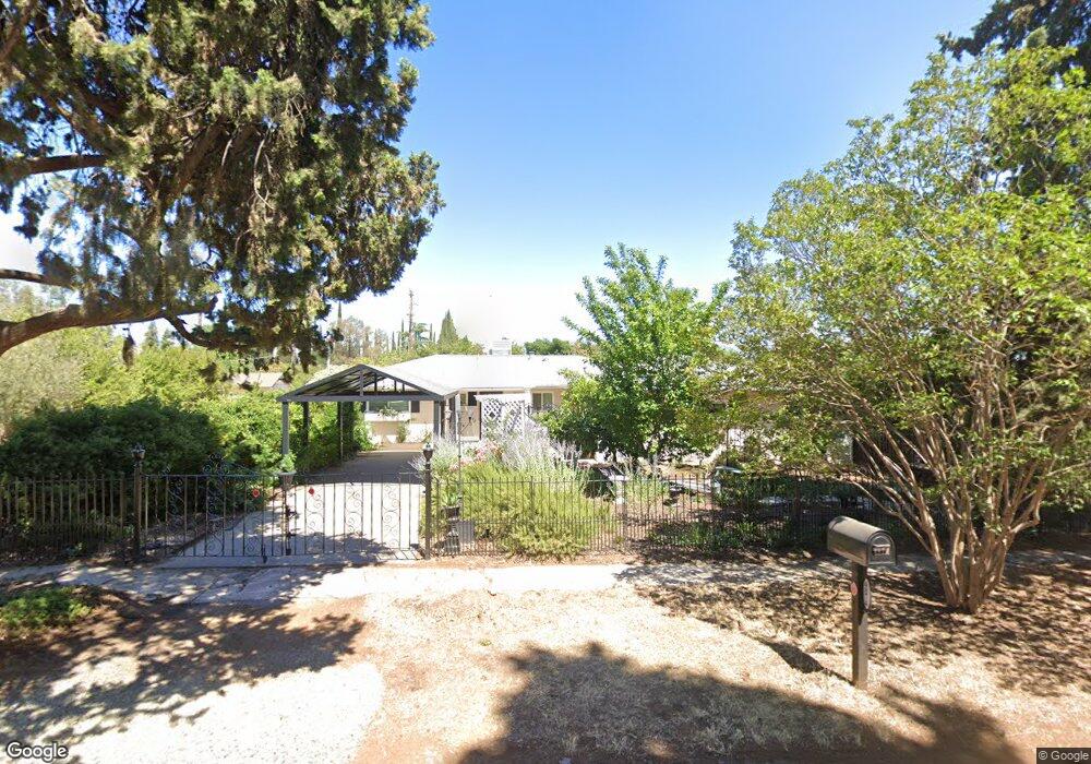
4874 N Arthur Ave Fresno, CA 93705
Bullard NeighborhoodEstimated Value: $309,843 - $373,000
3
Beds
1
Bath
1,200
Sq Ft
$277/Sq Ft
Est. Value
About This Home
This home is located at 4874 N Arthur Ave, Fresno, CA 93705 and is currently estimated at $331,961, approximately $276 per square foot. 4874 N Arthur Ave is a home located in Fresno County with nearby schools including Powers-Ginsburg Elementary, Bullard High School, and Endeavor Charter.
Ownership History
Date
Name
Owned For
Owner Type
Purchase Details
Closed on
Mar 13, 2019
Sold by
Jones Andrew R
Bought by
Jones Andrew R and Jones Melissa M
Current Estimated Value
Purchase Details
Closed on
Jan 3, 2011
Sold by
Wells Fargo Bank N A
Bought by
Jones Andrew R
Purchase Details
Closed on
Sep 8, 2010
Sold by
Costis Alex
Bought by
Wells Fargo Bank Na
Purchase Details
Closed on
Sep 3, 2010
Sold by
Costis Alex
Bought by
Wells Fargo Bank Na
Purchase Details
Closed on
Feb 19, 2002
Sold by
Costis Harry G and Costis Paula Ann
Bought by
Costis Alex
Purchase Details
Closed on
Sep 27, 2000
Sold by
Lopopolo Farms Inc
Bought by
Costis Harry G and Costis Paula Ann
Home Financials for this Owner
Home Financials are based on the most recent Mortgage that was taken out on this home.
Original Mortgage
$68,000
Interest Rate
8.93%
Create a Home Valuation Report for This Property
The Home Valuation Report is an in-depth analysis detailing your home's value as well as a comparison with similar homes in the area
Home Values in the Area
Average Home Value in this Area
Purchase History
| Date | Buyer | Sale Price | Title Company |
|---|---|---|---|
| Jones Andrew R | -- | None Available | |
| Jones Andrew R | $105,000 | Chicago Title Company | |
| Wells Fargo Bank Na | $47,667 | Accommodation | |
| Wells Fargo Bank Na | $47,667 | Accommodation | |
| Costis Alex | -- | -- | |
| Costis Harry G | $85,000 | Fidelity National Title Co |
Source: Public Records
Mortgage History
| Date | Status | Borrower | Loan Amount |
|---|---|---|---|
| Previous Owner | Costis Harry G | $68,000 | |
| Closed | Costis Harry G | $8,500 |
Source: Public Records
Tax History Compared to Growth
Tax History
| Year | Tax Paid | Tax Assessment Tax Assessment Total Assessment is a certain percentage of the fair market value that is determined by local assessors to be the total taxable value of land and additions on the property. | Land | Improvement |
|---|---|---|---|---|
| 2025 | $1,499 | $121,700 | $38,430 | $83,270 |
| 2023 | $1,470 | $116,977 | $36,939 | $80,038 |
| 2022 | $1,451 | $114,684 | $36,215 | $78,469 |
| 2021 | $1,411 | $112,436 | $35,505 | $76,931 |
| 2020 | $1,405 | $111,284 | $35,141 | $76,143 |
| 2019 | $1,351 | $109,102 | $34,452 | $74,650 |
| 2018 | $1,322 | $106,964 | $33,777 | $73,187 |
| 2017 | $1,299 | $104,867 | $33,115 | $71,752 |
| 2016 | $1,257 | $102,812 | $32,466 | $70,346 |
| 2015 | $1,238 | $101,269 | $31,979 | $69,290 |
| 2014 | $1,212 | $99,286 | $31,353 | $67,933 |
Source: Public Records
Map
Nearby Homes
- 4895 N Thorne Ave
- 4939 N Fruit Ave
- 4702 N Fruit Ave
- 116 E Alamos Ave
- 709 W Alamos Ave
- 4734 N Harrison Ave
- 4822 N Safford Ave
- 4843 N Palm Ave
- 638 W Rialto Ave
- 4666 N Harrison Ave
- 1473 W Scott Ave
- 1110 W Fairmont Ave
- 336 E Gettysburg Ave
- 1582 W San Jose Ave
- 4481 N Palm Ave
- 4915 N Wishon Ct
- 1159 W San Madele Ave
- 929 W Norwich Ave
- 4689 N Van Ness Blvd
- 5180 N Channing Way
- 4886 N Arthur Ave
- 4864 N Arthur Ave
- 4896 N Arthur Ave
- 4877 N Arthur Ave
- 4844 N Arthur Ave
- 4885 N Arthur Ave
- 4865 N Arthur Ave
- 4895 N Arthur Ave
- 4857 N Arthur Ave
- 4845 N Arthur Ave
- 4832 N Arthur Ave
- 4866 N Vagedes Ave Unit 103
- 4866 N Vagedes Ave
- 4924 N Arthur Ave
- 4907 N Arthur Ave Unit 105
- 4907 N Arthur Ave Unit 103
- 4907 N Arthur Ave Unit 106
- 4907 N Arthur Ave Unit 104
- 4907 N Arthur Ave Unit 102
- 4907 N Arthur Ave Unit 101