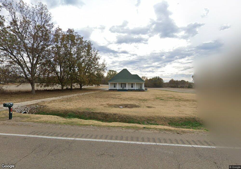
4876 Us Highway 70 E Brownsville, TN 38012
Estimated Value: $202,000 - $416,000
--
Bed
1
Bath
1,897
Sq Ft
$146/Sq Ft
Est. Value
About This Home
This home is located at 4876 Us Highway 70 E, Brownsville, TN 38012 and is currently estimated at $276,363, approximately $145 per square foot. 4876 Us Highway 70 E is a home located in Haywood County with nearby schools including Anderson Early Childhood Center, East Side Elementary School, and Haywood Elementary School.
Ownership History
Date
Name
Owned For
Owner Type
Purchase Details
Closed on
Dec 24, 2014
Sold by
Harrell John A
Bought by
Booth Marilyn H
Current Estimated Value
Purchase Details
Closed on
Oct 28, 2014
Sold by
Harrell Jacqueline L
Bought by
Harrell John A and Harrell James A
Purchase Details
Closed on
May 2, 1996
Sold by
Harrell Lyle Claud W
Bought by
Marilyn Booth
Purchase Details
Closed on
Dec 2, 1994
Bought by
Harrell Lyle and Harrell Claud W
Purchase Details
Closed on
Jan 19, 1989
Bought by
Booth Marilyn H Etvir and Booth Lyle
Purchase Details
Closed on
Dec 5, 1988
Bought by
Booth Marilyn H Etvir Jerome
Purchase Details
Closed on
Nov 2, 1942
Bought by
Vera Harrell A and Vera Est
Create a Home Valuation Report for This Property
The Home Valuation Report is an in-depth analysis detailing your home's value as well as a comparison with similar homes in the area
Home Values in the Area
Average Home Value in this Area
Purchase History
| Date | Buyer | Sale Price | Title Company |
|---|---|---|---|
| Booth Marilyn H | -- | -- | |
| Harrell John A | -- | -- | |
| Marilyn Booth | -- | -- | |
| Harrell Lyle | $75,000 | -- | |
| Booth Marilyn H Etvir | -- | -- | |
| Booth Marilyn H Etvir Jerome | $135,100 | -- | |
| Vera Harrell A | -- | -- |
Source: Public Records
Tax History Compared to Growth
Tax History
| Year | Tax Paid | Tax Assessment Tax Assessment Total Assessment is a certain percentage of the fair market value that is determined by local assessors to be the total taxable value of land and additions on the property. | Land | Improvement |
|---|---|---|---|---|
| 2025 | $918 | $47,625 | $0 | $0 |
| 2024 | $918 | $47,625 | $9,975 | $37,650 |
| 2023 | $877 | $31,825 | $8,050 | $23,775 |
| 2022 | $877 | $31,825 | $8,050 | $23,775 |
| 2021 | $877 | $31,825 | $8,050 | $23,775 |
| 2020 | $877 | $31,825 | $8,050 | $23,775 |
| 2019 | $877 | $31,825 | $8,050 | $23,775 |
| 2018 | $796 | $27,675 | $6,375 | $21,300 |
| 2017 | $796 | $27,675 | $6,375 | $21,300 |
| 2016 | $727 | $27,675 | $6,375 | $21,300 |
| 2015 | $733 | $27,425 | $6,375 | $21,050 |
| 2014 | $677 | $28,250 | $6,650 | $21,600 |
Source: Public Records
Map
Nearby Homes
- 135 Davis Rd
- 77 Upper Zion Rd
- 855 Springfield Rd
- 1450 Friendship Rd
- 470 Marbury Rd
- 0 Deerfield Cove Unit 2504512
- 2902 Us Highway 79 N
- 5596 79 Hwy N
- 00 Route 76
- 2397 U S 79
- 736 Tippett Ln
- 1295 Anderson Ave
- 2267 Anderson Ave
- 1114 Warren St
- 917 Anderson Ave Unit A
- 930 Gray St
- 703 Cottonwood Dr
- 103 N Bond Ave
- 105 N Bond Ave
- 411 N Bond Ave
- 4876 U S 70
- 4826 Us Highway 70 E
- 00 Tritt Rd
- 4911 Us Highway 70 E
- 4871 Us Highway 70 E
- 85 Bratt Thomas Rd
- 95 Bratt Thomas Rd
- 4735 Us Highway 70 E
- 5035 Us Highway 70 E
- 5068 Us Highway 70 E
- 4665 Us Highway 70 E
- 5157 Us Highway 70 E
- 4545 Us Highway 70 E
- 4579 Us Highway 70 E
- 387 Tritt Rd
- 275 Davis Rd
- 4441 Us Highway 70 E
- 5437 Us Highway 70 E
- 5462 Us Highway 70 E
- 405 Davis Rd