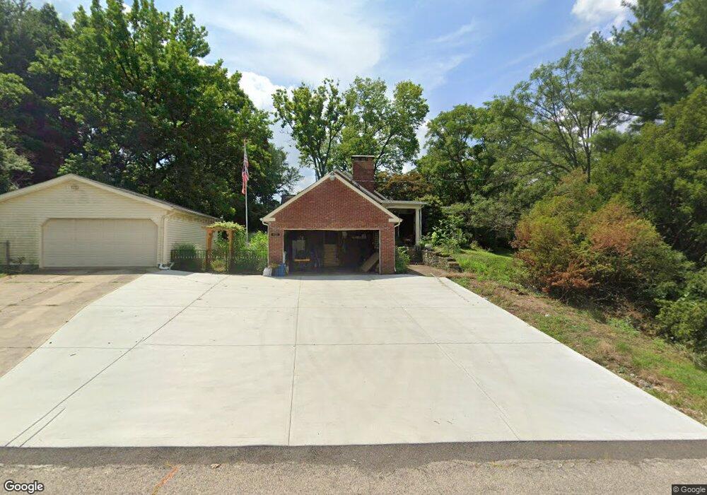
488 Fernway Dr Hamilton, OH 45011
Fairfield Township NeighborhoodEstimated Value: $312,000 - $343,000
2
Beds
2
Baths
2,047
Sq Ft
$161/Sq Ft
Est. Value
About This Home
This home is located at 488 Fernway Dr, Hamilton, OH 45011 and is currently estimated at $329,256, approximately $160 per square foot. 488 Fernway Dr is a home located in Butler County with nearby schools including Fairfield North Elementary School, Creekside Middle School, and Fairfield Senior High School.
Ownership History
Date
Name
Owned For
Owner Type
Purchase Details
Closed on
Aug 6, 2021
Sold by
Kearns Steven R
Bought by
Kearns Steven R
Current Estimated Value
Home Financials for this Owner
Home Financials are based on the most recent Mortgage that was taken out on this home.
Original Mortgage
$345,000
Interest Rate
2.88%
Purchase Details
Closed on
Jul 11, 2019
Sold by
Kearns Cora S
Bought by
Kearns Steven R
Purchase Details
Closed on
Jan 25, 1995
Sold by
Forrester Douglas
Bought by
Kearns Steven R
Purchase Details
Closed on
Apr 1, 1993
Bought by
Kearns Steven R
Purchase Details
Closed on
Feb 1, 1986
Create a Home Valuation Report for This Property
The Home Valuation Report is an in-depth analysis detailing your home's value as well as a comparison with similar homes in the area
Home Values in the Area
Average Home Value in this Area
Purchase History
| Date | Buyer | Sale Price | Title Company |
|---|---|---|---|
| Kearns Steven R | -- | Fnc Title Services Llc | |
| Kearns Steven R | -- | None Available | |
| Kearns Steven R | $138,500 | -- | |
| Kearns Steven R | $100,000 | -- | |
| -- | $104,000 | -- |
Source: Public Records
Mortgage History
| Date | Status | Borrower | Loan Amount |
|---|---|---|---|
| Previous Owner | Kearns Steven R | $345,000 | |
| Previous Owner | Kearns Steven R | $345,000 | |
| Closed | Kearns Steven R | -- |
Source: Public Records
Tax History Compared to Growth
Tax History
| Year | Tax Paid | Tax Assessment Tax Assessment Total Assessment is a certain percentage of the fair market value that is determined by local assessors to be the total taxable value of land and additions on the property. | Land | Improvement |
|---|---|---|---|---|
| 2024 | $3,087 | $91,750 | $19,640 | $72,110 |
| 2023 | $3,071 | $84,300 | $19,640 | $64,660 |
| 2022 | $3,224 | $72,090 | $19,640 | $52,450 |
| 2021 | $2,872 | $69,120 | $19,640 | $49,480 |
| 2020 | $2,973 | $69,120 | $19,640 | $49,480 |
| 2019 | $5,363 | $57,060 | $19,900 | $37,160 |
| 2018 | $2,714 | $57,060 | $19,900 | $37,160 |
| 2017 | $2,733 | $57,060 | $19,900 | $37,160 |
| 2016 | $2,616 | $52,500 | $19,900 | $32,600 |
| 2015 | $2,576 | $52,500 | $19,900 | $32,600 |
| 2014 | $2,626 | $52,500 | $19,900 | $32,600 |
| 2013 | $2,626 | $57,750 | $24,490 | $33,260 |
Source: Public Records
Map
Nearby Homes
- 6047 Allison Ave
- 1801 Morey Ave
- 2345 Hamilton Middletown Rd
- 6145 Gristmill Dr Unit 10
- 6145 Gristmill Dr
- 617 Elaine Ave
- 2610 Fairfield Ridge Dr
- 1739 Morey Ave
- 2644 Apex Ct
- 2661 Apex Ct
- 2844 Ashton Cir Unit 22844
- 2710 Zoellners Way
- 2978 Audubon Dr
- 6399 Kimberly Dr
- 0 Walden Ponds Cir Unit 1824952
- 1217 Vine St
- 5975 Oakridge Dr
- 6664 Creekside Way
- 1125 Vine St
- 301 N Fair Ave
- 495 Fernway Dr
- 5980 Theodore Ave
- 5985 Allison Ave
- 5953 Allison Ave
- 5990 Theodore Ave
- 5995 Allison Ave
- 473 Fernway Dr
- 463 Fernway Dr
- 5945 Allison Ave
- 459 Fernway Dr
- 6004 Theodore Ave
- 6015 Allison Ave
- 5971 Theodore Ave
- 5990 Allison Ave
- 5979 Theodore Ave
- 5995 Theodore Ave
- 6000 Allison Ave
- 5987 Theodore Ave
- 6018 Theodore Ave
- 5980 Allison Ave