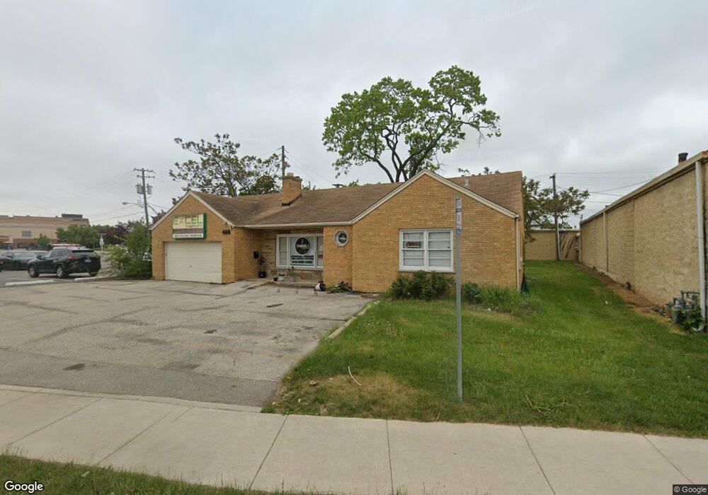
488 S River Rd Des Plaines, IL 60016
Estimated Value: $374,699 - $421,000
3
Beds
1
Bath
1,505
Sq Ft
$262/Sq Ft
Est. Value
About This Home
This home is located at 488 S River Rd, Des Plaines, IL 60016 and is currently estimated at $394,675, approximately $262 per square foot. 488 S River Rd is a home located in Cook County with nearby schools including North Elementary School, Chippewa Middle School, and Maine West High School.
Ownership History
Date
Name
Owned For
Owner Type
Purchase Details
Closed on
Dec 10, 2015
Sold by
Armbil Inc
Bought by
Fozo Properties Llc
Current Estimated Value
Home Financials for this Owner
Home Financials are based on the most recent Mortgage that was taken out on this home.
Original Mortgage
$191,250
Interest Rate
5%
Mortgage Type
New Conventional
Purchase Details
Closed on
Nov 8, 2012
Sold by
Oakbrook Medical Associates Sc
Bought by
Armbil Inc
Purchase Details
Closed on
Mar 15, 2006
Sold by
Chicago Title Land Trust Co
Bought by
Oakbrook Medical Associates Sc
Home Financials for this Owner
Home Financials are based on the most recent Mortgage that was taken out on this home.
Original Mortgage
$262,500
Interest Rate
7.5%
Mortgage Type
Purchase Money Mortgage
Purchase Details
Closed on
Nov 30, 2001
Sold by
Hudson Michael A
Bought by
Lasalle Bank National Assn and Trust #26-6616-00
Create a Home Valuation Report for This Property
The Home Valuation Report is an in-depth analysis detailing your home's value as well as a comparison with similar homes in the area
Home Values in the Area
Average Home Value in this Area
Purchase History
| Date | Buyer | Sale Price | Title Company |
|---|---|---|---|
| Fozo Properties Llc | $255,000 | Attorney | |
| Armbil Inc | -- | None Available | |
| Oakbrook Medical Associates Sc | $350,000 | Cti | |
| Lasalle Bank National Assn | $62,000 | -- |
Source: Public Records
Mortgage History
| Date | Status | Borrower | Loan Amount |
|---|---|---|---|
| Closed | Fozo Properties Llc | $191,250 | |
| Previous Owner | Oakbrook Medical Associates Sc | $262,500 |
Source: Public Records
Tax History
| Year | Tax Paid | Tax Assessment Tax Assessment Total Assessment is a certain percentage of the fair market value that is determined by local assessors to be the total taxable value of land and additions on the property. | Land | Improvement |
|---|---|---|---|---|
| 2025 | $7,646 | $33,001 | $7,223 | $25,778 |
| 2024 | $7,646 | $29,000 | $6,420 | $22,580 |
| 2023 | $7,462 | $29,000 | $6,420 | $22,580 |
| 2022 | $7,462 | $29,000 | $6,420 | $22,580 |
| 2021 | $6,859 | $22,314 | $5,216 | $17,098 |
| 2020 | $6,743 | $22,314 | $5,216 | $17,098 |
| 2019 | $6,672 | $24,794 | $5,216 | $19,578 |
| 2018 | $7,816 | $26,135 | $4,614 | $21,521 |
| 2017 | $7,678 | $26,135 | $4,614 | $21,521 |
| 2016 | $7,262 | $26,135 | $4,614 | $21,521 |
| 2015 | $6,782 | $22,433 | $4,012 | $18,421 |
| 2014 | $7,251 | $24,503 | $4,012 | $20,491 |
| 2013 | $7,071 | $24,503 | $4,012 | $20,491 |
Source: Public Records
Map
Nearby Homes
- 430 Oak St
- 603 S River Rd Unit 2M
- 395 Graceland Ave Unit 208
- 1389 Perry St Unit 303
- 365 Graceland Ave Unit 205A
- 677 S River Rd Unit 2D
- 1374 Jefferson St
- 1601 Sherman Place
- 1349 E Washington St Unit 404A
- 1347 Perry St Unit 4
- 1330 Perry St Unit 504
- 1685 Mill St Unit 605
- 1325 Perry St Unit 606
- 750 Pearson St Unit 904
- 770 Pearson St Unit 2207
- 1578 Woodland Ave Unit D
- 1258 Brown St Unit 302
- 194 Grove Ave Unit A
- 825 Pearson St Unit 3D
- 821 Lexington Cir E
- 488 S River Rd
- 480 S River Rd
- 480 S River Rd
- 494 Lee St Unit 2S
- 494 Lee St Unit 2N
- 494 Lee St
- 490 Lee St Unit 3
- 490 Lee St Unit A-B-C
- 496 Lee St
- 445 S River Rd
- 498 Lee St Unit 2S
- 445 S River Rd
- 1645 Elk Blvd
- 450 Lee St Unit 1
- 450 Lee St
- 450 Lee St Unit 2
- 485 S River Rd
- 1509 Brown St Unit 19
- 1509 Brown St Unit 17
- 1509 Brown St Unit 12