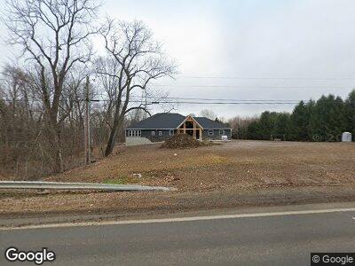
488 State Route 97 St Mansfield, OH 44904
Estimated Value: $321,000 - $456,730
2
Beds
3
Baths
2,330
Sq Ft
$168/Sq Ft
Est. Value
About This Home
This home is located at 488 State Route 97 St, Mansfield, OH 44904 and is currently estimated at $390,433, approximately $167 per square foot. 488 State Route 97 St is a home with nearby schools including Lexington High School and Grace Christian School.
Ownership History
Date
Name
Owned For
Owner Type
Purchase Details
Closed on
Apr 6, 2022
Sold by
Griffith Family Trust
Bought by
Griffith Preservation Trust
Current Estimated Value
Home Financials for this Owner
Home Financials are based on the most recent Mortgage that was taken out on this home.
Original Mortgage
$517,500
Interest Rate
3.69%
Mortgage Type
New Conventional
Purchase Details
Closed on
Feb 22, 2021
Sold by
Booth Lisa M and Delong Lisa M
Bought by
Griffith William B and Griffith Shelley A
Purchase Details
Closed on
Jan 4, 2002
Sold by
Stevens Edward N
Bought by
Lehman C Richard
Create a Home Valuation Report for This Property
The Home Valuation Report is an in-depth analysis detailing your home's value as well as a comparison with similar homes in the area
Home Values in the Area
Average Home Value in this Area
Purchase History
| Date | Buyer | Sale Price | Title Company |
|---|---|---|---|
| Griffith Preservation Trust | $125 | Cooper Adel Vu & Associates Lp | |
| Griffith William B | $66,000 | Chicago Title | |
| Lehman C Richard | $30,000 | -- |
Source: Public Records
Mortgage History
| Date | Status | Borrower | Loan Amount |
|---|---|---|---|
| Previous Owner | Griffith Family Trust | $517,500 | |
| Previous Owner | Griffith William B | $427,500 |
Source: Public Records
Tax History Compared to Growth
Tax History
| Year | Tax Paid | Tax Assessment Tax Assessment Total Assessment is a certain percentage of the fair market value that is determined by local assessors to be the total taxable value of land and additions on the property. | Land | Improvement |
|---|---|---|---|---|
| 2024 | $6,752 | $123,310 | $13,620 | $109,690 |
| 2023 | $6,752 | $123,310 | $13,620 | $109,690 |
| 2022 | $5,854 | $91,690 | $12,010 | $79,680 |
| 2021 | $268 | $4,100 | $4,100 | $0 |
| 2020 | $269 | $4,100 | $4,100 | $0 |
| 2019 | $243 | $3,400 | $3,400 | $0 |
| 2018 | $212 | $3,400 | $3,400 | $0 |
| 2017 | $210 | $3,400 | $3,400 | $0 |
| 2016 | $193 | $3,060 | $3,060 | $0 |
| 2015 | $193 | $3,060 | $3,060 | $0 |
| 2014 | $187 | $3,060 | $3,060 | $0 |
| 2012 | $181 | $3,150 | $3,150 | $0 |
Source: Public Records
Map
Nearby Homes
- 119 Otterbein Dr
- 290 Oxford Rd
- 52 Mayfair Rd
- 209 Hanover Rd
- 147 Mohican Trail
- 278 W Main St
- 88 Sherwood Dr
- 122 Woodside Blvd
- 0 Crossbridge Ct
- 0 Highridge Rd
- 85 Essex Cir
- 153 Templeton Terrace
- 169 Woodside Ct
- 167 Plymouth St
- 191 Valley hi Dr
- 39 1st Ave
- 0 Fox Rd
- 51 Plymouth St
- 3843 U S Highway 42
- 1 Frederick St
- 488 State Route 97 St
- 478 W Main St
- 30 Sussex Ct W
- 24 Sussex Ct W
- 18 Sussex Ct W
- 36 Sussex Ct W
- 12 Sussex Ct W
- 42 Sussex Ct W
- 21 Sussex Ct W
- 2530 State Route 97
- 15 Sussex Ct W
- 14 Sussex Ct E
- 27 Sussex Ct W
- 72 Wellsley Dr
- 20 Sussex Ct E
- 274 Darby Dr
- 280 Darby Dr
- 22 Cambridge Ct
- 28 Cambridge Ct
- 62 Wellsley Dr