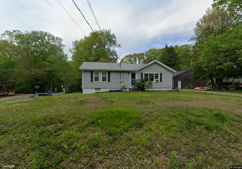
488 Toll Gate Rd Groton, CT 06340
Estimated Value: $279,000 - $339,000
2
Beds
1
Bath
946
Sq Ft
$332/Sq Ft
Est. Value
About This Home
This home is located at 488 Toll Gate Rd, Groton, CT 06340 and is currently estimated at $314,134, approximately $332 per square foot. 488 Toll Gate Rd is a home located in New London County with nearby schools including Claude Chester School, Groton Middle School, and Robert E. Fitch High School.
Ownership History
Date
Name
Owned For
Owner Type
Purchase Details
Closed on
Mar 24, 1993
Sold by
Mills George and Mills Catherine
Bought by
Parker Michael
Current Estimated Value
Create a Home Valuation Report for This Property
The Home Valuation Report is an in-depth analysis detailing your home's value as well as a comparison with similar homes in the area
Home Values in the Area
Average Home Value in this Area
Purchase History
| Date | Buyer | Sale Price | Title Company |
|---|---|---|---|
| Parker Michael | $70,860 | -- |
Source: Public Records
Mortgage History
| Date | Status | Borrower | Loan Amount |
|---|---|---|---|
| Open | Parker Michael | $182,560 | |
| Closed | Parker Michael | $132,000 | |
| Closed | Parker Michael | $127,462 |
Source: Public Records
Tax History Compared to Growth
Tax History
| Year | Tax Paid | Tax Assessment Tax Assessment Total Assessment is a certain percentage of the fair market value that is determined by local assessors to be the total taxable value of land and additions on the property. | Land | Improvement |
|---|---|---|---|---|
| 2025 | $4,503 | $152,600 | $68,957 | $83,643 |
| 2024 | $4,239 | $152,600 | $68,957 | $83,643 |
| 2023 | $4,155 | $152,600 | $33,110 | $119,490 |
| 2022 | $4,059 | $152,600 | $33,110 | $119,490 |
| 2021 | $3,818 | $117,600 | $33,110 | $84,490 |
| 2020 | $3,719 | $117,600 | $33,110 | $84,490 |
| 2019 | $3,581 | $117,600 | $33,110 | $84,490 |
| 2018 | $3,544 | $117,600 | $33,110 | $84,490 |
| 2017 | $3,453 | $117,600 | $33,110 | $84,490 |
| 2016 | $3,776 | $134,470 | $50,540 | $83,930 |
| 2015 | $3,631 | $134,470 | $50,540 | $83,930 |
| 2014 | $3,534 | $134,470 | $50,540 | $83,930 |
Source: Public Records
Map
Nearby Homes
- 517-571 Gold Star Hwy
- 83 Leafwood Ln Unit 227
- 205 Winding Hollow Rd
- 22 Toll Gate Rd
- 7 Carol Ct
- 109 Valley Rd
- 411 Long Hill Rd
- 301 Buddington Rd Unit LOT 64
- 1211 Gold Star Hwy
- 97 North Rd
- 1064 North Rd
- 141 Starr Hill Rd
- 21 Grove Ave
- 130 Meridian St Unit 313
- 78 Spicer Ave
- 136 Meridian St Unit 110
- 140 Laurelwood Rd
- 91 Buddington Rd Unit LOT 53
- 146 Mirra Dr
- 95 Murphys Dr Unit 95
- 480 Toll Gate Rd
- 504 Toll Gate Rd
- 493 Toll Gate Rd
- 483 Toll Gate Rd
- 503 Toll Gate Rd
- 514 Toll Gate Rd
- 468 Toll Gate Rd
- 465 Toll Gate Rd
- 515 Toll Gate Rd
- 458 Toll Gate Rd
- 524 Toll Gate Rd
- 45 Peters Dr
- 516 Gold Star Hwy Unit 524
- 536 Toll Gate Rd
- 90 Magnolia Dr
- 0 Antonino Rd Unit E228893
- 0 Antonino Rd Unit E10192088
- 0 Antonino Rd Unit E10192552
- 0 Antonino Rd Unit E10192550
- 0 Antonino Rd Unit E10192549