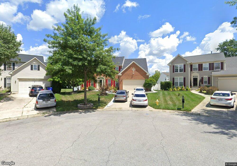
4880 Cranston Ct Waldorf, MD 20602
Estimated Value: $577,592 - $617,000
--
Bed
4
Baths
3,348
Sq Ft
$178/Sq Ft
Est. Value
About This Home
This home is located at 4880 Cranston Ct, Waldorf, MD 20602 and is currently estimated at $595,148, approximately $177 per square foot. 4880 Cranston Ct is a home located in Charles County with nearby schools including Mary B. Neal Elementary School, Benjamin Stoddert Middle School, and St. Charles High School.
Ownership History
Date
Name
Owned For
Owner Type
Purchase Details
Closed on
Feb 20, 2015
Sold by
Davis Cynthia M
Bought by
Davis Cynthia and Davis Nathaniel
Current Estimated Value
Purchase Details
Closed on
Apr 12, 2013
Sold by
Davis Nathaniel F
Bought by
Davis Cynthia M
Purchase Details
Closed on
Jul 11, 2005
Sold by
Brock Lamont A and Cambrel Brock L
Bought by
Davis Nathaniel F and Davis Cynthia M
Home Financials for this Owner
Home Financials are based on the most recent Mortgage that was taken out on this home.
Original Mortgage
$371,892
Outstanding Balance
$192,122
Interest Rate
5.5%
Mortgage Type
Adjustable Rate Mortgage/ARM
Estimated Equity
$403,026
Purchase Details
Closed on
Feb 6, 2004
Sold by
Nvr Inc
Bought by
Brock Lamont A and Cambrel Brock L
Create a Home Valuation Report for This Property
The Home Valuation Report is an in-depth analysis detailing your home's value as well as a comparison with similar homes in the area
Home Values in the Area
Average Home Value in this Area
Purchase History
| Date | Buyer | Sale Price | Title Company |
|---|---|---|---|
| Davis Cynthia | -- | None Available | |
| Davis Cynthia M | -- | None Available | |
| Davis Nathaniel F | $464,990 | -- | |
| Brock Lamont A | $337,740 | -- |
Source: Public Records
Mortgage History
| Date | Status | Borrower | Loan Amount |
|---|---|---|---|
| Open | Davis Nathaniel F | $371,892 | |
| Closed | Davis Nathaniel F | $92,998 | |
| Closed | Brock Lamont A | -- |
Source: Public Records
Tax History Compared to Growth
Tax History
| Year | Tax Paid | Tax Assessment Tax Assessment Total Assessment is a certain percentage of the fair market value that is determined by local assessors to be the total taxable value of land and additions on the property. | Land | Improvement |
|---|---|---|---|---|
| 2025 | $16,251 | $563,900 | -- | -- |
| 2024 | $7,266 | $539,300 | $126,100 | $413,200 |
| 2023 | $7,184 | $502,700 | $0 | $0 |
| 2022 | $6,328 | $466,100 | $0 | $0 |
| 2021 | $5,710 | $429,500 | $108,100 | $321,400 |
| 2020 | $5,710 | $416,233 | $0 | $0 |
| 2019 | $5,522 | $402,967 | $0 | $0 |
| 2018 | $5,303 | $389,700 | $90,100 | $299,600 |
| 2017 | $5,180 | $381,000 | $0 | $0 |
| 2016 | -- | $372,300 | $0 | $0 |
| 2015 | $4,114 | $363,600 | $0 | $0 |
| 2014 | $4,114 | $356,667 | $0 | $0 |
Source: Public Records
Map
Nearby Homes
- 4973 Derryfield Ct
- 4909 Cordova Ct
- 4600 Angushire Ct
- 5123 Shawe Place Unit C
- 1404 Boswell Ct
- 4300 Eagle Trace Ct
- 11613 Bardmoor Ct
- 4646 Scottsdale Place
- 4504C Ruston Place Unit 41-M
- 1756 Brightwell Ct
- 4471 Quinn Ct
- 4586 Scottsdale Place
- 4532 Reeves Place Unit C
- 610 University Dr
- 2103 Gibbons Ct
- 3902 Newman Ct
- 4460 Red Rome Ct
- 9 Wicklow Ct
- 5084 Ottawa Park Place
- 1180 Bannister Cir
- 4881 Cranston Ct
- 4882 Cranston Ct
- 12095 Bluff Creek Ct
- 12096 Bluff Creek Ct
- 12093 Bluff Creek Ct
- 4883 Cranston Ct
- 4884 Cranston Ct
- 4885 Cranston Ct
- 4945 Deal Ct
- 12094 Bluff Creek Ct
- 4886 Cranston Ct
- 4758 Sheffield Cir
- 4888 Cranston Ct
- 4887 Cranston Ct
- 4946 Deal Ct
- 4852 Congressional Ct
- 4943 Deal Ct
- 12082 Blue Mount Ct
- 12092 Bluff Creek Ct
- 4766 Sheffield Cir