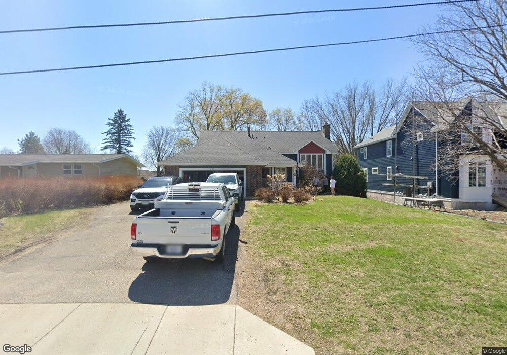
4881 Independence St Maple Plain, MN 55359
Estimated Value: $428,000 - $489,208
4
Beds
2
Baths
2,338
Sq Ft
$196/Sq Ft
Est. Value
About This Home
This home is located at 4881 Independence St, Maple Plain, MN 55359 and is currently estimated at $458,802, approximately $196 per square foot. 4881 Independence St is a home located in Hennepin County with nearby schools including Schumann Elementary School, Orono Intermediate Elementary School, and Orono Middle School.
Ownership History
Date
Name
Owned For
Owner Type
Purchase Details
Closed on
Sep 5, 2019
Sold by
Lafavor Rebecca A and Lafavor Robert D
Bought by
Rose Graham M and Rose Krista M
Current Estimated Value
Home Financials for this Owner
Home Financials are based on the most recent Mortgage that was taken out on this home.
Original Mortgage
$369,000
Outstanding Balance
$323,876
Interest Rate
3.7%
Mortgage Type
VA
Estimated Equity
$134,926
Purchase Details
Closed on
Dec 9, 2016
Sold by
Lafavor Rebecca A and Lafavor Robert D
Bought by
Lafavor Rebecca A and Lafavor Robert D
Create a Home Valuation Report for This Property
The Home Valuation Report is an in-depth analysis detailing your home's value as well as a comparison with similar homes in the area
Home Values in the Area
Average Home Value in this Area
Purchase History
| Date | Buyer | Sale Price | Title Company |
|---|---|---|---|
| Rose Graham M | $369,000 | Carver Cnty Abstract & Ttl C | |
| Lafavor Rebecca A | -- | None Available |
Source: Public Records
Mortgage History
| Date | Status | Borrower | Loan Amount |
|---|---|---|---|
| Open | Rose Graham M | $369,000 |
Source: Public Records
Tax History Compared to Growth
Tax History
| Year | Tax Paid | Tax Assessment Tax Assessment Total Assessment is a certain percentage of the fair market value that is determined by local assessors to be the total taxable value of land and additions on the property. | Land | Improvement |
|---|---|---|---|---|
| 2024 | $6,795 | $432,300 | $91,000 | $341,300 |
| 2023 | $6,540 | $443,300 | $99,000 | $344,300 |
| 2022 | $6,670 | $430,000 | $93,000 | $337,000 |
| 2021 | $6,335 | $384,000 | $83,000 | $301,000 |
| 2020 | $5,982 | $359,000 | $72,000 | $287,000 |
| 2019 | $5,885 | $318,000 | $70,000 | $248,000 |
| 2018 | $4,365 | $296,000 | $63,000 | $233,000 |
| 2017 | $4,248 | $255,000 | $52,000 | $203,000 |
| 2016 | $3,901 | $236,000 | $52,000 | $184,000 |
| 2015 | $3,689 | $221,000 | $46,000 | $175,000 |
| 2014 | -- | $229,000 | $61,000 | $168,000 |
Source: Public Records
Map
Nearby Homes
- 4837 Baker Reserve Ln
- Reiley Plan at Baker Park Estates - Classic and Heritage Collections
- Huntington Plan at Baker Park Estates - Classic and Heritage Collections
- Virginia Plan at Baker Park Estates - Classic and Heritage Collections
- Finland Plan at Baker Park Estates - Classic and Heritage Collections
- Brookston Plan at Baker Park Estates - Classic and Heritage Collections
- Whitney Plan at Baker Park Estates - Classic and Heritage Collections
- Somerset Plan at Baker Park Estates - Classic and Heritage Collections
- 4819 Baker Reserve Ln
- Fraser Plan at Baker Park Estates - Classic and Heritage Collections
- Brookfield Plan at Baker Park Estates - Classic and Heritage Collections
- 4842 Baker Reserve Ln
- 4801 Baker Reserve Ln
- 4835 Drake St
- 5029 Oak St E
- 5183 Independence St
- 5249 Main St E
- 5245 Clayton Dr
- 2017 Bridgevine Ct
- 5293 Manchester Dr Unit 4
- 4887 Independence St
- 4905 Independence St
- 4880 Main St E
- 4870 Main St E
- 4890 Main St E
- 1668 Perkins Ln
- 4880 Independence St
- 4845 Independence St
- 4854 Main St E
- 4904 Main St E
- 4919 Independence St
- 4900 Independence St
- 4850 Independence St
- 4850 Main St E
- 4920 Main St E
- 4829 Independence St
- 1684 Perkins Ln
- 4875 Bradford St
- 4830 Main St E
- 1685 Perkins Ln