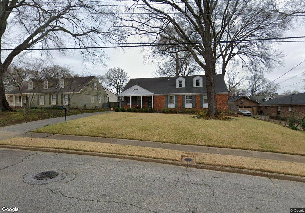
4882 Lorece Ave Memphis, TN 38117
Audubon Park NeighborhoodEstimated Value: $394,000 - $455,000
5
Beds
3
Baths
3,041
Sq Ft
$141/Sq Ft
Est. Value
About This Home
This home is located at 4882 Lorece Ave, Memphis, TN 38117 and is currently estimated at $429,555, approximately $141 per square foot. 4882 Lorece Ave is a home located in Shelby County with nearby schools including White Station Elementary School, White Station Middle, and White Station High.
Ownership History
Date
Name
Owned For
Owner Type
Purchase Details
Closed on
Oct 31, 2000
Sold by
Booth Michael E and Booth Judith L
Bought by
Jones Ii Joseph B and Jones Julie N
Current Estimated Value
Home Financials for this Owner
Home Financials are based on the most recent Mortgage that was taken out on this home.
Original Mortgage
$210,900
Outstanding Balance
$78,045
Interest Rate
7.94%
Estimated Equity
$351,510
Purchase Details
Closed on
Jan 7, 1999
Sold by
Booth Michael E and Booth Judith L
Bought by
Booth Michael Edwin and Booth Judith L
Create a Home Valuation Report for This Property
The Home Valuation Report is an in-depth analysis detailing your home's value as well as a comparison with similar homes in the area
Home Values in the Area
Average Home Value in this Area
Purchase History
| Date | Buyer | Sale Price | Title Company |
|---|---|---|---|
| Jones Ii Joseph B | $222,000 | Tri State Title & Escrow | |
| Booth Michael Edwin | -- | -- |
Source: Public Records
Mortgage History
| Date | Status | Borrower | Loan Amount |
|---|---|---|---|
| Open | Jones Ii Joseph B | $210,900 |
Source: Public Records
Tax History Compared to Growth
Tax History
| Year | Tax Paid | Tax Assessment Tax Assessment Total Assessment is a certain percentage of the fair market value that is determined by local assessors to be the total taxable value of land and additions on the property. | Land | Improvement |
|---|---|---|---|---|
| 2025 | $2,898 | $106,125 | $27,300 | $78,825 |
| 2024 | $2,898 | $85,500 | $27,300 | $58,200 |
| 2023 | $5,208 | $85,500 | $27,300 | $58,200 |
| 2022 | $5,208 | $85,500 | $27,300 | $58,200 |
| 2021 | $5,269 | $85,500 | $27,300 | $58,200 |
| 2020 | $4,719 | $65,125 | $27,300 | $37,825 |
| 2019 | $4,719 | $65,125 | $27,300 | $37,825 |
| 2018 | $4,719 | $65,125 | $27,300 | $37,825 |
| 2017 | $2,677 | $65,125 | $27,300 | $37,825 |
| 2016 | $2,556 | $58,500 | $0 | $0 |
| 2014 | $2,556 | $58,500 | $0 | $0 |
Source: Public Records
Map
Nearby Homes
- 4985 Chickasaw Rd
- 4980 Barfield Rd
- 352 Avon Rd
- 131 N Mendenhall Rd
- 416 Elwood Ln
- 4956 Robindale Ln
- 4737 Sequoia Rd
- 4730 Sequoia Rd
- 209 Leonora Dr
- 4798 Normandy Ln
- 4723 Normandy Ln
- 4865 Princeton Rd
- 346 Leonora Dr
- 352 Leonora Dr
- 5081 Rich Rd
- 4950 Princeton Rd
- 4931 Princeton Grove
- 4640 Chickasaw Rd
- 5121 Lynbar Ave
- 202 Betty jo Ln
- 4874 Lorece Ave
- 4890 Lorece Ave
- 247 N Mendenhall Rd
- 4868 Lorece Ave
- 4887 Grosvenor Hill Cove
- 237 N Mendenhall Rd
- 4881 Grosvenor Hill Cove
- 258 Pinewood St
- 263 N Mendenhall Rd
- 4860 Lorece Ave
- 4901 Grosvenor Hill Cove
- 4882 Grosvenor Hill Cove
- 221 N Mendenhall Rd
- 4886 Grosvenor Hill Cove
- 266 Pinewood St
- 4883 Lorece Ave
- 4882 Grosvenor Hill Cove
- 4900 Grosvenor Hill Cove
- 4875 Lorece Ave
- 4852 Lorece Ave