Estimated Value: $186,495 - $196,000
3
Beds
2
Baths
1,048
Sq Ft
$182/Sq Ft
Est. Value
About This Home
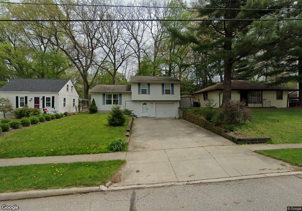
This home is located at 489 S Francis St, Kent, OH 44240 and is currently estimated at $190,624, approximately $181 per square foot. 489 S Francis St is a home located in Portage County with nearby schools including Longcoy Elementary School, Stanton Middle School, and Theodore Roosevelt High School.
Ownership History
Date
Name
Owned For
Owner Type
Purchase Details
Closed on
Apr 5, 2011
Sold by
Federal Home Loan Mortgage Corporation
Bought by
Zhao Lei
Current Estimated Value
Purchase Details
Closed on
Aug 10, 2010
Sold by
Boyden Melanie R
Bought by
Federal Home Loan Mortgage Corp
Purchase Details
Closed on
Feb 22, 1995
Sold by
Wright Robert L
Bought by
Pennington Mark D Uden and Pennington Linda J
Create a Home Valuation Report for This Property
The Home Valuation Report is an in-depth analysis detailing your home's value as well as a comparison with similar homes in the area
Home Values in the Area
Average Home Value in this Area
Purchase History
| Date | Buyer | Sale Price | Title Company |
|---|---|---|---|
| Zhao Lei | $82,250 | Attorney | |
| Federal Home Loan Mortgage Corp | $70,000 | None Available | |
| Pennington Mark D Uden | $57,900 | -- |
Source: Public Records
Mortgage History
| Date | Status | Borrower | Loan Amount |
|---|---|---|---|
| Closed | Pennington Mark D Uden | -- |
Source: Public Records
Tax History Compared to Growth
Tax History
| Year | Tax Paid | Tax Assessment Tax Assessment Total Assessment is a certain percentage of the fair market value that is determined by local assessors to be the total taxable value of land and additions on the property. | Land | Improvement |
|---|---|---|---|---|
| 2024 | $2,777 | $60,380 | $7,070 | $53,310 |
| 2023 | $2,800 | $49,390 | $7,070 | $42,320 |
| 2022 | $2,798 | $49,390 | $7,070 | $42,320 |
| 2021 | $2,804 | $49,390 | $7,070 | $42,320 |
| 2020 | $2,571 | $40,390 | $7,070 | $33,320 |
| 2019 | $2,588 | $40,390 | $7,070 | $33,320 |
| 2018 | $2,850 | $36,860 | $7,070 | $29,790 |
| 2017 | $2,467 | $36,860 | $7,070 | $29,790 |
| 2016 | $2,461 | $36,860 | $7,070 | $29,790 |
| 2015 | $2,702 | $36,860 | $7,070 | $29,790 |
| 2014 | $2,629 | $36,860 | $7,070 | $29,790 |
| 2013 | $2,609 | $36,860 | $7,070 | $29,790 |
Source: Public Records
Map
Nearby Homes
- 1181 Norwood St
- 1265 W Main St
- 3127 Deercrest Path
- 600 Silver Meadows Blvd
- 2973 Mourning Dove Cir
- 978 Silver Meadows Blvd
- 430 W Elm St
- 346 Harris St
- 328 Dodge St
- 115 S Mantua St
- 3383 Suffolk Downs
- 940 Kevin Dr
- 715 Franklin Ave
- 529 Rockwell St
- 1204 Franklin Ave
- 146 W Elm St
- 2703 York Dr Unit 41
- 3128 Bay Meadows Cir
- 334 N Mantua St
- 634 S Water St
- 485 S Francis St
- 493 S Francis St
- 497 S Francis St
- 501 S Francis St
- 481 S Francis St
- 507 S Francis St
- 484 S Francis St
- 492 S Francis St
- 496 S Francis St
- 111 Gill Dr
- 471 S Francis St
- 476 S Francis St
- 500 S Francis St
- 0 Francis Unit 4467495
- 0 Francis Unit 4383008
- 465 S Francis St
- 479 Laurel Dr
- 105 Gill Dr
- 521 S Francis St
- 497 Laurel Dr