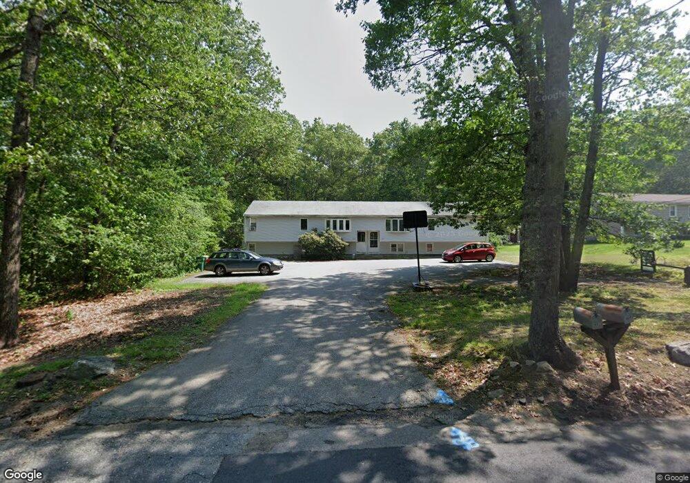
489 Stearns Ave Unit 491 Mansfield, MA 02048
Estimated Value: $477,000 - $747,032
6
Beds
2
Baths
1,976
Sq Ft
$326/Sq Ft
Est. Value
About This Home
This home is located at 489 Stearns Ave Unit 491, Mansfield, MA 02048 and is currently estimated at $643,258, approximately $325 per square foot. 489 Stearns Ave Unit 491 is a home located in Bristol County with nearby schools including Jordan/Jackson Elementary School, Everett W. Robinson Elementary School, and Harold L. Qualters Middle School.
Ownership History
Date
Name
Owned For
Owner Type
Purchase Details
Closed on
Feb 9, 2007
Sold by
Belanger Bonnie L
Bought by
Belanger Bonnie
Current Estimated Value
Home Financials for this Owner
Home Financials are based on the most recent Mortgage that was taken out on this home.
Original Mortgage
$15,000
Outstanding Balance
$9,014
Interest Rate
6.22%
Mortgage Type
Purchase Money Mortgage
Estimated Equity
$634,244
Purchase Details
Closed on
Mar 18, 2002
Sold by
Porter Frances A and Porter Francis A
Bought by
Belanger Scott and Belanger Bonnie
Home Financials for this Owner
Home Financials are based on the most recent Mortgage that was taken out on this home.
Original Mortgage
$125,000
Interest Rate
7.04%
Mortgage Type
Purchase Money Mortgage
Create a Home Valuation Report for This Property
The Home Valuation Report is an in-depth analysis detailing your home's value as well as a comparison with similar homes in the area
Home Values in the Area
Average Home Value in this Area
Purchase History
| Date | Buyer | Sale Price | Title Company |
|---|---|---|---|
| Belanger Bonnie | -- | -- | |
| Belanger Scott | $210,000 | -- |
Source: Public Records
Mortgage History
| Date | Status | Borrower | Loan Amount |
|---|---|---|---|
| Open | Belanger Bonnie | $15,000 | |
| Previous Owner | Belanger Scott | $125,000 |
Source: Public Records
Tax History Compared to Growth
Tax History
| Year | Tax Paid | Tax Assessment Tax Assessment Total Assessment is a certain percentage of the fair market value that is determined by local assessors to be the total taxable value of land and additions on the property. | Land | Improvement |
|---|---|---|---|---|
| 2025 | $8,347 | $633,800 | $267,100 | $366,700 |
| 2024 | $7,439 | $551,000 | $254,900 | $296,100 |
| 2023 | $7,227 | $512,900 | $254,900 | $258,000 |
| 2022 | $7,315 | $482,200 | $236,000 | $246,200 |
| 2021 | $6,734 | $438,400 | $224,800 | $213,600 |
| 2020 | $6,302 | $410,300 | $196,700 | $213,600 |
| 2019 | $5,962 | $391,700 | $187,200 | $204,500 |
| 2018 | $4,857 | $374,300 | $178,600 | $195,700 |
| 2017 | $4,761 | $317,000 | $173,500 | $143,500 |
| 2016 | $4,569 | $296,500 | $165,200 | $131,300 |
| 2015 | $4,515 | $291,300 | $165,200 | $126,100 |
Source: Public Records
Map
Nearby Homes
- 29 Owl Ridge Rd
- 4 Plantation Rd
- 16 Erick Rd Unit 34
- 151 Stearns Ave
- 98 Massapoag Ave
- 6 Erick Rd Unit 73
- 34 Kevins Way
- 3 Cushing Ln
- 23 Estelle Marsan Dr
- 89 Massapoag Ave
- 218 Massapoag Ave
- 55 Eastman St
- 260 Massapoag Ave
- 631 East St Unit E203
- 157 Highland St
- 11 Hilltop Ln
- 212 Mill St
- 28 Heidi Rd
- 36 Sierra Dr
- 409 Pratt St
- 485 Stearns Ave Unit 487
- 485 Stearns Ave Unit 485
- 499 Stearns Ave
- 498 Stearns Ave
- 481 Stearns Ave Unit 483
- 481 Stearns Ave Unit 1
- 481-483 Stearns Ave
- 500 Stearns Ave
- 475 Stearns Ave
- 120 Mill St
- 501 Stearns Ave
- 495 Stearns Ave
- 113 Mill St
- 112 Mill St
- 469 Stearns Ave
- 494 Stearns Ave
- 109 Mill St
- 189 Chestnut St
- 108 Mill St
- 105 Mill St