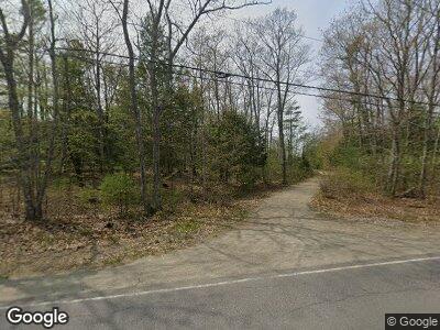
489 Wiscasset Rd Whitefield, ME 04353
Estimated Value: $329,000 - $466,000
3
Beds
2
Baths
2,400
Sq Ft
$174/Sq Ft
Est. Value
About This Home
This home is located at 489 Wiscasset Rd, Whitefield, ME 04353 and is currently estimated at $417,215, approximately $173 per square foot. 489 Wiscasset Rd is a home located in Lincoln County with nearby schools including Whitefield Elementary School.
Ownership History
Date
Name
Owned For
Owner Type
Purchase Details
Closed on
Oct 8, 2014
Sold by
Hunt Gayle and Stodder Gayle
Bought by
Stodder Erin L
Current Estimated Value
Home Financials for this Owner
Home Financials are based on the most recent Mortgage that was taken out on this home.
Original Mortgage
$188,775
Outstanding Balance
$149,626
Interest Rate
4.1%
Mortgage Type
New Conventional
Estimated Equity
$292,562
Create a Home Valuation Report for This Property
The Home Valuation Report is an in-depth analysis detailing your home's value as well as a comparison with similar homes in the area
Home Values in the Area
Average Home Value in this Area
Purchase History
| Date | Buyer | Sale Price | Title Company |
|---|---|---|---|
| Stodder Erin L | -- | -- |
Source: Public Records
Mortgage History
| Date | Status | Borrower | Loan Amount |
|---|---|---|---|
| Open | Stodder Erin L | $188,775 | |
| Previous Owner | Stodder Gayle | $50,000 |
Source: Public Records
Tax History Compared to Growth
Tax History
| Year | Tax Paid | Tax Assessment Tax Assessment Total Assessment is a certain percentage of the fair market value that is determined by local assessors to be the total taxable value of land and additions on the property. | Land | Improvement |
|---|---|---|---|---|
| 2024 | $3,987 | $395,900 | $75,500 | $320,400 |
| 2023 | $3,542 | $221,352 | $35,250 | $186,102 |
| 2022 | $3,701 | $221,352 | $35,250 | $186,102 |
| 2020 | $235 | $221,462 | $35,250 | $186,212 |
| 2019 | $3,475 | $221,462 | $35,250 | $186,212 |
| 2018 | $258 | $221,462 | $35,250 | $186,212 |
| 2017 | $3,056 | $221,462 | $35,250 | $186,212 |
| 2016 | $3,322 | $221,462 | $35,250 | $186,212 |
| 2015 | $3,255 | $221,462 | $35,250 | $186,212 |
| 2014 | $3,156 | $221,462 | $35,250 | $186,212 |
| 2013 | $3,377 | $221,462 | $35,250 | $186,212 |
Source: Public Records
Map
Nearby Homes
- 55 Misty Mountain Ln
- 552 Egypt Rd
- Lot 2 Rosie Estates
- 53 Rosie Estates
- 32 Rosie Ln
- 1854 Alna Rd
- 1135 E Pittston Rd
- 36 Dodge Rd
- 0-1 County Rd
- 0 County Rd
- 99 Angier Rd
- 209 S Beech Hill Rd
- 28-001 Hassan Ave
- 515 S Clary Rd
- 37 Atkins Rd
- 320 Cross Rd
- 526 Gardiner Rd
- 0 Atkins
- 17 Atkins Rd
- 287 Jones Woods Rd
- 489 Wiscasset Rd
- 35 Granite Ln
- 503 Wiscasset Rd
- 158 Sweet Fern Ln
- 28 Nilsen Ln
- 432 Wiscasset Rd
- 10 Nilsen Ln
- 420 Wiscasset Rd
- 416 Wiscasset Rd
- 96 Sweet Fern Ln
- 573 Wiscasset Rd
- 571 Wiscasset Rd
- 575 Wiscasset Rd
- 403 Wiscasset Rd
- 541 Wiscasset Rd
- 581 Wiscasset Rd
- 381 Wiscasset Rd
- 402 Wiscasset Rd
- 390 Wiscasset Rd
- 373 Wiscasset Rd
