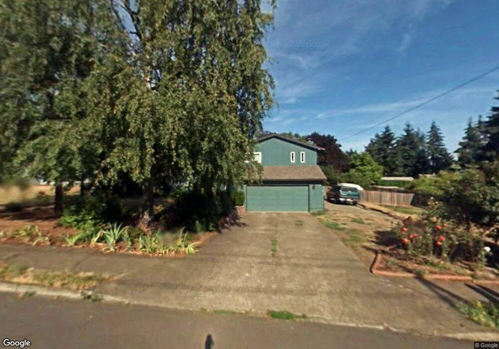
4891 Summit St West Linn, OR 97068
Sunset NeighborhoodEstimated Value: $662,575 - $768,000
3
Beds
3
Baths
2,480
Sq Ft
$281/Sq Ft
Est. Value
About This Home
This home is located at 4891 Summit St, West Linn, OR 97068 and is currently estimated at $696,894, approximately $281 per square foot. 4891 Summit St is a home located in Clackamas County with nearby schools including Sunset Primary School, Rosemont Ridge Middle School, and West Linn High School.
Ownership History
Date
Name
Owned For
Owner Type
Purchase Details
Closed on
Feb 5, 2015
Sold by
Spiridon Tiberiu
Bought by
Bjorklund Roger E and Bjorklund Molly A
Current Estimated Value
Home Financials for this Owner
Home Financials are based on the most recent Mortgage that was taken out on this home.
Original Mortgage
$175,000
Outstanding Balance
$133,844
Interest Rate
3.8%
Mortgage Type
New Conventional
Estimated Equity
$563,050
Purchase Details
Closed on
Sep 27, 2013
Sold by
Molnar David M and Molnar Shawn N
Bought by
Spiridon Tiberiu
Purchase Details
Closed on
Aug 25, 2006
Sold by
Ray Gary L and Ray Vicki L
Bought by
Molnar David M and Molnar Shawn N
Home Financials for this Owner
Home Financials are based on the most recent Mortgage that was taken out on this home.
Original Mortgage
$35,990
Interest Rate
6.33%
Mortgage Type
Stand Alone Second
Create a Home Valuation Report for This Property
The Home Valuation Report is an in-depth analysis detailing your home's value as well as a comparison with similar homes in the area
Home Values in the Area
Average Home Value in this Area
Purchase History
| Date | Buyer | Sale Price | Title Company |
|---|---|---|---|
| Bjorklund Roger E | $375,000 | Fidelity National Title Co | |
| Spiridon Tiberiu | $230,700 | Wfg Title | |
| Molnar David M | $359,900 | Fidelity Natl Title Co Of Or |
Source: Public Records
Mortgage History
| Date | Status | Borrower | Loan Amount |
|---|---|---|---|
| Open | Bjorklund Roger E | $175,000 | |
| Previous Owner | Molnar David M | $35,990 | |
| Previous Owner | Molnar David M | $287,920 |
Source: Public Records
Tax History
| Year | Tax Paid | Tax Assessment Tax Assessment Total Assessment is a certain percentage of the fair market value that is determined by local assessors to be the total taxable value of land and additions on the property. | Land | Improvement |
|---|---|---|---|---|
| 2025 | $6,634 | $344,231 | -- | -- |
| 2024 | $6,386 | $334,205 | -- | -- |
| 2023 | $6,386 | $324,471 | $0 | $0 |
| 2022 | $6,027 | $315,021 | $0 | $0 |
| 2021 | $5,721 | $305,846 | $0 | $0 |
| 2020 | $5,723 | $296,938 | $0 | $0 |
| 2019 | $5,491 | $288,290 | $0 | $0 |
| 2018 | $5,213 | $279,893 | $0 | $0 |
| 2017 | $5,031 | $271,741 | $0 | $0 |
| 2016 | $4,811 | $263,826 | $0 | $0 |
Source: Public Records
Map
Nearby Homes
- 4977 Summit St
- 4794 Coho Ln
- 2805 York St
- 4707 Summer Run Dr
- 4735 Sussex St
- 2790 York St
- 4090 Ireland Ln
- 2740 Lancaster St
- 4667 Exeter St
- 5202 Nelco Cir
- 22790 Oregon City Loop
- 6123 Skyline Dr
- 6141 Skyline Dr
- 5219 Summit St
- 3102 Winkel Way
- 4264 Sussex St
- 4480 Grant St
- 6002 Skyline Cir
- 4405 Grant St
- 3987 Wheeler Ln
Your Personal Tour Guide
Ask me questions while you tour the home.