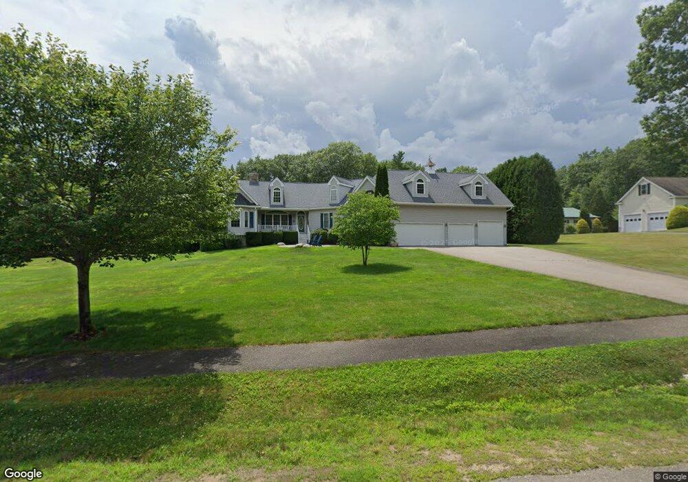
49 Bobbys Way Laconia, NH 03246
Estimated Value: $1,124,268 - $1,427,000
4
Beds
4
Baths
3,205
Sq Ft
$397/Sq Ft
Est. Value
About This Home
This home is located at 49 Bobbys Way, Laconia, NH 03246 and is currently estimated at $1,270,817, approximately $396 per square foot. 49 Bobbys Way is a home located in Belknap County with nearby schools including Laconia Middle School and Laconia High School.
Ownership History
Date
Name
Owned For
Owner Type
Purchase Details
Closed on
Feb 18, 2010
Sold by
Preskins 3Rd William G and 3Rd Linda M Preskin
Bought by
Kelley James P and Kelley Carol A
Current Estimated Value
Purchase Details
Closed on
Nov 4, 2003
Sold by
Donahue Builders Inc
Bought by
Preskins William G and Preskins Linda M
Home Financials for this Owner
Home Financials are based on the most recent Mortgage that was taken out on this home.
Original Mortgage
$300,000
Interest Rate
6.05%
Create a Home Valuation Report for This Property
The Home Valuation Report is an in-depth analysis detailing your home's value as well as a comparison with similar homes in the area
Home Values in the Area
Average Home Value in this Area
Purchase History
| Date | Buyer | Sale Price | Title Company |
|---|---|---|---|
| Kelley James P | $460,000 | -- | |
| Preskins William G | $384,900 | -- |
Source: Public Records
Mortgage History
| Date | Status | Borrower | Loan Amount |
|---|---|---|---|
| Previous Owner | Preskins William G | $340,000 | |
| Previous Owner | Preskins William G | $42,000 | |
| Previous Owner | Preskins William G | $300,000 |
Source: Public Records
Tax History Compared to Growth
Tax History
| Year | Tax Paid | Tax Assessment Tax Assessment Total Assessment is a certain percentage of the fair market value that is determined by local assessors to be the total taxable value of land and additions on the property. | Land | Improvement |
|---|---|---|---|---|
| 2024 | $12,969 | $951,500 | $446,200 | $505,300 |
| 2023 | $12,188 | $876,200 | $384,700 | $491,500 |
| 2022 | $11,253 | $757,800 | $337,200 | $420,600 |
| 2021 | $10,117 | $536,400 | $169,100 | $367,300 |
| 2020 | $10,197 | $517,100 | $149,800 | $367,300 |
| 2019 | $10,342 | $502,300 | $145,000 | $357,300 |
| 2018 | $10,335 | $495,700 | $145,000 | $350,700 |
| 2017 | $9,800 | $466,000 | $145,000 | $321,000 |
| 2016 | $9,617 | $433,200 | $125,600 | $307,600 |
| 2015 | $9,775 | $440,300 | $132,700 | $307,600 |
| 2014 | $9,482 | $423,300 | $132,700 | $290,600 |
| 2013 | $9,190 | $416,200 | $125,600 | $290,600 |
Source: Public Records
Map
Nearby Homes
- 164 Birch Haven Rd
- 200 Hilliard Rd Unit 12
- 19 Dillon Way Unit 4
- 883 Weirs Blvd Unit 48
- 883 Weirs Blvd Unit 21
- 130 Endicott St N Unit 211
- 76 Endicott St N
- 23 Rose Point
- 9 Treetop Cir Unit 135
- 75 Treetop Cir Unit 32
- 75 Treetop Cir Unit 14
- 9 Treetop Cir Unit 15
- 107 Treetop Cir Unit 16
- 28 Vantagepoint Dr Unit 1
- 36 Vantage Point Dr Unit 1
- 36 Vantage Point Dr Unit 4
- 36 Vantage Point Dr Unit 3
- 738 Weirs Blvd Unit 34
- 177 Mentor Ave Unit 412
- UNIT 52 Stonewall Corners Way Unit 52