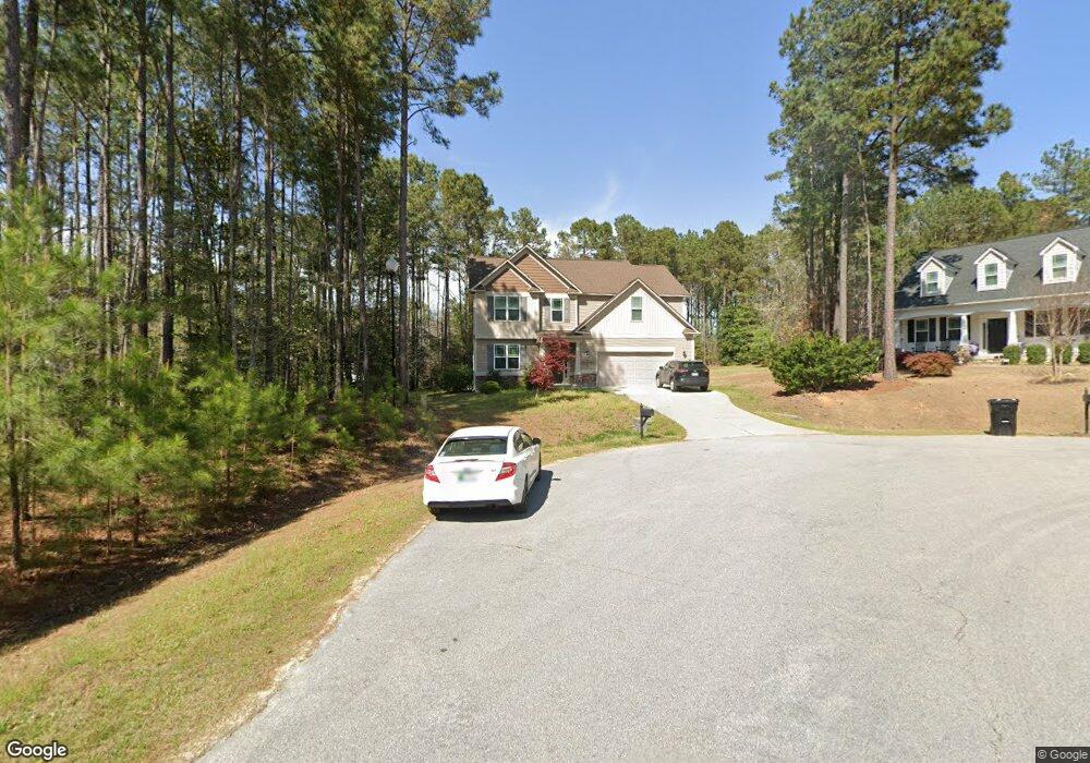
49 Bowie Ct Angier, NC 27501
Pleasant Grove NeighborhoodEstimated Value: $410,002 - $480,000
4
Beds
3
Baths
2,621
Sq Ft
$170/Sq Ft
Est. Value
About This Home
This home is located at 49 Bowie Ct, Angier, NC 27501 and is currently estimated at $444,501, approximately $169 per square foot. 49 Bowie Ct is a home located in Harnett County with nearby schools including Dixon Road Elementary School, McGee's Crossroads Middle School, and West Johnston High School.
Ownership History
Date
Name
Owned For
Owner Type
Purchase Details
Closed on
Mar 15, 2017
Sold by
Golden Properties & Dev Inc
Bought by
Banuelos Faustino and Banuelos Alma D
Current Estimated Value
Home Financials for this Owner
Home Financials are based on the most recent Mortgage that was taken out on this home.
Original Mortgage
$207,900
Outstanding Balance
$172,498
Interest Rate
4.19%
Mortgage Type
New Conventional
Estimated Equity
$272,003
Purchase Details
Closed on
Jun 23, 2016
Sold by
Crossroads Developments Corp
Bought by
Golden Properties And Development Sinc
Create a Home Valuation Report for This Property
The Home Valuation Report is an in-depth analysis detailing your home's value as well as a comparison with similar homes in the area
Home Values in the Area
Average Home Value in this Area
Purchase History
| Date | Buyer | Sale Price | Title Company |
|---|---|---|---|
| Banuelos Faustino | $228,000 | -- | |
| Golden Properties And Development Sinc | $96,000 | None Available |
Source: Public Records
Mortgage History
| Date | Status | Borrower | Loan Amount |
|---|---|---|---|
| Open | Banuelos Faustino | $207,900 |
Source: Public Records
Tax History Compared to Growth
Tax History
| Year | Tax Paid | Tax Assessment Tax Assessment Total Assessment is a certain percentage of the fair market value that is determined by local assessors to be the total taxable value of land and additions on the property. | Land | Improvement |
|---|---|---|---|---|
| 2025 | $2,534 | $399,090 | $65,000 | $334,090 |
| 2024 | $1,769 | $218,360 | $40,000 | $178,360 |
| 2023 | $1,714 | $218,360 | $40,000 | $178,360 |
| 2022 | $1,769 | $218,360 | $40,000 | $178,360 |
| 2021 | $1,769 | $218,360 | $40,000 | $178,360 |
| 2020 | $1,834 | $218,360 | $40,000 | $178,360 |
| 2019 | $1,791 | $218,360 | $40,000 | $178,360 |
| 2018 | $1,889 | $224,910 | $30,000 | $194,910 |
| 2017 | $1,889 | $224,910 | $30,000 | $194,910 |
Source: Public Records
Map
Nearby Homes
- 85 Landlocked Cir
- 376 Everland Pkwy
- 232 Burrage Dr
- 123 Terawood Farm Dr
- 154 Everland Pkwy
- 17 Kiowa Ct
- 1025 Lake Path Rd
- 94 Bridle Dr
- 51 Borgo Ct
- 623 Canady Ct
- 250 Crosscreek Ln
- 135 Brookstone Way
- 126 Lakeside Cir
- 19 Lake Refuge Ct
- 1251 Ennis Rd
- 577 Dixon Rd Unit D
- 823 Shadow Lake Dr
- 230 Paula Dr
- 197 Silverside Dr
- 420 Beulah Milton Dr
- 57 Timberland Dr
- 57 Bowie Ct
- 118 Landlocked Cir
- 148 Landlocked Cir
- 84 Landlocked Cir
- 50 Bowie Ct
- 30 Bowie Ct
- 30 Timberland Dr
- 160 Landlocked Cir
- 24 Landlocked Cir Unit BELLE
- 282 Timberland Dr
- 161 Landlocked Cir
- 258 Timberland Dr
- 258 Timberland Dr Unit 85
- 53 Landlocked Cir
- 149 Landlocked Cir
- 270 Timberland Dr Unit 86
- 270 Timberland Dr
- 107 Landlocked Cir
- 12 Landlocked Cir