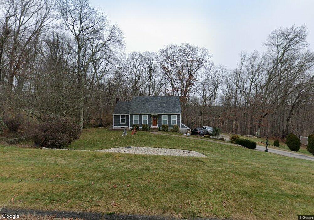
49 Cannon Dr Amston, CT 06231
Estimated Value: $440,023 - $507,000
4
Beds
2
Baths
1,613
Sq Ft
$294/Sq Ft
Est. Value
About This Home
This home is located at 49 Cannon Dr, Amston, CT 06231 and is currently estimated at $474,756, approximately $294 per square foot. 49 Cannon Dr is a home located in Tolland County with nearby schools including Gilead Hill School, Hebron Elementary School, and RHAM Middle School.
Ownership History
Date
Name
Owned For
Owner Type
Purchase Details
Closed on
Feb 23, 2001
Sold by
Rowell Lonette
Bought by
Tarallo Craig and Tarallo Lori
Current Estimated Value
Home Financials for this Owner
Home Financials are based on the most recent Mortgage that was taken out on this home.
Original Mortgage
$156,400
Interest Rate
6.89%
Purchase Details
Closed on
Sep 27, 1996
Sold by
Bengston David and Bengston Elizabeth
Bought by
Rowell Lonette
Create a Home Valuation Report for This Property
The Home Valuation Report is an in-depth analysis detailing your home's value as well as a comparison with similar homes in the area
Home Values in the Area
Average Home Value in this Area
Purchase History
| Date | Buyer | Sale Price | Title Company |
|---|---|---|---|
| Tarallo Craig | $195,500 | -- | |
| Rowell Lonette | $155,000 | -- |
Source: Public Records
Mortgage History
| Date | Status | Borrower | Loan Amount |
|---|---|---|---|
| Open | Rowell Lonette | $205,000 | |
| Closed | Rowell Lonette | $197,000 | |
| Closed | Rowell Lonette | $100,000 | |
| Closed | Rowell Lonette | $156,400 |
Source: Public Records
Tax History Compared to Growth
Tax History
| Year | Tax Paid | Tax Assessment Tax Assessment Total Assessment is a certain percentage of the fair market value that is determined by local assessors to be the total taxable value of land and additions on the property. | Land | Improvement |
|---|---|---|---|---|
| 2025 | $6,789 | $184,240 | $54,390 | $129,850 |
| 2024 | $6,356 | $184,240 | $54,390 | $129,850 |
| 2023 | $6,115 | $184,240 | $54,390 | $129,850 |
| 2022 | $5,840 | $184,240 | $54,390 | $129,850 |
| 2021 | $5,733 | $157,810 | $54,390 | $103,420 |
| 2020 | $5,733 | $157,810 | $54,390 | $103,420 |
| 2019 | $5,847 | $157,810 | $54,390 | $103,420 |
| 2018 | $5,908 | $157,810 | $54,390 | $103,420 |
| 2017 | $5,839 | $157,810 | $54,390 | $103,420 |
| 2016 | $6,412 | $179,900 | $91,840 | $88,060 |
| 2015 | $6,476 | $179,900 | $91,840 | $88,060 |
| 2014 | $6,431 | $179,900 | $91,840 | $88,060 |
Source: Public Records
Map
Nearby Homes
- 40 Cannon Dr
- 218 Hope Valley Rd
- 20 Mohegan Ln
- 30 Pepperbush Dr
- 25 Smith Farm Rd
- 14 Jeremy Way Unit 14
- 255 Millstream Rd
- 1 Church St
- 2 Church St
- 0 Deepwood Dr
- 18 Spring Hill Rd
- 14 Woodside Rd
- 2 Lots on Deepwood Dr
- 185 Deepwood Dr
- 6 Deepwood Dr
- 22 Gilbert Ln Unit 22
- 80 Wellswood Rd Unit 9
- 65 Wellswood Rd
- 34 Spafford Dr
- 0 Kellys Corner
- 53 Cannon Dr
- 8 Attawanhood Trail
- 14 Attawanhood Trail
- 46 Cannon Dr
- 20 Attawanhood Trail
- 9 Attawanhood Trail
- 58 Cannon Dr
- 30 Attawanhood Trail
- 65 Cannon Dr
- 29 Cannon Dr
- 13 Attawanhood Trail
- 36 Attawanhood Trail
- 34 Cannon Dr
- 64 Cannon Dr
- 71 Cannon Dr
- 19 Attawanhood Trail
- 25 Attawanhood Trail
- 21 Cannon Dr
- 40 Attawanhood Trail
- 28 Cannon Dr