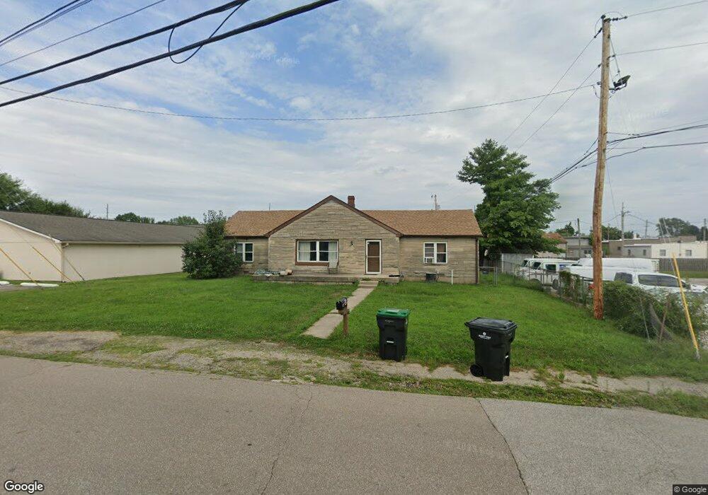
49 Center St Whiteland, IN 46184
Estimated Value: $237,351 - $254,000
3
Beds
1
Bath
1,583
Sq Ft
$156/Sq Ft
Est. Value
About This Home
This home is located at 49 Center St, Whiteland, IN 46184 and is currently estimated at $246,838, approximately $155 per square foot. 49 Center St is a home located in Johnson County with nearby schools including Whiteland Elementary School, Clark-Pleasant Middle School, and Whiteland Community High School.
Ownership History
Date
Name
Owned For
Owner Type
Purchase Details
Closed on
Sep 3, 2025
Sold by
Stone Cynthia M
Bought by
Nandireddy Llc
Current Estimated Value
Home Financials for this Owner
Home Financials are based on the most recent Mortgage that was taken out on this home.
Original Mortgage
$117,000
Outstanding Balance
$117,000
Interest Rate
6.72%
Mortgage Type
Construction
Estimated Equity
$129,838
Purchase Details
Closed on
Aug 12, 2023
Sold by
Stone Grover T
Bought by
Stone Cynthia M
Purchase Details
Closed on
Jan 20, 2009
Sold by
Stone Grover T and Bradley Cynthia M
Bought by
Stone Grover T
Purchase Details
Closed on
Apr 23, 2008
Sold by
Stone Cynthia Bradley
Bought by
Stone Grover T
Create a Home Valuation Report for This Property
The Home Valuation Report is an in-depth analysis detailing your home's value as well as a comparison with similar homes in the area
Home Values in the Area
Average Home Value in this Area
Purchase History
| Date | Buyer | Sale Price | Title Company |
|---|---|---|---|
| Nandireddy Llc | -- | Ata National Title | |
| Stone Cynthia M | -- | None Listed On Document | |
| Stone Grover T | -- | None Available | |
| Stone Grover T | -- | None Available |
Source: Public Records
Mortgage History
| Date | Status | Borrower | Loan Amount |
|---|---|---|---|
| Open | Nandireddy Llc | $117,000 |
Source: Public Records
Tax History Compared to Growth
Tax History
| Year | Tax Paid | Tax Assessment Tax Assessment Total Assessment is a certain percentage of the fair market value that is determined by local assessors to be the total taxable value of land and additions on the property. | Land | Improvement |
|---|---|---|---|---|
| 2025 | $1,576 | $203,200 | $37,400 | $165,800 |
| 2024 | $1,576 | $164,700 | $37,400 | $127,300 |
| 2023 | $1,559 | $160,000 | $37,400 | $122,600 |
| 2022 | $2,715 | $130,600 | $24,900 | $105,700 |
| 2021 | $2,474 | $118,500 | $24,900 | $93,600 |
| 2020 | $2,387 | $113,600 | $24,900 | $88,700 |
| 2019 | $1,078 | $113,600 | $24,900 | $88,700 |
| 2018 | $1,056 | $110,500 | $19,100 | $91,400 |
| 2017 | $1,038 | $109,200 | $19,100 | $90,100 |
| 2016 | $1,094 | $109,400 | $19,100 | $90,300 |
| 2014 | $1,090 | $108,100 | $19,200 | $88,900 |
| 2013 | $1,090 | $108,200 | $19,300 | $88,900 |
Source: Public Records
Map
Nearby Homes
- 630 Walnut St
- 650 E Pearl St
- 657 Whiteland Rd
- 545 Whiteland Rd
- 180 Briar Hill Dr
- 320 Briar Hill Dr
- 510 Greensprings Dr
- 111 Ames Dr
- Henley Plan at Saddlebrook Farms
- Fairfax Plan at Saddlebrook Farms - North
- 841 E Pearl St
- Henley Plan at Saddlebrook Farms - North
- Freeport Plan at Saddlebrook Farms - North
- Johnstown Plan at Saddlebrook Farms - North
- Dayton Plan at Saddlebrook Farms - North
- Chatham Plan at Saddlebrook Farms - North
- Dayton Plan at Saddlebrook Farms
- Harmony Plan at Saddlebrook Farms - North
- Johnstown Plan at Saddlebrook Farms
- Stamford Plan at Saddlebrook Farms - North