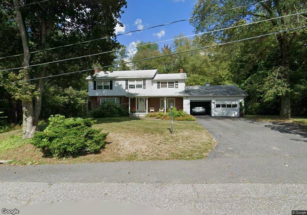
49 Cloverleaf Rd Leominster, MA 01453
Estimated Value: $624,746 - $745,000
4
Beds
3
Baths
2,736
Sq Ft
$245/Sq Ft
Est. Value
About This Home
This home is located at 49 Cloverleaf Rd, Leominster, MA 01453 and is currently estimated at $671,437, approximately $245 per square foot. 49 Cloverleaf Rd is a home located in Worcester County with nearby schools including Leominster High School, St. Leo School, and St. Anna Catholic School.
Ownership History
Date
Name
Owned For
Owner Type
Purchase Details
Closed on
Oct 28, 2025
Sold by
Keating Paul J and Keating Barbara A
Bought by
Keating Barbara A
Current Estimated Value
Purchase Details
Closed on
Jan 26, 1973
Bought by
Keating Paul J and Keating Barbara A
Create a Home Valuation Report for This Property
The Home Valuation Report is an in-depth analysis detailing your home's value as well as a comparison with similar homes in the area
Home Values in the Area
Average Home Value in this Area
Purchase History
| Date | Buyer | Sale Price | Title Company |
|---|---|---|---|
| Keating Barbara A | -- | -- | |
| Keating Paul J | -- | -- |
Source: Public Records
Mortgage History
| Date | Status | Borrower | Loan Amount |
|---|---|---|---|
| Previous Owner | Keating Paul J | $283,400 | |
| Previous Owner | Keating Paul J | $274,500 | |
| Previous Owner | Keating Paul J | $20,000 | |
| Previous Owner | Keating Paul J | $150,000 |
Source: Public Records
Tax History
| Year | Tax Paid | Tax Assessment Tax Assessment Total Assessment is a certain percentage of the fair market value that is determined by local assessors to be the total taxable value of land and additions on the property. | Land | Improvement |
|---|---|---|---|---|
| 2025 | $7,836 | $558,500 | $152,700 | $405,800 |
| 2024 | $7,700 | $530,700 | $145,400 | $385,300 |
| 2023 | $7,322 | $471,200 | $126,500 | $344,700 |
| 2022 | $7,005 | $423,000 | $110,000 | $313,000 |
| 2021 | $6,973 | $384,600 | $85,700 | $298,900 |
| 2020 | $6,750 | $375,400 | $85,700 | $289,700 |
| 2019 | $6,559 | $353,800 | $81,600 | $272,200 |
| 2018 | $6,512 | $336,900 | $79,200 | $257,700 |
| 2017 | $6,312 | $319,900 | $73,900 | $246,000 |
| 2016 | $6,150 | $314,100 | $73,900 | $240,200 |
| 2015 | $5,655 | $290,900 | $73,900 | $217,000 |
| 2014 | $5,378 | $284,700 | $79,700 | $205,000 |
Source: Public Records
Map
Nearby Homes
- 55 Cloverleaf Rd
- 39 Cloverleaf Rd
- 32 Cloverleaf Rd
- 58 Cloverleaf Rd
- 12 Cloverleaf Rd
- 73 Cloverleaf Rd
- 68 Cloverleaf Rd
- 25 Cloverleaf Rd
- 8 Cloverleaf Rd
- 6 Cloverleaf Rd
- 80 Cloverleaf Rd
- 54 Briar Rd
- 53 Briar Rd
- 83 Cloverleaf Rd
- 2 Cloverleaf Rd
- 9 Cloverleaf Rd
- 0 Pierce Rd Unit 2
- 17 Cloverleaf Rd
- 5 Cloverleaf Rd
- 132 Bonnydale Rd
Your Personal Tour Guide
Ask me questions while you tour the home.