Estimated Value: $416,000 - $537,000
2
Beds
1
Bath
832
Sq Ft
$566/Sq Ft
Est. Value
About This Home
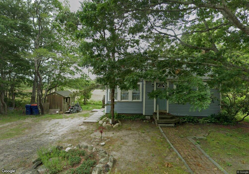
This home is located at 49 Commonwealth Ave, Onset, MA 02558 and is currently estimated at $471,169, approximately $566 per square foot. 49 Commonwealth Ave is a home with nearby schools including Bourne High School, Bridgeview Montessori School, and Waldorf School of Cape Cod.
Ownership History
Date
Name
Owned For
Owner Type
Purchase Details
Closed on
Mar 18, 2010
Sold by
Petrie Pauline Ann
Bought by
Zollo Robert T and Zollo Gina
Current Estimated Value
Purchase Details
Closed on
Aug 20, 2008
Sold by
Petrie Pauline Ann
Bought by
49 Commonwealth Ave and Petrie
Purchase Details
Closed on
Apr 20, 1993
Sold by
Pelligrini Lena and Lamborghini Marjorie
Bought by
Petrie Pauline Ann
Create a Home Valuation Report for This Property
The Home Valuation Report is an in-depth analysis detailing your home's value as well as a comparison with similar homes in the area
Home Values in the Area
Average Home Value in this Area
Purchase History
| Date | Buyer | Sale Price | Title Company |
|---|---|---|---|
| Zollo Robert T | $200,000 | -- | |
| Petrie Pauline Ann | -- | -- | |
| Petrie Pauline Ann | -- | -- | |
| Zollo Robert T | $200,000 | -- | |
| Petrie Pauline Ann | -- | -- | |
| 49 Commonwealth Ave | -- | -- | |
| 49 Commonwealth Ave | -- | -- | |
| 49 Commonwealth Ave | -- | -- | |
| Petrie Pauline Ann | $84,000 | -- | |
| Petrie Pauline Ann | $84,000 | -- |
Source: Public Records
Mortgage History
| Date | Status | Borrower | Loan Amount |
|---|---|---|---|
| Previous Owner | Petrie Pauline Ann | $20,000 |
Source: Public Records
Tax History
| Year | Tax Paid | Tax Assessment Tax Assessment Total Assessment is a certain percentage of the fair market value that is determined by local assessors to be the total taxable value of land and additions on the property. | Land | Improvement |
|---|---|---|---|---|
| 2025 | $2,742 | $351,100 | $156,800 | $194,300 |
| 2024 | $2,651 | $330,500 | $149,300 | $181,200 |
| 2023 | $2,569 | $291,600 | $132,100 | $159,500 |
| 2022 | $2,457 | $243,500 | $116,900 | $126,600 |
| 2021 | $2,387 | $221,600 | $106,400 | $115,200 |
| 2020 | $2,304 | $214,500 | $105,400 | $109,100 |
| 2019 | $2,204 | $209,700 | $105,400 | $104,300 |
| 2018 | $2,052 | $194,700 | $100,400 | $94,300 |
| 2017 | $1,986 | $192,800 | $99,400 | $93,400 |
| 2016 | $1,809 | $178,100 | $99,400 | $78,700 |
| 2015 | $1,683 | $167,100 | $88,400 | $78,700 |
Source: Public Records
Map
Nearby Homes
- 49 Commonwealth Ave
- 49 Commonwealth Ave
- 23 Westdale Park
- 27 Westdale Park
- 27 Westdale Park
- 15 Westdale Park
- 52 Commonwealth Ave
- 52 Commonwealth Ave
- 54 Commonwealth Ave
- 860 Sandwich Rd
- 860 Sandwich Rd Unit 3
- 860 Sandwich Rd Unit 27
- 54 Commonwealth Ave
- 46 Commonwealth Ave
- 2 Commonwealth Ave
- 28 Westdale Park
- 55 Commonwealth Ave
- 35 Oak St
- 22 Westdale Park
- 20 Westdale Park
Your Personal Tour Guide
Ask me questions while you tour the home.