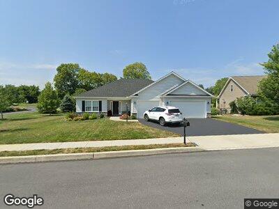
49 Franklin Dr Mechanicsburg, PA 17055
Monroe Township NeighborhoodEstimated Value: $447,000 - $557,000
3
Beds
3
Baths
1,981
Sq Ft
$258/Sq Ft
Est. Value
About This Home
This home is located at 49 Franklin Dr, Mechanicsburg, PA 17055 and is currently estimated at $511,178, approximately $258 per square foot. 49 Franklin Dr is a home with nearby schools including Monroe Elementary School, Eagle View Middle School, and Cumberland Valley High School.
Ownership History
Date
Name
Owned For
Owner Type
Purchase Details
Closed on
Jul 26, 2018
Sold by
Trindle Station Llc
Bought by
Fetterolf Michael D and Fetterolf Virginia A
Current Estimated Value
Home Financials for this Owner
Home Financials are based on the most recent Mortgage that was taken out on this home.
Original Mortgage
$314,561
Interest Rate
4.5%
Mortgage Type
New Conventional
Create a Home Valuation Report for This Property
The Home Valuation Report is an in-depth analysis detailing your home's value as well as a comparison with similar homes in the area
Home Values in the Area
Average Home Value in this Area
Purchase History
| Date | Buyer | Sale Price | Title Company |
|---|---|---|---|
| Fetterolf Michael D | $100,000 | None Available |
Source: Public Records
Mortgage History
| Date | Status | Borrower | Loan Amount |
|---|---|---|---|
| Open | Fetterolf Michael D | $242,000 | |
| Closed | Fetterolf Michael D | $314,561 |
Source: Public Records
Tax History Compared to Growth
Tax History
| Year | Tax Paid | Tax Assessment Tax Assessment Total Assessment is a certain percentage of the fair market value that is determined by local assessors to be the total taxable value of land and additions on the property. | Land | Improvement |
|---|---|---|---|---|
| 2025 | $5,496 | $355,300 | $140,800 | $214,500 |
| 2024 | $5,218 | $355,300 | $140,800 | $214,500 |
| 2023 | $4,942 | $355,300 | $140,800 | $214,500 |
| 2022 | $4,815 | $355,300 | $140,800 | $214,500 |
| 2021 | $4,706 | $355,300 | $140,800 | $214,500 |
| 2020 | $4,614 | $355,300 | $140,800 | $214,500 |
| 2019 | $1,396 | $110,100 | $110,100 | $0 |
| 2018 | $1,369 | $110,100 | $110,100 | $0 |
| 2017 | $1,343 | $110,100 | $110,100 | $0 |
| 2016 | -- | $110,100 | $110,100 | $0 |
| 2015 | -- | $110,100 | $110,100 | $0 |
Source: Public Records
Map
Nearby Homes
- 51 Franklin Dr
- 757 Barn Swallow Way
- 545 Joseph Ct
- 547 Joseph Ct
- 911 Nixon Dr
- 1287 W Trindle Rd
- 104 S George St
- 623 W Main St
- 419 S Broad St
- 1217 Gross Dr
- 6 Briar Gate Rd
- 6 Briargate Rd
- 17 Clouser Road Spur
- 103 Notting Hill Ct
- 497 Glenn St
- 116 Kensington Place
- 423 W Simpson St
- 305 W Elmwood Ave
- 422 W Simpson St
- 152 Independence Way
- 49 Franklin Dr
- 47 Franklin Dr
- 842 Tamanini Way
- Lot 62 Tamanini Way Unit TRINDLE STATION
- Lot 75 Tamanini Way
- Lot 20 Tamanini Way
- 1234 Tamanini Way
- 46 Franklin Dr
- 0 Franklin Dr Unit PACB2038464
- Homesite 76 Franklin Dr
- 0 Franklin Dr Unit PACB110608
- 0 Franklin Dr Unit PACB110596
- 0 Franklin Dr Unit PACB110546
- 0 Franklin Dr Unit PACB110042
- 0 Franklin Dr Unit PACB109922
- 0 Franklin Dr Unit PACB108554
- 0 Franklin Dr
- 841 Tamanini Way
- 45 Franklin Dr
- 53 Franklin Dr