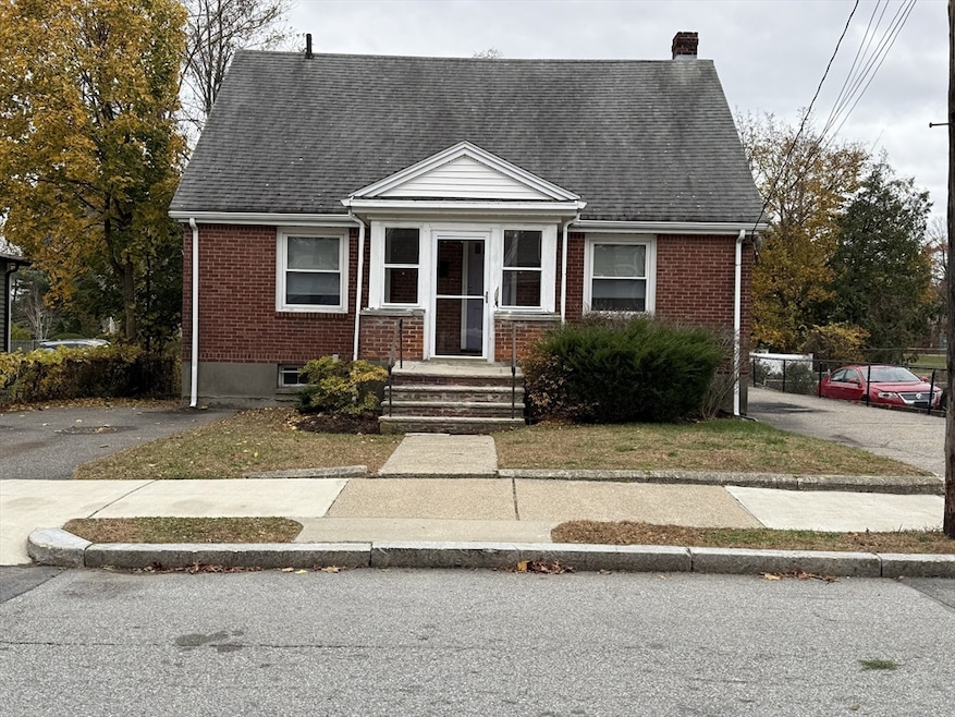
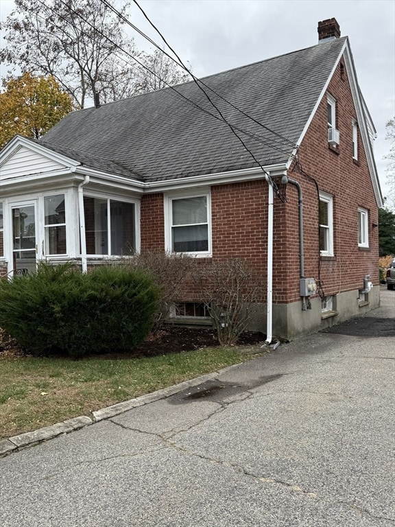
49 Hawthorn St Newton, MA 02458
Nonantum NeighborhoodEstimated payment $6,445/month
Highlights
- Property is near public transit
- Jogging Path
- Coin Laundry
- Lincoln-Eliot Elementary School Rated A
- Shops
- 1-minute walk to Pellegrini Park
About This Home
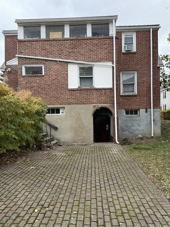
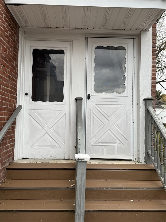
Contractors, investors, and savvy renovators—opportunity knocks in Nonantum! This classic multi-family home is primed for updates, customization, or a complete reimagination—offering exceptional value and equity potential. Each unit features bright living spaces, eat-in kitchens, and separate entrances, ideal for rental income or multi-generational living. A full basement provides ample storage, while dual driveways offer convenient off-street parking. The solid brick construction delivers great bones for modernization, expansion, or full renovation. Perfectly positioned just steps from Pellegrini Park, Nonantum Village shops, and local restaurants, with easy access to Newton Corner, the Mass Pike, and the Commuter Rail. A rare opportunity to create lasting value in one of Newton’s most desirable neighborhoods.
Property Details
Home Type
- Multi-Family
Est. Annual Taxes
- $7,890
Year Built
- Built in 1950
Home Design
- Duplex
- Brick Exterior Construction
- Frame Construction
- Shingle Roof
- Concrete Perimeter Foundation
Interior Spaces
- 1,566 Sq Ft Home
- Property has 1 Level
Bedrooms and Bathrooms
- 3 Bedrooms
- 2 Full Bathrooms
Unfinished Basement
- Walk-Out Basement
- Interior Basement Entry
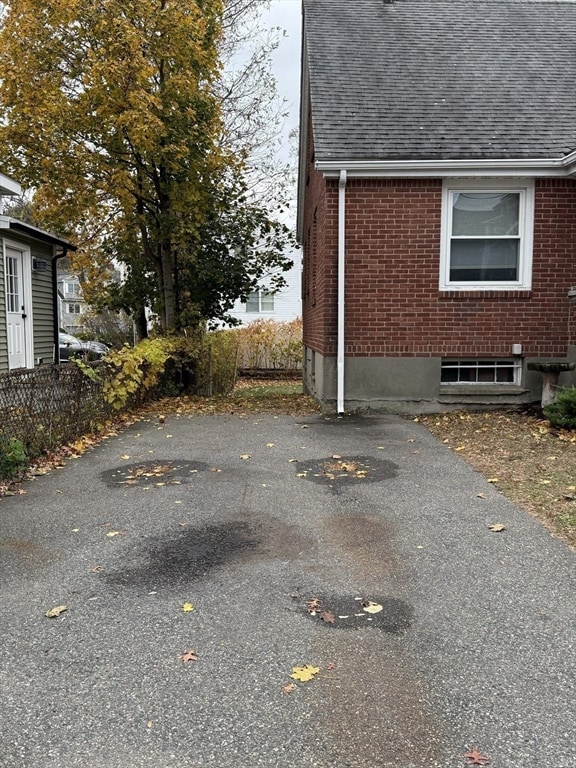
Parking
- 5 Car Parking Spaces
- Driveway
- Open Parking
- Off-Street Parking
Location
- Property is near public transit
- Property is near schools
Schools
- Horace Mann Elementary School
- Day Middle School
- Newton North High School
Additional Features
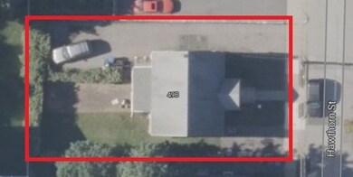
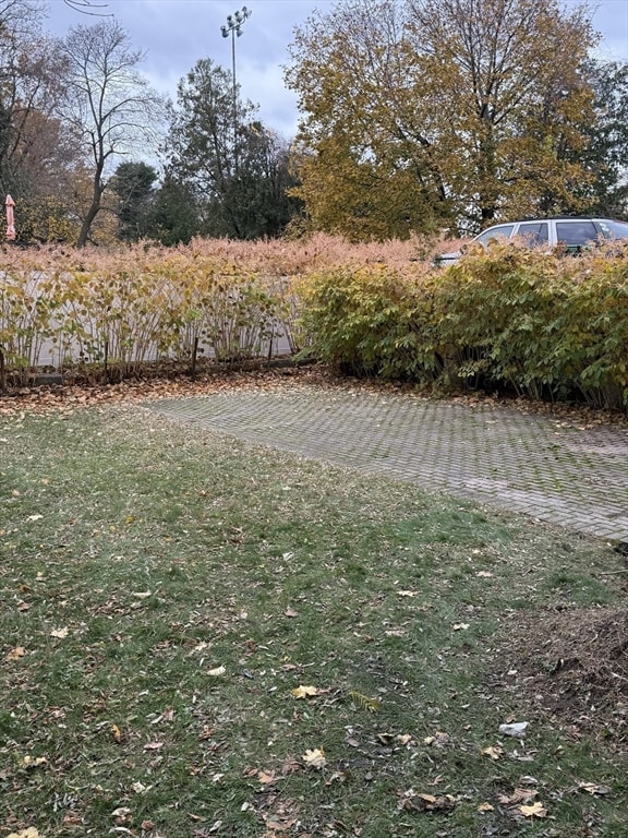
- 5,500 Sq Ft Lot
- 1 Heating Zone
Listing and Financial Details
- Assessor Parcel Number 14016 0030,684048
Community Details
Amenities
- Shops
- Coin Laundry
Recreation
- Jogging Path
Additional Features
- 2 Units
- Net Operating Income $18,000
Map
Home Values in the Area
Average Home Value in this Area
Tax History
| Year | Tax Paid | Tax Assessment Tax Assessment Total Assessment is a certain percentage of the fair market value that is determined by local assessors to be the total taxable value of land and additions on the property. | Land | Improvement |
|---|---|---|---|---|
| 2025 | $7,621 | $777,700 | $637,300 | $140,400 |
| 2024 | $7,369 | $755,000 | $618,700 | $136,300 |
| 2023 | $7,001 | $687,700 | $490,200 | $197,500 |
| 2022 | $6,699 | $636,800 | $453,900 | $182,900 |
| 2021 | $6,286 | $584,200 | $416,400 | $167,800 |
| 2020 | $6,099 | $584,200 | $416,400 | $167,800 |
| 2019 | $5,706 | $546,000 | $389,200 | $156,800 |
| 2018 | $5,583 | $516,000 | $365,800 | $150,200 |
| 2017 | $5,264 | $473,400 | $335,600 | $137,800 |
| 2016 | $4,942 | $434,300 | $307,900 | $126,400 |
| 2015 | $4,712 | $405,900 | $287,800 | $118,100 |
Property History
| Date | Event | Price | List to Sale | Price per Sq Ft |
|---|---|---|---|---|
| 11/12/2025 11/12/25 | For Sale | $1,099,000 | -- | $702 / Sq Ft |
Purchase History
| Date | Type | Sale Price | Title Company |
|---|---|---|---|
| Deed | -- | -- |
Source: MLS Property Information Network (MLS PIN)
MLS Number: 73454284
APN: NEWT-000014-000016-000030
Disclaimer: Certain information contained herein is derived from information provided by parties other than Homes.com. All information provided is deemed reliable, but is not guaranteed to be accurate and should be independently verified.
![]() The property listing data and information, or the Images, set forth herein were provided to MLS Property Information Network, Inc. from third party sources, including sellers, lessors and public records, and were compiled by MLS Property Information Network, Inc. The property listing data and information, and the Images, are for the personal, non-commercial use of consumers having a good faith interest in purchasing or leasing listed properties of the type displayed to them and may not be used for any purpose other than to identify prospective properties which such consumers may have a good faith interest in purchasing or leasing. MLS Property Information Network, Inc. and its subscribers disclaim any and all representations and warranties as to the accuracy of the property listing data and information, or as to the accuracy of any of the Images, set forth herein.
The property listing data and information, or the Images, set forth herein were provided to MLS Property Information Network, Inc. from third party sources, including sellers, lessors and public records, and were compiled by MLS Property Information Network, Inc. The property listing data and information, and the Images, are for the personal, non-commercial use of consumers having a good faith interest in purchasing or leasing listed properties of the type displayed to them and may not be used for any purpose other than to identify prospective properties which such consumers may have a good faith interest in purchasing or leasing. MLS Property Information Network, Inc. and its subscribers disclaim any and all representations and warranties as to the accuracy of the property listing data and information, or as to the accuracy of any of the Images, set forth herein.
- 3 Ashmont Ave
- 11 Murphy Ct
- 188-190 Adams St
- 158 Adams St
- 22-24 Emerald St
- 53 West St
- 42-44 Judkins St
- 34 West St Unit A
- 86 West St
- 30 Middle St
- 12-14 Middle St
- 282 Nevada St Unit 282
- 286 Nevada St Unit 286
- 290 Watertown St Unit 3
- 290 Watertown St Unit 4
- 77 Court St Unit 205
- 324 Adams St Unit 2
- 168 Walnut St
- 230 Bellevue St Unit 1
- 90 Waban Park Unit 2
