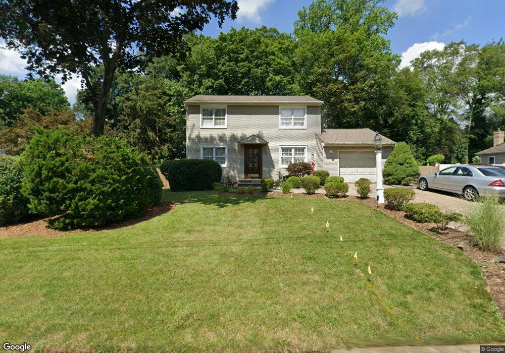
49 Lois Dr Pearl River, NY 10965
Estimated Value: $743,000 - $773,371
4
Beds
3
Baths
1,862
Sq Ft
$407/Sq Ft
Est. Value
About This Home
This home is located at 49 Lois Dr, Pearl River, NY 10965 and is currently estimated at $757,843, approximately $407 per square foot. 49 Lois Dr is a home located in Rockland County with nearby schools including Pearl River High School and St Margaret School.
Create a Home Valuation Report for This Property
The Home Valuation Report is an in-depth analysis detailing your home's value as well as a comparison with similar homes in the area
Home Values in the Area
Average Home Value in this Area
Tax History
| Year | Tax Paid | Tax Assessment Tax Assessment Total Assessment is a certain percentage of the fair market value that is determined by local assessors to be the total taxable value of land and additions on the property. | Land | Improvement |
|---|---|---|---|---|
| 2024 | $15,699 | $213,000 | $48,600 | $164,400 |
| 2023 | $15,699 | $213,000 | $48,600 | $164,400 |
| 2022 | $4,550 | $213,000 | $48,600 | $164,400 |
| 2021 | $14,266 | $213,000 | $48,600 | $164,400 |
| 2020 | $11,130 | $213,000 | $48,600 | $164,400 |
| 2019 | $4,234 | $213,000 | $48,600 | $164,400 |
| 2018 | $10,407 | $213,000 | $48,600 | $164,400 |
| 2017 | $10,412 | $213,000 | $48,600 | $164,400 |
| 2016 | $10,077 | $213,000 | $48,600 | $164,400 |
| 2015 | -- | $213,000 | $48,600 | $164,400 |
| 2014 | -- | $213,000 | $48,600 | $164,400 |
Source: Public Records
Map
Nearby Homes
- 34 Mountainview Ave
- 60 Old Middletown Rd
- 210 Rockland Rd
- 1 Alexa Ct
- 90 S Middletown Rd
- 352 Holt Dr
- 258 Holt Dr
- 148 E Washington Ave
- 54 Meyer Oval
- 54 Douglas Ct
- 124 Braunsdorf Rd
- 7 Staubitz Ave
- 33 Marion Place
- 77 Hunt Ave
- 146-148 Ridge St
- 225 N Middletown Rd Unit J
- 7 St Andrews Cir
- 31 St Andrews Cir
- 717 Orange Ct
- 166 E Crooked Hill Rd Unit 166
Your Personal Tour Guide
Ask me questions while you tour the home.