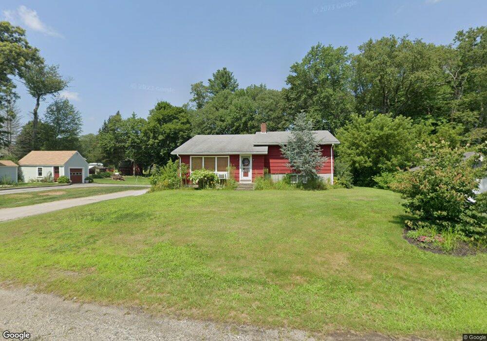
49 Main St Sutton, MA 01590
Estimated Value: $411,247 - $492,000
3
Beds
3
Baths
1,238
Sq Ft
$357/Sq Ft
Est. Value
About This Home
This home is located at 49 Main St, Sutton, MA 01590 and is currently estimated at $442,562, approximately $357 per square foot. 49 Main St is a home located in Worcester County with nearby schools including Sutton Elementary School, Sutton Middle School, and Sutton High School.
Create a Home Valuation Report for This Property
The Home Valuation Report is an in-depth analysis detailing your home's value as well as a comparison with similar homes in the area
Home Values in the Area
Average Home Value in this Area
Tax History
| Year | Tax Paid | Tax Assessment Tax Assessment Total Assessment is a certain percentage of the fair market value that is determined by local assessors to be the total taxable value of land and additions on the property. | Land | Improvement |
|---|---|---|---|---|
| 2025 | $5,275 | $396,600 | $146,300 | $250,300 |
| 2024 | $5,290 | $382,800 | $140,000 | $242,800 |
| 2023 | $4,981 | $330,500 | $126,500 | $204,000 |
| 2022 | $5,046 | $304,700 | $101,200 | $203,500 |
| 2021 | $4,751 | $260,100 | $101,200 | $158,900 |
| 2020 | $7,314 | $254,000 | $101,200 | $152,800 |
| 2019 | $4,111 | $232,900 | $97,300 | $135,600 |
| 2018 | $7,316 | $210,600 | $82,700 | $127,900 |
| 2017 | $7,127 | $202,500 | $71,500 | $131,000 |
| 2016 | $3,548 | $197,900 | $71,500 | $126,400 |
| 2015 | $3,445 | $191,800 | $71,500 | $120,300 |
| 2014 | $3,232 | $177,600 | $69,400 | $108,200 |
Source: Public Records
Map
Nearby Homes
- 108 Mumford St
- 4 1st St
- 36 Compass Point Dr Unit 36
- 19 Birch St
- 26 Compass Point Dr Unit 26
- 33 Nautical Way Unit 107
- 8 Hough Rd
- 22 Gilboa St
- 5 B St
- 80 Barnett Rd
- 408 NE Main St
- 2 White Ct
- 266 Putnam Hill Rd
- 8 Wallis St
- 18 Lakeshore Dr
- 3 S East Main St
- 198 Uxbridge Rd
- 28 Johnson Rd
- 201 Prescott Rd
- Lot 27 Cedar St
Your Personal Tour Guide
Ask me questions while you tour the home.