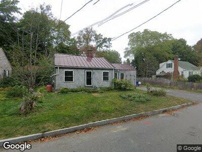
49 Mayland St Portland, ME 04103
Back Cove NeighborhoodEstimated Value: $454,473 - $499,000
2
Beds
1
Bath
1,192
Sq Ft
$399/Sq Ft
Est. Value
About This Home
This home is located at 49 Mayland St, Portland, ME 04103 and is currently estimated at $476,118, approximately $399 per square foot. 49 Mayland St is a home located in Cumberland County with nearby schools including Ocean Avenue Elementary School, Lyman Moore Middle School, and Baxter Academy for Tech & Sciences.
Ownership History
Date
Name
Owned For
Owner Type
Purchase Details
Closed on
Nov 17, 2023
Sold by
Richards Sarah and Opportunity Richards
Bought by
Hildreth Frances D and Hildreth Frances D
Current Estimated Value
Purchase Details
Closed on
Oct 11, 2019
Sold by
Richards Sarah
Bought by
Opportunity T T and Opportunity Richards
Create a Home Valuation Report for This Property
The Home Valuation Report is an in-depth analysis detailing your home's value as well as a comparison with similar homes in the area
Home Values in the Area
Average Home Value in this Area
Purchase History
| Date | Buyer | Sale Price | Title Company |
|---|---|---|---|
| Hildreth Frances D | -- | None Available | |
| Hildreth Frances D | -- | None Available | |
| Richards Sarah | -- | None Available | |
| Opportunity T T | -- | -- | |
| Opportunity T T | -- | -- |
Source: Public Records
Mortgage History
| Date | Status | Borrower | Loan Amount |
|---|---|---|---|
| Previous Owner | Richards Sarah | $20,000 | |
| Previous Owner | Richards Sarah | $22,800 |
Source: Public Records
Tax History Compared to Growth
Tax History
| Year | Tax Paid | Tax Assessment Tax Assessment Total Assessment is a certain percentage of the fair market value that is determined by local assessors to be the total taxable value of land and additions on the property. | Land | Improvement |
|---|---|---|---|---|
| 2024 | $4,541 | $302,500 | $62,000 | $240,500 |
| 2023 | $4,359 | $302,500 | $62,000 | $240,500 |
| 2022 | $4,117 | $302,500 | $62,000 | $240,500 |
| 2021 | $3,929 | $302,500 | $62,000 | $240,500 |
| 2020 | $3,387 | $145,300 | $62,000 | $83,300 |
| 2019 | $3,387 | $145,300 | $62,000 | $83,300 |
| 2018 | $2,739 | $145,300 | $62,000 | $83,300 |
| 2017 | $3,146 | $145,300 | $62,000 | $83,300 |
| 2016 | $3,067 | $145,300 | $62,000 | $83,300 |
| 2015 | $2,998 | $145,300 | $62,000 | $83,300 |
| 2014 | $2,906 | $145,300 | $62,000 | $83,300 |
Source: Public Records
Map
Nearby Homes
- 774 Forest Ave
- 31 Mackworth St
- 9 Derby Rd
- 194 Walton St
- 14 Codman St
- 29 Chenery St
- 90 Wellington Rd
- 43 Hersey St
- 25 Nevens St Unit 1
- 130 Hartley St
- 72 Bay St
- 121 Bay Street Extension Unit 4
- 147 Pleasant Ave Unit 1
- 75 Mcauley Way Unit 307
- 75 Mcauley Way Unit 506
- 75 Mcauley Way Unit 203
- 75 Mcauley Way Unit 504
- 75 Mcauley Way Unit 502
- 75 Mcauley Way Unit 403
- 75 Mcauley Way Unit 301