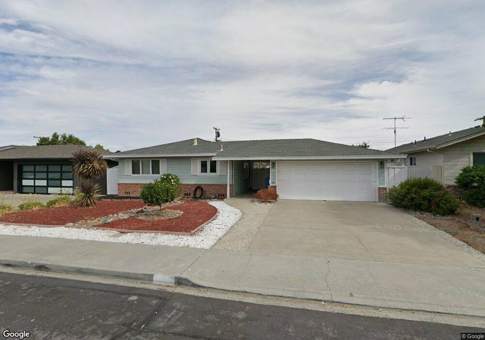
49 Michael Way Santa Clara, CA 95051
Pruneridge NeighborhoodEstimated Value: $2,378,203 - $2,690,000
3
Beds
2
Baths
1,274
Sq Ft
$2,044/Sq Ft
Est. Value
About This Home
This home is located at 49 Michael Way, Santa Clara, CA 95051 and is currently estimated at $2,603,551, approximately $2,043 per square foot. 49 Michael Way is a home located in Santa Clara County with nearby schools including Dwight D. Eisenhower Elementary School, Warren E. Hyde Middle School, and Cupertino High School.
Ownership History
Date
Name
Owned For
Owner Type
Purchase Details
Closed on
Jun 28, 2024
Sold by
Kern John M
Bought by
John M Kern Family Trust and Kern
Current Estimated Value
Purchase Details
Closed on
Oct 16, 2023
Sold by
John And April Kern Family Trust
Bought by
Kern John M
Purchase Details
Closed on
Jul 22, 2009
Sold by
Kern John M
Bought by
Kern John M and Kern April L
Create a Home Valuation Report for This Property
The Home Valuation Report is an in-depth analysis detailing your home's value as well as a comparison with similar homes in the area
Home Values in the Area
Average Home Value in this Area
Purchase History
| Date | Buyer | Sale Price | Title Company |
|---|---|---|---|
| John M Kern Family Trust | -- | None Listed On Document | |
| Kern John M | -- | None Listed On Document | |
| Kern John M | -- | None Available |
Source: Public Records
Tax History Compared to Growth
Tax History
| Year | Tax Paid | Tax Assessment Tax Assessment Total Assessment is a certain percentage of the fair market value that is determined by local assessors to be the total taxable value of land and additions on the property. | Land | Improvement |
|---|---|---|---|---|
| 2025 | $6,783 | $579,504 | $439,699 | $139,805 |
| 2024 | $6,783 | $568,142 | $431,078 | $137,064 |
| 2023 | $6,733 | $557,003 | $422,626 | $134,377 |
| 2022 | $6,848 | $546,083 | $414,340 | $131,743 |
| 2021 | $6,784 | $535,376 | $406,216 | $129,160 |
| 2020 | $6,709 | $529,887 | $402,051 | $127,836 |
| 2019 | $6,568 | $519,498 | $394,168 | $125,330 |
| 2018 | $6,422 | $509,313 | $386,440 | $122,873 |
| 2017 | $6,397 | $499,327 | $378,863 | $120,464 |
| 2016 | $6,202 | $489,537 | $371,435 | $118,102 |
| 2015 | $6,168 | $482,184 | $365,856 | $116,328 |
| 2014 | $6,003 | $472,740 | $358,690 | $114,050 |
Source: Public Records
Map
Nearby Homes
- 4691 Albany Cir Unit 116
- 4685 Albany Cir Unit 151
- 4815 Capistrano Ave
- 4661 Albany Cir Unit 121
- 4733 Lago Vista Cir
- 5011 Lapa Dr
- 380 Richfield Dr
- 477 Greendale Way
- 410 Auburn Way Unit 42
- 494 Greendale Way
- 380 Auburn Way Unit 10
- 380 Auburn Way Unit 6
- 4792 Raspberry Place
- 490 Auburn Way Unit 14
- 3517 Oxford Dr
- 18630 Crabtree Ave
- 2831 Malabar Ave
- 4626 Moorpark Ave
- 3457 Forbes Ave
- 740 Cornell Dr