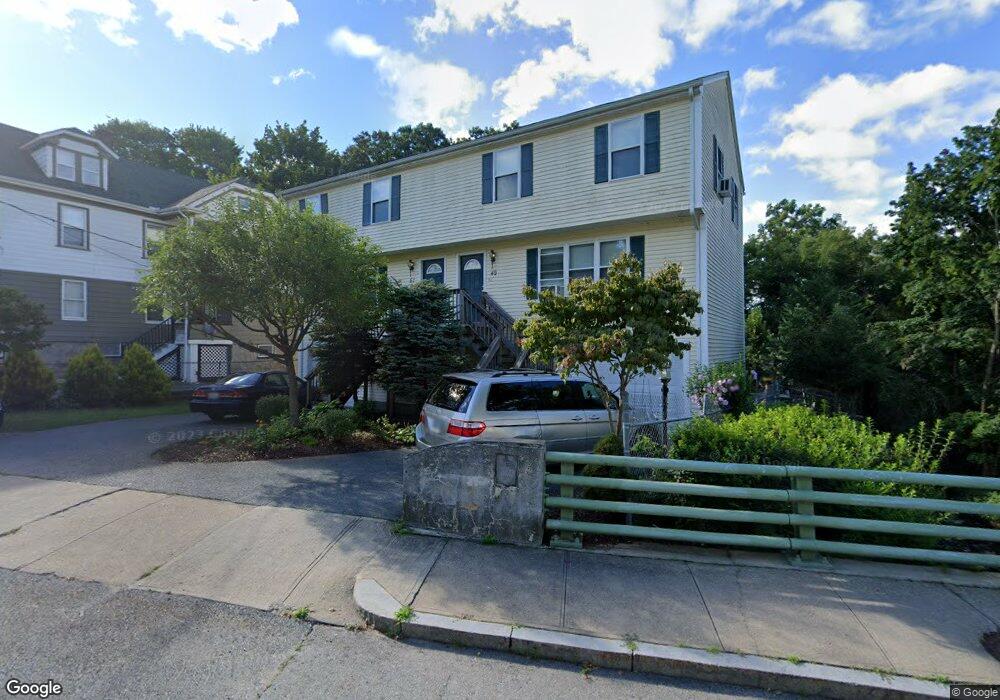
49 Mill St Woonsocket, RI 02895
East Woonsocket NeighborhoodEstimated Value: $277,000 - $321,000
3
Beds
2
Baths
1,296
Sq Ft
$236/Sq Ft
Est. Value
About This Home
This home is located at 49 Mill St, Woonsocket, RI 02895 and is currently estimated at $305,475, approximately $235 per square foot. 49 Mill St is a home located in Providence County with nearby schools including Woonsocket High School, Rise Prep Mayoral Academy Middle School, and Rise Prep Mayoral Academy.
Ownership History
Date
Name
Owned For
Owner Type
Purchase Details
Closed on
Jul 16, 2024
Sold by
Bui Hung V
Bought by
Bui Hung T
Current Estimated Value
Purchase Details
Closed on
Aug 12, 2022
Sold by
Bui Hung V and Bui Hoa T
Bought by
Rlb Realty Llc
Purchase Details
Closed on
Sep 5, 2008
Sold by
Stlouis Michael W and Stlouis Shannon
Bought by
Bui Hung V
Home Financials for this Owner
Home Financials are based on the most recent Mortgage that was taken out on this home.
Original Mortgage
$104,000
Interest Rate
5.8%
Mortgage Type
Adjustable Rate Mortgage/ARM
Purchase Details
Closed on
Jul 19, 2005
Sold by
Decore Raymond G
Bought by
Stlouis Michael W and Stlouis Shannon
Home Financials for this Owner
Home Financials are based on the most recent Mortgage that was taken out on this home.
Original Mortgage
$210,612
Interest Rate
5.67%
Mortgage Type
Purchase Money Mortgage
Create a Home Valuation Report for This Property
The Home Valuation Report is an in-depth analysis detailing your home's value as well as a comparison with similar homes in the area
Home Values in the Area
Average Home Value in this Area
Purchase History
| Date | Buyer | Sale Price | Title Company |
|---|---|---|---|
| Bui Hung T | -- | None Available | |
| Bui Hung T | -- | None Available | |
| Rlb Realty Llc | $3,200 | None Available | |
| Bui Hung V | $160,000 | -- | |
| Bui Hung V | $160,000 | -- | |
| Stlouis Michael W | $208,000 | -- | |
| Stlouis Michael W | $208,000 | -- |
Source: Public Records
Mortgage History
| Date | Status | Borrower | Loan Amount |
|---|---|---|---|
| Previous Owner | Stlouis Michael W | $47,000 | |
| Previous Owner | Stlouis Michael W | $104,000 | |
| Previous Owner | Stlouis Michael W | $210,612 |
Source: Public Records
Tax History
| Year | Tax Paid | Tax Assessment Tax Assessment Total Assessment is a certain percentage of the fair market value that is determined by local assessors to be the total taxable value of land and additions on the property. | Land | Improvement |
|---|---|---|---|---|
| 2025 | $3,060 | $272,500 | $0 | $272,500 |
| 2024 | $2,917 | $200,600 | $0 | $200,600 |
| 2023 | $2,804 | $200,600 | $0 | $200,600 |
| 2022 | $2,804 | $200,600 | $0 | $200,600 |
| 2021 | $3,707 | $156,100 | $0 | $156,100 |
| 2020 | $3,746 | $156,100 | $0 | $156,100 |
| 2018 | $3,759 | $156,100 | $0 | $156,100 |
| 2017 | $2,712 | $90,100 | $0 | $90,100 |
| 2016 | $2,869 | $90,100 | $0 | $90,100 |
| 2015 | $3,296 | $90,100 | $0 | $90,100 |
| 2014 | $3,713 | $103,300 | $0 | $103,300 |
Source: Public Records
Map
Nearby Homes
- 752 Social St
- 88 Mill St Unit 304
- 96 Mill St Unit 303
- 685 Social St Unit 211
- 685 Social St Unit 115
- 142 Brook St
- 60 Rathbun St
- 42 Elbow St
- 263 Elm St
- 271 Elm St
- 13 Ethel St
- 311 Elm St
- 256 Privilege St
- 56 Mailloux St
- 568 Elm St
- 34 Heroux Ave
- 110 Saint Leon Ave
- 25 Lakeview St
- Lot 2 Pulaski Blvd
- 23 Rutland St
- 51 Mill St
- 65 Mill St Unit 2
- 65 Mill St Unit 1
- 63 Mill St
- 73 Mill St
- 26 Mill St
- 801 Social St
- 855 Social St
- 837 Social St
- 821 Social St
- 78 Mill St Unit 301
- 78 Mill St Unit 104
- 78 Mill St Unit 303
- 78 Mill St Unit 201
- 78 Mill St Unit 204
- 78 Mill St Unit 101
- 78 Mill St Unit 302
- 78 Mill St Unit 304
- 78 Mill St Unit 203
- 78 Mill St Unit 103
Your Personal Tour Guide
Ask me questions while you tour the home.