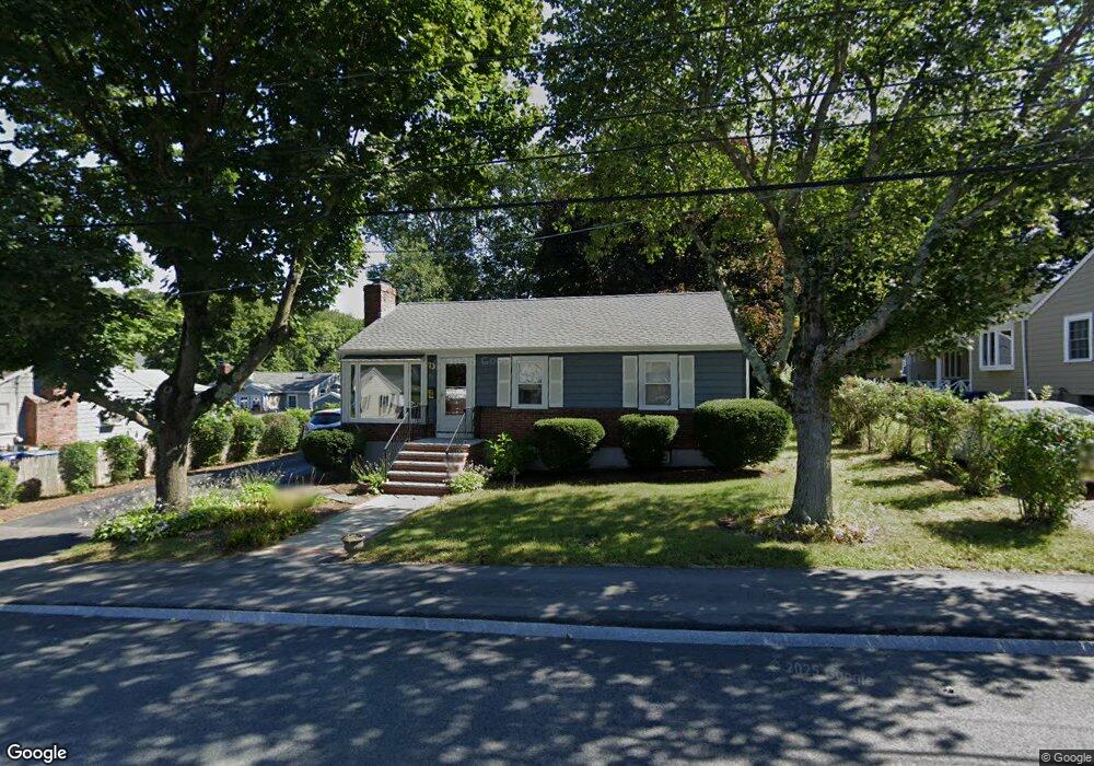
49 Paul St Braintree, MA 02184
Braintree Highlands NeighborhoodEstimated Value: $679,000 - $821,000
3
Beds
2
Baths
1,656
Sq Ft
$439/Sq Ft
Est. Value
About This Home
This home is located at 49 Paul St, Braintree, MA 02184 and is currently estimated at $726,295, approximately $438 per square foot. 49 Paul St is a home located in Norfolk County with nearby schools including Boston Higashi School, Lighthouse Baptist Christian Academy, and CATS Academy Boston.
Ownership History
Date
Name
Owned For
Owner Type
Purchase Details
Closed on
Nov 19, 1986
Bought by
Campbell Thomas M and Campbell Maggie H
Current Estimated Value
Create a Home Valuation Report for This Property
The Home Valuation Report is an in-depth analysis detailing your home's value as well as a comparison with similar homes in the area
Home Values in the Area
Average Home Value in this Area
Purchase History
| Date | Buyer | Sale Price | Title Company |
|---|---|---|---|
| Campbell Thomas M | $90,500 | -- |
Source: Public Records
Mortgage History
| Date | Status | Borrower | Loan Amount |
|---|---|---|---|
| Open | Campbell Thomas M | $55,000 | |
| Closed | Campbell Thomas M | $25,000 | |
| Closed | Campbell Thomas M | $70,000 | |
| Closed | Campbell Thomas M | $28,000 |
Source: Public Records
Tax History Compared to Growth
Tax History
| Year | Tax Paid | Tax Assessment Tax Assessment Total Assessment is a certain percentage of the fair market value that is determined by local assessors to be the total taxable value of land and additions on the property. | Land | Improvement |
|---|---|---|---|---|
| 2025 | $5,847 | $585,900 | $348,000 | $237,900 |
| 2024 | $5,223 | $551,000 | $316,000 | $235,000 |
| 2023 | $4,929 | $505,000 | $283,900 | $221,100 |
| 2022 | $4,752 | $477,600 | $256,500 | $221,100 |
| 2021 | $4,367 | $438,900 | $231,700 | $207,200 |
| 2020 | $4,120 | $417,900 | $210,700 | $207,200 |
| 2019 | $3,884 | $384,900 | $201,500 | $183,400 |
| 2018 | $3,791 | $359,700 | $183,200 | $176,500 |
| 2017 | $3,764 | $350,500 | $174,000 | $176,500 |
| 2016 | $3,702 | $337,200 | $164,900 | $172,300 |
| 2015 | $3,428 | $309,700 | $137,400 | $172,300 |
| 2014 | $3,219 | $281,900 | $131,900 | $150,000 |
Source: Public Records
Map
Nearby Homes
- 104 Milton Rd
- 6 E Division St
- 1501 Liberty St
- 373 N Franklin St
- 16 Woodcliff Rd
- 61 Woodside Ave
- 116 Cardinal Ct
- 16 Winthrop Ave
- 187 Belcher St
- 44 Arlington Ave
- 1579 Washington St
- 184 Richard Rd
- 148 N Franklin St
- 115 Richard Rd
- 5 Clarendon Cir Unit Lot 4
- 30 Bradford Commons Ln
- 117 Amherst Rd
- 256 Evergreen Ave
- 27 Winter St
- 134 Tyson Commons Ln