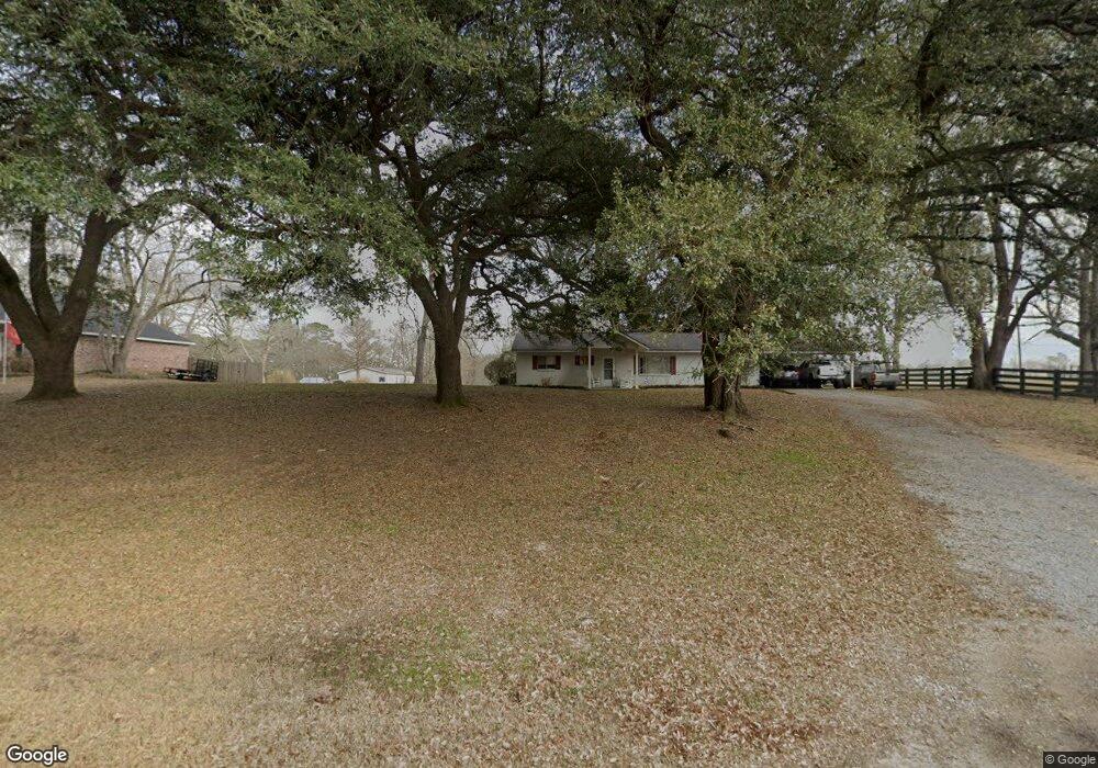
49 Peanut Sumrall Rd Laurel, MS 39443
Estimated Value: $111,000 - $196,000
Studio
--
Bath
1,378
Sq Ft
$113/Sq Ft
Est. Value
About This Home
This home is located at 49 Peanut Sumrall Rd, Laurel, MS 39443 and is currently estimated at $156,005, approximately $113 per square foot. 49 Peanut Sumrall Rd is a home located in Jones County.
Ownership History
Date
Name
Owned For
Owner Type
Purchase Details
Closed on
Oct 30, 2015
Bought by
Nichols Samuel L
Current Estimated Value
Home Financials for this Owner
Home Financials are based on the most recent Mortgage that was taken out on this home.
Original Mortgage
$80,205
Outstanding Balance
$62,953
Interest Rate
3.89%
Mortgage Type
New Conventional
Estimated Equity
$93,052
Purchase Details
Closed on
Jul 24, 2012
Sold by
Burkes Robert E and Burkes Robert Earl
Bought by
Johnson Wanda C
Home Financials for this Owner
Home Financials are based on the most recent Mortgage that was taken out on this home.
Original Mortgage
$61,750
Interest Rate
3.68%
Mortgage Type
New Conventional
Create a Home Valuation Report for This Property
The Home Valuation Report is an in-depth analysis detailing your home's value as well as a comparison with similar homes in the area
Purchase History
| Date | Buyer | Sale Price | Title Company |
|---|---|---|---|
| Nichols Samuel L | -- | -- | |
| Johnson Wanda C | -- | -- |
Source: Public Records
Mortgage History
| Date | Status | Borrower | Loan Amount |
|---|---|---|---|
| Open | Nichols Samuel L | $80,205 | |
| Previous Owner | Johnson Wanda C | $61,750 |
Source: Public Records
Tax History
| Year | Tax Paid | Tax Assessment Tax Assessment Total Assessment is a certain percentage of the fair market value that is determined by local assessors to be the total taxable value of land and additions on the property. | Land | Improvement |
|---|---|---|---|---|
| 2025 | $479 | $6,021 | $0 | $0 |
| 2024 | $482 | $5,607 | $0 | $0 |
| 2023 | $482 | $5,607 | $0 | $0 |
| 2022 | $498 | $5,607 | $0 | $0 |
| 2021 | $501 | $5,607 | $0 | $0 |
| 2020 | $508 | $5,522 | $0 | $0 |
| 2019 | $511 | $5,522 | $0 | $0 |
| 2018 | $511 | $5,522 | $0 | $0 |
| 2017 | $510 | $5,522 | $0 | $0 |
| 2016 | $444 | $5,002 | $0 | $0 |
| 2015 | -- | $5,002 | $0 | $0 |
| 2014 | -- | $4,945 | $0 | $0 |
Source: Public Records
Map
Nearby Homes
- 422 Maxey Rd
- 84 Maxey Rd
- 0 Maxey Rd
- 0 Cactus Dr
- 309 Lebanon Rd
- 96 Hines Rd
- 215 Grafton Rd
- 00 Bear Pen Creek Rd
- 78 Tim Holifield Rd
- 56 Lakeshore Dr
- 5 Lakeshore Dr
- 372 Jessie's Ln
- 31 Leonard Holloway Rd
- 5 Westerly Dr
- 7 & 9 Amyden Ct
- 77 Joshbury Cir
- 13 Joshbury Cir
- Lot 806 Joshbury Cir
- Lot 805 Joshbury Cir
- 18 Joshbury Cir
- 43 Peanut Sumrall Rd
- 4 Oak Tree Dr
- 54 Peanut Sumrall Rd
- 12 Oak Tree Dr
- 56 McAndrews Dr
- 29 Peanut Sumrall Rd
- 24 Oak Tree Dr
- 15 Oak Tree Dr
- 44 McAndrews Ln
- 66 Peanut Sumrall Rd
- 72 Peanut Sumrall Rd
- 32 Oak Tree Dr Unit 32A
- 21 Peanut Sumrall Rd
- 25 Oak Tree Dr
- 18 Peanut Sumrall Rd
- 0 McAndrews Ln
- 41 McAndrews Dr
- 9 McAndrews Dr
- 11 Peanut Sumrall Rd
- 44 McAndrews Rd
Your Personal Tour Guide
Ask me questions while you tour the home.