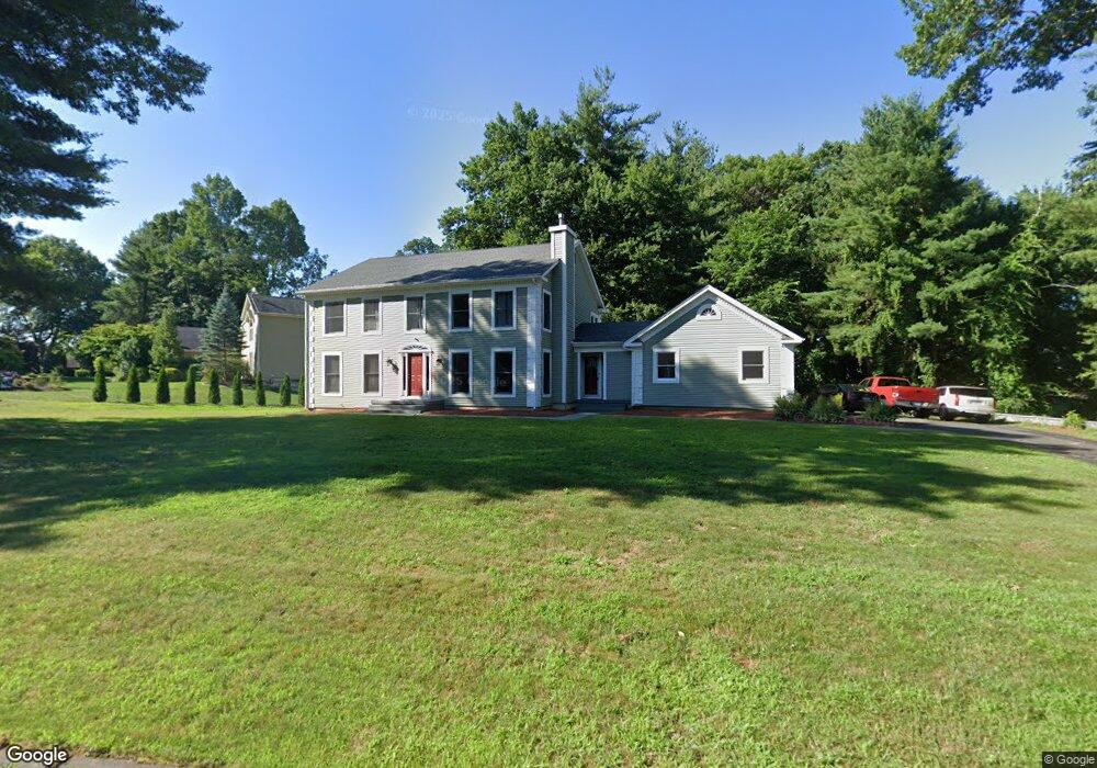
49 Pierce Blvd Windsor, CT 06095
West Windsor NeighborhoodEstimated Value: $626,756 - $669,000
4
Beds
3
Baths
3,272
Sq Ft
$196/Sq Ft
Est. Value
About This Home
This home is located at 49 Pierce Blvd, Windsor, CT 06095 and is currently estimated at $641,439, approximately $196 per square foot. 49 Pierce Blvd is a home located in Hartford County with nearby schools including Oliver Ellsworth School, John F. Kennedy School, and Sage Park Middle School.
Ownership History
Date
Name
Owned For
Owner Type
Purchase Details
Closed on
Mar 7, 2008
Sold by
Gutcheon Harvey and Gutcheon Deborah
Bought by
Hudson Gregory and Hudson Varessa
Current Estimated Value
Home Financials for this Owner
Home Financials are based on the most recent Mortgage that was taken out on this home.
Original Mortgage
$388,550
Interest Rate
5.57%
Mortgage Type
Purchase Money Mortgage
Purchase Details
Closed on
May 28, 1999
Bought by
Gutchleon Harvey and Gutchleon Deborah
Purchase Details
Closed on
Apr 29, 1991
Sold by
Lambert Jack and Lambert Ann
Purchase Details
Closed on
Oct 12, 1988
Sold by
Derekseth Corp
Bought by
Lambert Jack
Create a Home Valuation Report for This Property
The Home Valuation Report is an in-depth analysis detailing your home's value as well as a comparison with similar homes in the area
Home Values in the Area
Average Home Value in this Area
Purchase History
| Date | Buyer | Sale Price | Title Company |
|---|---|---|---|
| Hudson Gregory | $409,900 | -- | |
| Gutchleon Harvey | $297,500 | -- | |
| -- | $302,500 | -- | |
| Lambert Jack | $372,639 | -- |
Source: Public Records
Mortgage History
| Date | Status | Borrower | Loan Amount |
|---|---|---|---|
| Open | Lambert Jack | $374,308 | |
| Closed | Lambert Jack | $383,926 | |
| Closed | Lambert Jack | $388,550 |
Source: Public Records
Tax History
| Year | Tax Paid | Tax Assessment Tax Assessment Total Assessment is a certain percentage of the fair market value that is determined by local assessors to be the total taxable value of land and additions on the property. | Land | Improvement |
|---|---|---|---|---|
| 2025 | $10,523 | $369,880 | $73,290 | $296,590 |
| 2024 | $11,215 | $369,880 | $73,290 | $296,590 |
| 2023 | $8,385 | $249,550 | $58,030 | $191,520 |
| 2022 | $8,303 | $249,550 | $58,030 | $191,520 |
| 2021 | $8,303 | $249,550 | $58,030 | $191,520 |
| 2020 | $8,263 | $249,550 | $58,030 | $191,520 |
| 2019 | $8,080 | $249,550 | $58,030 | $191,520 |
| 2018 | $7,881 | $239,120 | $58,030 | $181,090 |
| 2017 | $7,759 | $239,120 | $58,030 | $181,090 |
| 2016 | $7,537 | $239,120 | $58,030 | $181,090 |
| 2015 | $7,394 | $239,120 | $58,030 | $181,090 |
| 2014 | $7,286 | $239,120 | $58,030 | $181,090 |
Source: Public Records
Map
Nearby Homes
- 24 Mary Catherine Cir
- 1 Deanne Lynn Cir
- 10 Cleary Ln
- 22 Eastview Dr
- 490 Old Day Hill Rd
- 22 Apple Tree Ln
- 9 Milo Peck Ln
- 16 Cornfield Rd
- 109 Old Village Cir
- 136 High Path Rd
- 118 High Path Rd Unit 118
- 98 High Path Rd
- 268 High Path Rd Unit 268
- 58 High Path Rd Unit 58
- 943 High Path Rd Unit 943
- 1946 Poquonock Ave
- 16 Hilltop Rd
- 25 High St
- 105 Trent Dr
- 823 Stone Rd
Your Personal Tour Guide
Ask me questions while you tour the home.