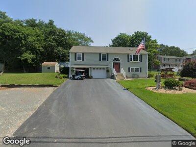
49 Riverside Dr Berkley, MA 02779
Camp Merriwood/Camp Welch NeighborhoodEstimated Value: $535,000 - $701,000
3
Beds
2
Baths
1,456
Sq Ft
$413/Sq Ft
Est. Value
About This Home
This home is located at 49 Riverside Dr, Berkley, MA 02779 and is currently estimated at $601,193, approximately $412 per square foot. 49 Riverside Dr is a home located in Bristol County with nearby schools including Berkley Community School.
Ownership History
Date
Name
Owned For
Owner Type
Purchase Details
Closed on
Nov 10, 2021
Sold by
Robert Ronald L and Robert Joan M
Bought by
Robert Ft
Current Estimated Value
Purchase Details
Closed on
May 20, 2004
Sold by
Chartier Lucille Y
Bought by
Robert Joan M and Robert Roland L
Create a Home Valuation Report for This Property
The Home Valuation Report is an in-depth analysis detailing your home's value as well as a comparison with similar homes in the area
Home Values in the Area
Average Home Value in this Area
Purchase History
| Date | Buyer | Sale Price | Title Company |
|---|---|---|---|
| Robert Ft | -- | None Available | |
| Robert Joan M | $120,000 | -- |
Source: Public Records
Mortgage History
| Date | Status | Borrower | Loan Amount |
|---|---|---|---|
| Previous Owner | Robert Joan M | $40,000 | |
| Previous Owner | Robert Roland L | $110,000 | |
| Previous Owner | Robert Roland L | $75,000 | |
| Previous Owner | Robert Joan M | $118,000 |
Source: Public Records
Tax History Compared to Growth
Tax History
| Year | Tax Paid | Tax Assessment Tax Assessment Total Assessment is a certain percentage of the fair market value that is determined by local assessors to be the total taxable value of land and additions on the property. | Land | Improvement |
|---|---|---|---|---|
| 2025 | $58 | $486,800 | $99,500 | $387,300 |
| 2024 | $6,369 | $511,600 | $141,800 | $369,800 |
| 2023 | $5,708 | $431,800 | $112,400 | $319,400 |
| 2022 | $5,757 | $418,700 | $110,200 | $308,500 |
| 2021 | $5,596 | $391,900 | $105,000 | $286,900 |
| 2020 | $5,417 | $372,800 | $93,000 | $279,800 |
| 2019 | $5,276 | $360,400 | $94,900 | $265,500 |
| 2018 | $4,837 | $345,000 | $94,900 | $250,100 |
| 2017 | $4,566 | $319,300 | $97,600 | $221,700 |
| 2016 | $4,391 | $295,900 | $97,600 | $198,300 |
| 2015 | $4,127 | $296,700 | $98,200 | $198,500 |
| 2014 | $3,907 | $305,000 | $106,500 | $198,500 |
Source: Public Records
Map
Nearby Homes
- 49 Riverside Dr
- 2 Shore Rd
- 46 Riverside Drive (Waterfront)
- 47 Riverside Dr
- 55 Riverside Dr
- Lot 000 Ridge St
- Lot 00 Ridge St
- 21 Shore Rd
- 2 Ridge Rd
- 16 Broadview Ave
- 0 Ridge Rd Unit 72342616
- 0 Ridge Rd Unit 72202332
- 56 Riverside Dr
- Lot 0000 Ridge St
- 50 Riverside Dr
- 4 Ridge St Unit 1
- 4 Ridge St
- 24 Riverside Dr
- 14 Broadview Ave
- 46 Riverside Dr (Waterfront)