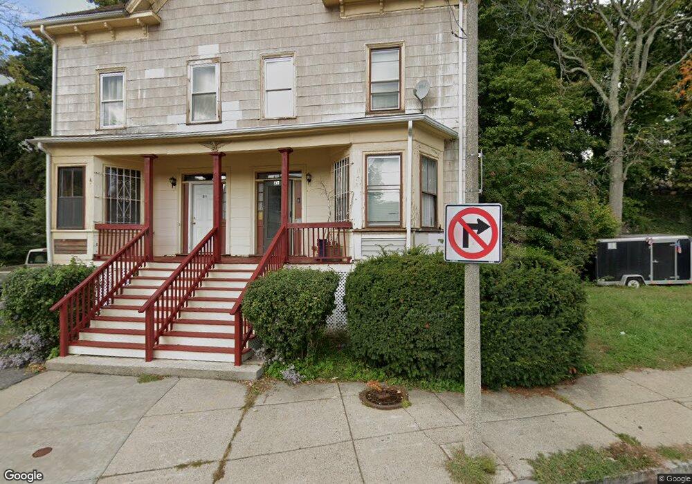
49 Rockland St Unit 51 Roxbury, MA 02119
Washington Park NeighborhoodEstimated Value: $984,000 - $1,082,000
5
Beds
3
Baths
3,744
Sq Ft
$281/Sq Ft
Est. Value
About This Home
This home is located at 49 Rockland St Unit 51, Roxbury, MA 02119 and is currently estimated at $1,051,884, approximately $280 per square foot. 49 Rockland St Unit 51 is a home located in Suffolk County with nearby schools including Bridge Boston Charter School and City on a Hill Charter Public School.
Ownership History
Date
Name
Owned For
Owner Type
Purchase Details
Closed on
Aug 30, 2023
Sold by
Omard Carolyn S
Bought by
Rockland St Brooks Llc
Current Estimated Value
Purchase Details
Closed on
Jan 5, 2012
Sold by
Wilson Shelton B
Bought by
Wilson Shelton B and Long Omard C
Create a Home Valuation Report for This Property
The Home Valuation Report is an in-depth analysis detailing your home's value as well as a comparison with similar homes in the area
Home Values in the Area
Average Home Value in this Area
Purchase History
| Date | Buyer | Sale Price | Title Company |
|---|---|---|---|
| Rockland St Brooks Llc | -- | None Available | |
| Wilson Shelton B | -- | -- |
Source: Public Records
Mortgage History
| Date | Status | Borrower | Loan Amount |
|---|---|---|---|
| Previous Owner | Wilson Shelton B | $10,603 | |
| Previous Owner | Wilson Shelton B | $20,000 |
Source: Public Records
Tax History Compared to Growth
Tax History
| Year | Tax Paid | Tax Assessment Tax Assessment Total Assessment is a certain percentage of the fair market value that is determined by local assessors to be the total taxable value of land and additions on the property. | Land | Improvement |
|---|---|---|---|---|
| 2025 | $9,919 | $856,600 | $340,600 | $516,000 |
| 2024 | $8,986 | $824,400 | $242,800 | $581,600 |
| 2023 | $8,431 | $785,000 | $231,200 | $553,800 |
| 2022 | $7,764 | $713,600 | $210,100 | $503,500 |
| 2021 | $7,116 | $666,900 | $196,400 | $470,500 |
| 2020 | $5,330 | $504,700 | $195,000 | $309,700 |
| 2019 | $4,969 | $471,400 | $148,200 | $323,200 |
| 2018 | $4,619 | $440,700 | $148,200 | $292,500 |
| 2017 | $4,445 | $419,700 | $148,200 | $271,500 |
| 2016 | $4,122 | $374,700 | $148,200 | $226,500 |
| 2015 | $2,402 | $198,360 | $85,320 | $113,040 |
| 2014 | $2,245 | $178,470 | $85,320 | $93,150 |
Source: Public Records
Map
Nearby Homes
- 94 Walnut Ave
- 37 Regent St Unit 2
- 9 W Cedar St Unit 1
- 10 Rockland St Unit 4
- 38 Juniper St
- 22 Rockville Park
- 20 Rockville Park
- 51 Saint James St
- 30 Copeland St Unit 1
- 16 Mayfair St
- 90 Munroe St
- 7 Langford Park Unit 3
- 33 Copeland Park Unit C
- 59 Perrin St
- 59 Perrin St Unit 1
- 31 Dorr St
- 8 Brinton St Unit 2
- 2856 Washington St
- 9-45 Vale St
- 49 Norfolk St
- 51 Rockland St Unit 1
- 34 Circuit St Unit B
- 34 Circuit St
- 34 Circuit St Unit 2
- 34 Circuit St Unit 3
- 34 Circuit St Unit 1
- 30 Circuit St
- 30 Circuit St Unit 2
- 30 Circuit St Unit Circuit St
- 30 Circuit St
- 30 Circuit St Unit 3
- 30 Circuit St Unit 1
- 32 Circuit St
- 32 Circuit St Unit 3
- 28 Circuit St
- 1 Circuit Square
- 39 Rockland St Unit 41
- 35 Wakullah St
- 2 Circuit Square
- 4 Wakullah St Unit 2