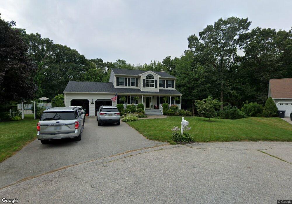
49 Rocky Crest Rd Cumberland, RI 02864
Cumberland Hill NeighborhoodEstimated Value: $651,000 - $804,000
3
Beds
3
Baths
2,196
Sq Ft
$329/Sq Ft
Est. Value
About This Home
This home is located at 49 Rocky Crest Rd, Cumberland, RI 02864 and is currently estimated at $722,951, approximately $329 per square foot. 49 Rocky Crest Rd is a home located in Providence County with nearby schools including Ashton Elementary School, North Cumberland Middle School, and Cumberland High School.
Ownership History
Date
Name
Owned For
Owner Type
Purchase Details
Closed on
May 24, 1996
Sold by
F Paolino Homes Inc
Bought by
Patras Frederick J and Clossin Elizabeth B
Current Estimated Value
Home Financials for this Owner
Home Financials are based on the most recent Mortgage that was taken out on this home.
Original Mortgage
$163,000
Interest Rate
8.01%
Mortgage Type
Purchase Money Mortgage
Create a Home Valuation Report for This Property
The Home Valuation Report is an in-depth analysis detailing your home's value as well as a comparison with similar homes in the area
Home Values in the Area
Average Home Value in this Area
Purchase History
| Date | Buyer | Sale Price | Title Company |
|---|---|---|---|
| Patras Frederick J | $67,000 | -- |
Source: Public Records
Mortgage History
| Date | Status | Borrower | Loan Amount |
|---|---|---|---|
| Open | Patras Frederick J | $110,000 | |
| Closed | Patras Frederick J | $163,000 |
Source: Public Records
Tax History Compared to Growth
Tax History
| Year | Tax Paid | Tax Assessment Tax Assessment Total Assessment is a certain percentage of the fair market value that is determined by local assessors to be the total taxable value of land and additions on the property. | Land | Improvement |
|---|---|---|---|---|
| 2025 | $6,492 | $529,100 | $174,200 | $354,900 |
| 2024 | $6,323 | $529,100 | $174,200 | $354,900 |
| 2023 | $6,148 | $529,100 | $174,200 | $354,900 |
| 2022 | $6,347 | $423,400 | $137,700 | $285,700 |
| 2021 | $6,241 | $423,400 | $137,700 | $285,700 |
| 2020 | $6,063 | $423,400 | $137,700 | $285,700 |
| 2019 | $5,876 | $370,000 | $117,300 | $252,700 |
| 2018 | $5,705 | $370,000 | $117,300 | $252,700 |
| 2017 | $5,628 | $370,000 | $117,300 | $252,700 |
| 2016 | $6,157 | $360,500 | $117,300 | $243,200 |
| 2015 | $6,157 | $360,500 | $117,300 | $243,200 |
| 2014 | $6,157 | $360,500 | $117,300 | $243,200 |
| 2013 | $5,774 | $365,900 | $117,900 | $248,000 |
Source: Public Records
Map
Nearby Homes
- 1302 Hunting Hill Dr
- 1504 Hunting Hill Dr
- 1503 Hunting Hill Dr
- 1501 Hunting Hill Dr
- 50 Circledale Dr
- 96 Evergreen St
- 86 Forestdale Dr
- 164 Scott Rd
- 64 Peacedale Rd
- 35 Timberland Dr
- 2 School St Unit 403
- 2 School St Unit 241
- 2 School St Unit 311
- 2 School St Unit 130
- 2 School St Unit 108
- 11 Secluded Ct
- 11 Southbury Rd
- 2 Main St Unit 15
- 27 Oxford Rd
- 11 Club Dr
- 45 Rocky Crest Rd
- 48 Rocky Crest Rd
- 44 Rocky Crest Rd
- 25 Tallyho Rd
- 71 High Ridge Dr
- 41 Rocky Crest Rd
- 40 Rocky Crest Rd
- 65 High Ridge Dr
- 24 Tallyho Rd
- 66 High Ridge Dr
- 35 Rocky Crest Rd
- 23 Tallyho Rd
- 36 Rocky Crest Rd
- 63 High Ridge Dr
- 20 Doire Rd
- 18 Doire Rd
- 22 Tallyho Rd
- 16 Doire Rd
- 24 Doire Rd
- 62 High Ridge Dr