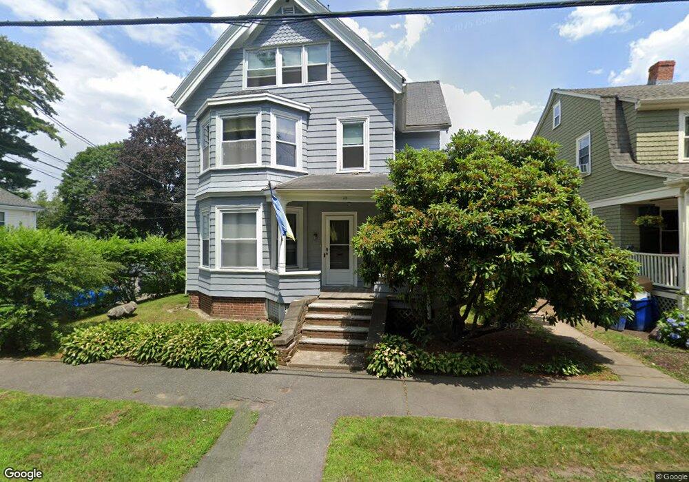
49 Salem St Unit 1 Swampscott, MA 01907
Estimated Value: $863,000 - $1,092,000
1
Bed
1
Bath
1,000
Sq Ft
$944/Sq Ft
Est. Value
About This Home
This home is located at 49 Salem St Unit 1, Swampscott, MA 01907 and is currently estimated at $943,577, approximately $943 per square foot. 49 Salem St Unit 1 is a home located in Essex County with nearby schools including Swampscott Middle School, Swampscott High School, and Epstein Hillel School.
Ownership History
Date
Name
Owned For
Owner Type
Purchase Details
Closed on
Jun 30, 1998
Sold by
Terrio Daniel P and Terrio Sheryl
Bought by
Frank Ruth
Current Estimated Value
Purchase Details
Closed on
Mar 18, 1996
Sold by
Liberty Fsb
Bought by
Terrio Daniel P and Terrio Sheryl
Purchase Details
Closed on
Feb 28, 1996
Sold by
Mickiewicz Stanley
Bought by
Liberty Sb
Purchase Details
Closed on
Oct 4, 1988
Sold by
Filipiak Cecile R
Bought by
Tevrow Barry
Create a Home Valuation Report for This Property
The Home Valuation Report is an in-depth analysis detailing your home's value as well as a comparison with similar homes in the area
Home Values in the Area
Average Home Value in this Area
Purchase History
| Date | Buyer | Sale Price | Title Company |
|---|---|---|---|
| Frank Ruth | $230,000 | -- | |
| Frank Ruth | $230,000 | -- | |
| Terrio Daniel P | $185,000 | -- | |
| Terrio Daniel P | $185,000 | -- | |
| Liberty Sb | $126,000 | -- | |
| Liberty Sb | $126,000 | -- | |
| Tevrow Barry | $230,000 | -- |
Source: Public Records
Mortgage History
| Date | Status | Borrower | Loan Amount |
|---|---|---|---|
| Open | Tevrow Barry | $100,000 | |
| Closed | Tevrow Barry | $41,500 |
Source: Public Records
Tax History Compared to Growth
Tax History
| Year | Tax Paid | Tax Assessment Tax Assessment Total Assessment is a certain percentage of the fair market value that is determined by local assessors to be the total taxable value of land and additions on the property. | Land | Improvement |
|---|---|---|---|---|
| 2025 | $8,667 | $755,600 | $292,400 | $463,200 |
| 2024 | $8,503 | $740,000 | $279,300 | $460,700 |
| 2023 | $8,227 | $700,800 | $253,100 | $447,700 |
| 2022 | $8,230 | $641,500 | $218,200 | $423,300 |
| 2021 | $8,138 | $589,700 | $200,700 | $389,000 |
| 2020 | $7,407 | $518,000 | $174,600 | $343,400 |
| 2019 | $7,214 | $474,600 | $139,600 | $335,000 |
| 2018 | $7,123 | $445,200 | $122,200 | $323,000 |
| 2017 | $7,018 | $402,200 | $122,200 | $280,000 |
| 2016 | $6,611 | $381,500 | $113,500 | $268,000 |
| 2015 | $6,467 | $377,100 | $109,100 | $268,000 |
| 2014 | $6,059 | $324,000 | $91,600 | $232,400 |
Source: Public Records
Map
Nearby Homes
- 25 Manton Rd
- 37 Stanley Rd
- 24 Orchard Cir
- 48 Bellevue Rd
- 179 Beach Bluff Ave
- 212 Humphrey St Unit 205
- 9 Tedesco Pond Place Unit 9
- 201 Humphrey St Unit 2
- 19 Elmwood Rd
- 35 Alden Rd
- 1006 Paradise Rd Unit 3R
- 1004 Paradise Rd Unit PHJ
- 2 Wilfred Terrace
- 71 Walnut Rd
- 6 Loring Hills Ave Unit D3
- 309 Paradise Rd
- 8 Ocean View Rd
- 35 Littles Point Rd Unit S201
- 25 Tedesco St
- 306 Paradise Rd
- 49 Salem St
- 45 Salem St
- 2 Harrison Ave
- 14 Harrison Ave
- 63 Salem St
- 22 Harrison Ave
- 39 One Salem St Unit 39
- 39 One Salem St
- 26 Harrison Ave
- 65 Salem St
- 34 Salem St Unit 1
- 30 Harrison Ave
- 42 Harrison Ave
- 9 Aycliffe Rd
- 44 Salem St Unit 1
- 34 One Salem St Unit 34
- 33 One Salem St
- 68 Dennison Ave
- 67 Salem St
- 35 Salem St Unit 35