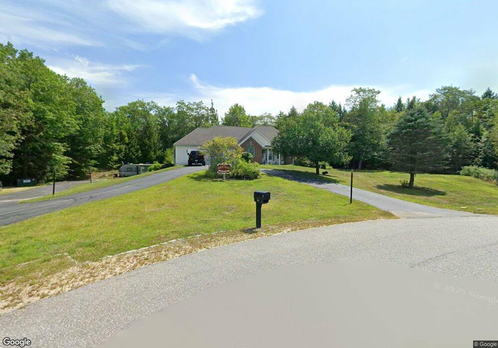
49 Scotts Ln Rindge, NH 03461
Estimated Value: $674,327 - $789,000
3
Beds
4
Baths
3,412
Sq Ft
$215/Sq Ft
Est. Value
About This Home
This home is located at 49 Scotts Ln, Rindge, NH 03461 and is currently estimated at $732,582, approximately $214 per square foot. 49 Scotts Ln is a home located in Cheshire County with nearby schools including Rindge Memorial School, Conant Middle High School, and Conant High School.
Ownership History
Date
Name
Owned For
Owner Type
Purchase Details
Closed on
Jul 31, 2012
Sold by
Vanblarcom David
Bought by
Doubleday Ret and Doubleday Elwyn
Current Estimated Value
Purchase Details
Closed on
Aug 8, 2005
Sold by
Minkkinen Allen W and Minkkinen Edith
Bought by
Bailey Ft
Purchase Details
Closed on
May 10, 2004
Sold by
Hakala Bros Corp
Bought by
Minkkinen Allen W and Minkkinen Edith
Create a Home Valuation Report for This Property
The Home Valuation Report is an in-depth analysis detailing your home's value as well as a comparison with similar homes in the area
Home Values in the Area
Average Home Value in this Area
Purchase History
| Date | Buyer | Sale Price | Title Company |
|---|---|---|---|
| Doubleday Ret | $277,500 | -- | |
| Bailey Ft | $468,500 | -- | |
| Minkkinen Allen W | $390,000 | -- |
Source: Public Records
Mortgage History
| Date | Status | Borrower | Loan Amount |
|---|---|---|---|
| Open | Minkkinen Allen W | $200,000 | |
| Previous Owner | Minkkinen Allen W | $241,173 | |
| Previous Owner | Minkkinen Allen W | $224,750 |
Source: Public Records
Tax History Compared to Growth
Tax History
| Year | Tax Paid | Tax Assessment Tax Assessment Total Assessment is a certain percentage of the fair market value that is determined by local assessors to be the total taxable value of land and additions on the property. | Land | Improvement |
|---|---|---|---|---|
| 2024 | $9,549 | $377,300 | $58,200 | $319,100 |
| 2023 | $9,448 | $377,300 | $58,200 | $319,100 |
| 2022 | $8,689 | $377,300 | $58,200 | $319,100 |
| 2021 | $8,546 | $377,300 | $58,200 | $319,100 |
| 2020 | $8,470 | $377,300 | $58,200 | $319,100 |
| 2019 | $7,889 | $284,200 | $48,000 | $236,200 |
| 2018 | $7,816 | $284,200 | $48,000 | $236,200 |
| 2017 | $7,727 | $284,200 | $48,000 | $236,200 |
| 2016 | $7,932 | $284,200 | $48,000 | $236,200 |
| 2015 | $7,926 | $284,200 | $48,000 | $236,200 |
| 2014 | $8,504 | $326,700 | $66,200 | $260,500 |
| 2013 | $8,318 | $326,700 | $66,200 | $260,500 |
Source: Public Records
Map
Nearby Homes
- 46 Swan Point Rd
- 110 Red Gate Ln
- 7 Emerson Dr
- 28 Wellington Rd
- Lot 4 Saybrook Dr
- 11 Mark St
- 19 Monomonac Terrace
- 64 Old Ashburnham Rd
- Lot 1 Saybrook Dr
- Lot 2 Saybrook Dr
- Lot 15-0 Saybrook Dr
- Lot 14 Saybrook Dr
- 40 Maple Dr
- 16 2nd St
- 20 W Main St
- 35 Hillside Dr
- 634 Old New Ipswich Rd
- 39 Willow Ln
- 41 Willow Ln
- 31 Willow Ln