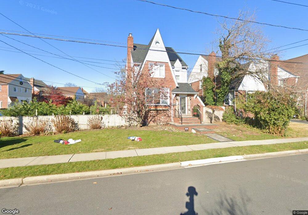
49 Wilson Rd Valley Stream, NY 11581
Estimated Value: $764,000 - $831,237
--
Bed
2
Baths
1,885
Sq Ft
$423/Sq Ft
Est. Value
About This Home
This home is located at 49 Wilson Rd, Valley Stream, NY 11581 and is currently estimated at $797,619, approximately $423 per square foot. 49 Wilson Rd is a home located in Nassau County with nearby schools including George W Hewlett High School, Yeshiva of South Shore, and Reenas Bais Yaakov.
Ownership History
Date
Name
Owned For
Owner Type
Purchase Details
Closed on
May 15, 2008
Sold by
Dejesus Bernardo
Bought by
Galla Hanna
Current Estimated Value
Purchase Details
Closed on
Jul 18, 2007
Sold by
Altimari Anthony F
Purchase Details
Closed on
May 29, 2003
Sold by
Stefanakos James
Bought by
Mennella Mary
Purchase Details
Closed on
Aug 28, 1998
Create a Home Valuation Report for This Property
The Home Valuation Report is an in-depth analysis detailing your home's value as well as a comparison with similar homes in the area
Home Values in the Area
Average Home Value in this Area
Purchase History
| Date | Buyer | Sale Price | Title Company |
|---|---|---|---|
| Galla Hanna | $477,500 | -- | |
| -- | $449,000 | -- | |
| Mennella Mary | $424,360 | -- | |
| -- | -- | -- |
Source: Public Records
Tax History Compared to Growth
Tax History
| Year | Tax Paid | Tax Assessment Tax Assessment Total Assessment is a certain percentage of the fair market value that is determined by local assessors to be the total taxable value of land and additions on the property. | Land | Improvement |
|---|---|---|---|---|
| 2025 | $13,473 | $519 | $189 | $330 |
| 2024 | $1,878 | $507 | $185 | $322 |
| 2023 | $11,536 | $537 | $196 | $341 |
| 2022 | $11,536 | $519 | $189 | $330 |
| 2021 | $9,894 | $529 | $190 | $339 |
| 2020 | $8,305 | $504 | $346 | $158 |
| 2019 | $8,210 | $540 | $328 | $212 |
| 2018 | $8,209 | $576 | $0 | $0 |
| 2017 | $6,710 | $580 | $350 | $230 |
| 2016 | $8,034 | $614 | $336 | $278 |
| 2015 | $1,452 | $648 | $316 | $332 |
| 2014 | $1,452 | $648 | $316 | $332 |
| 2013 | $1,413 | $678 | $330 | $348 |
Source: Public Records
Map
Nearby Homes
- 88 Marlboro Rd
- 75 Peninsula Blvd
- 3 N Brook Dr
- 375 Cochran Place
- 343 Cochran Place
- 80 Munro Blvd
- 29 Orleans Rd
- 33 Dartmouth St
- 1434 Noel Ave
- 165 Page Rd
- 510 Dubois Ave Unit 11B
- 530 Dubois Ave Unit 2C
- 530 Dubois Ave Unit 1B
- 530 Dubois Ave Unit B3
- 127 Gordon Rd
- 1584 Kew Ave
- 31 Drew St
- 51 Stevenson Rd
- 80 Gibson Blvd Unit 1c
- 21 Fremont Rd